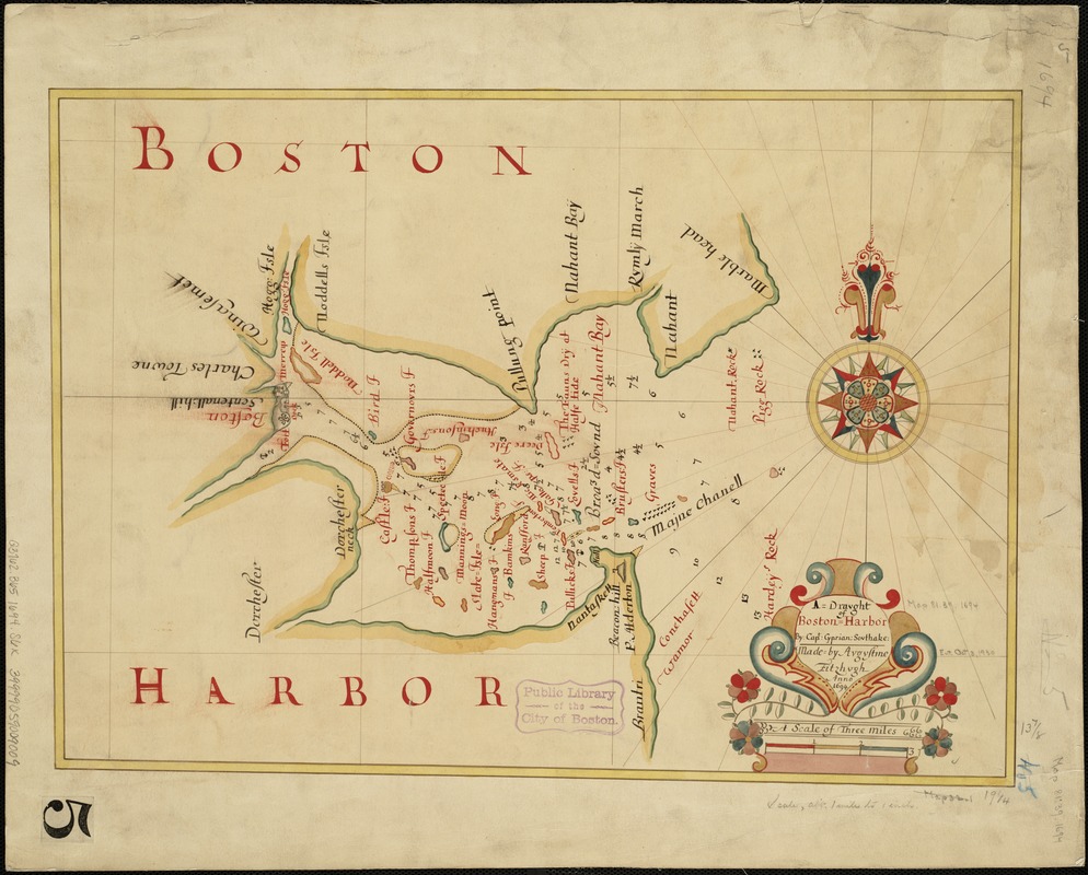
A draught of Boston Harbor by Capt. Cyprian Southake
Item Information
- Title:
- A draught of Boston Harbor by Capt. Cyprian Southake
- Description:
-
The 1694 copy of Southack's original chart was made by Augustine Fitzhugh. Boston Public Library copy is an exact duplicate, with exception of title and north point, of Boston Harbor in New England, 1689(?), in the English Pilot (book IV). Southack's earliest known effort was a chart of Boston Harbor, probably drawn in the late 1680s but now lost. It remains available, however, through the derivative displayed here. This chart is an 1884 copy of an ornate manuscript made in 1694 by London draughtsman Augustine Fitzhugh. Though the cartography is crude, the chart is an important example of how the work of colonial mapmakers was circulated back in the home country.
- Creator:
- Southack, Cyprian, 1662-1745
- Name on Item:
-
made by Augustine Fitzhugh, 1694.
- Date:
-
[1694]
- Format:
-
Maps/Atlases
Manuscripts
- Location:
-
Boston Public Library
Norman B. Leventhal Map Center - Collection (local):
-
Norman B. Leventhal Map Center Collection
- Subjects:
-
Boston Harbor (Mass.)--Maps--Early works to 1800
Boston (Mass.)--Maps--Early works to 1800
- Places:
-
Boston Harbor
- Extent:
- 1 ms. map : col. ; 49 x 35 cm.
- Terms of Use:
-
No known copyright restrictions.
No known restrictions on use.
- Publisher:
-
S.l :
s.n.
- Scale:
-
Scale 1:63,360.
- Language:
-
English
- Notes:
-
Depths shown by soundings.
Item is an 1884 manuscript copy of the original 1694 edition in the British Library. Item was made for Mr. H.F. Waters Esqr. and sent from London to Boston (cf. Proceedings of the Massachusetts Historical Society, vol. II, sceond series, 1885-186, p. 479).
- Notes (date):
-
This date is inferred.
- Notes (exhibitions):
-
Exhibited: "Made in Boston" organized by the Norman B. Leventhal Map Center at the Boston Public Library, 2013-2014.
- Identifier:
-
06_01_004931
- Call #:
-
G3762.B65 1694 .S6x
- Barcode:
-
39999059009009


