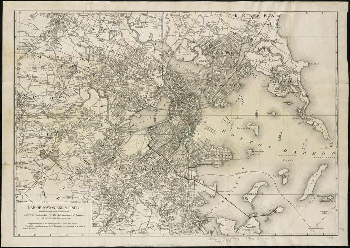
Map of Boston and vicinity
Item Information
- Title:
- Map of Boston and vicinity
- Creator:
- American Association for the Advancement of Science
- Name on Item:
-
prepared for the use of members of the American Association for the Advancement of Science at the Boston meeting, August, 1880.
- Date:
-
[1880?]
- Format:
-
Maps/Atlases
- Location:
-
Boston Public Library
Norman B. Leventhal Map Center - Collection (local):
-
Norman B. Leventhal Map Center Collection
- Subjects:
-
Boston (Mass.)--Maps
- Places:
-
Suffolk (county)Boston
- Extent:
- 1 map : col. ; 47 x 61 cm.
- Terms of Use:
-
No known copyright restrictions.
No known restrictions on use.
- Publisher:
-
Boston :
s.n.
- Scale:
-
Scale 1:32,000.
- Language:
-
English
- Notes:
-
The original shore-line of the Boston Peninsula is shown by a red line.
"The district burnt in the great fire of November 1872 is shown by a series of parallel red lines."
Shows radial distances from downtown Boston.
- Identifier:
-
06_01_004336
- Call #:
-
G3764.B6 1880.1 .A4
- Barcode:
-
39999059006260


