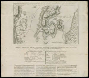
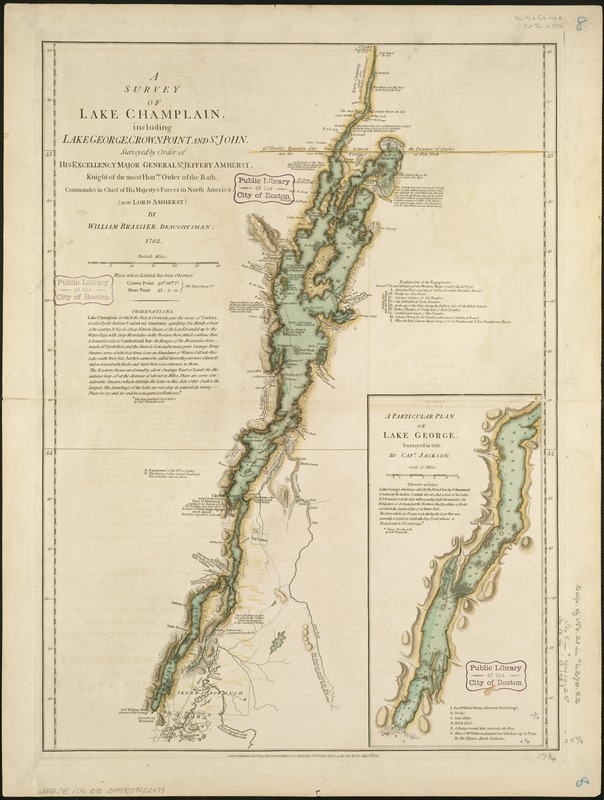
A survey of Lake Champlain, including Lake George, Crown Point, and St. John : surveyed by order of His Excellency Major-General Sr. Jeffery Amherst, Knight of the most Honble. Order of the Bath, Commander in Chief of His Majesty's forces in North America, (now Lord Amherst)
This map is also available in American Revolutionary Geographies Online (ARGO), a collections portal especially built for material relating to the American Revolutionary War Era. Visit ARGO to learn more about this item and explore the historical geography of North America in the late eighteenth century.
Item Information
- Title:
- A survey of Lake Champlain, including Lake George, Crown Point, and St. John : surveyed by order of His Excellency Major-General Sr. Jeffery Amherst, Knight of the most Honble. Order of the Bath, Commander in Chief of His Majesty's forces in North America, (now Lord Amherst)
- Creator:
- Brasier, William.
- Name on Item:
-
by William Brassier, draughtsman. 1762.
- Date:
-
1776
- Format:
-
Maps/Atlases
- Location:
-
Boston Public Library
Norman B. Leventhal Map Center - Collection (local):
-
Norman B. Leventhal Map Center Collection
- Subjects:
-
Valcour Island, Battle of, N.Y., 1776--Maps--Early works to 1800
Champlain, Lake--Maps--Early works to 1800
George, Lake (N.Y. : Lake)--Maps--Early works to 1800
- Places:
-
New YorkGeorge, Lake
Champlain, Lake
- Extent:
- 1 map : hand col. ; 66 x 45 cm.
- Terms of Use:
-
No known copyright restrictions.
No known restrictions on use.
- Publisher:
-
London :
Printed for Robt. Sayer & Jno. Bennett
- Scale:
-
Scale [ca. 1:400,000]
- Language:
-
English
- Notes:
-
Relief shown by hachures.
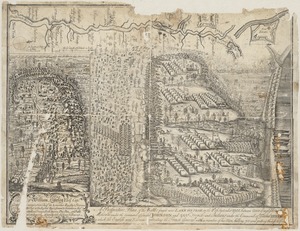
Shows naval actions at Valcour Island and Buttonmold Bay in Oct. 1776.
Includes indexes to points of interest and descriptive text.
Inset:A particular plan of Lake George, surveyed in 1756, by Capt. Jackson.
In The American military pocket atlas (London : R. Sayer and J Bennet, [1776]), no. 6.
- Identifier:
-
06_01_004057
- Call #:
-
G3802.C45 1776 .B73
- Barcode:
-
39999059022499