New map of Boston, comprising the whole city, with the new boundaries of the wards
Item Information
- Title:
- New map of Boston, comprising the whole city, with the new boundaries of the wards
- Description:
-
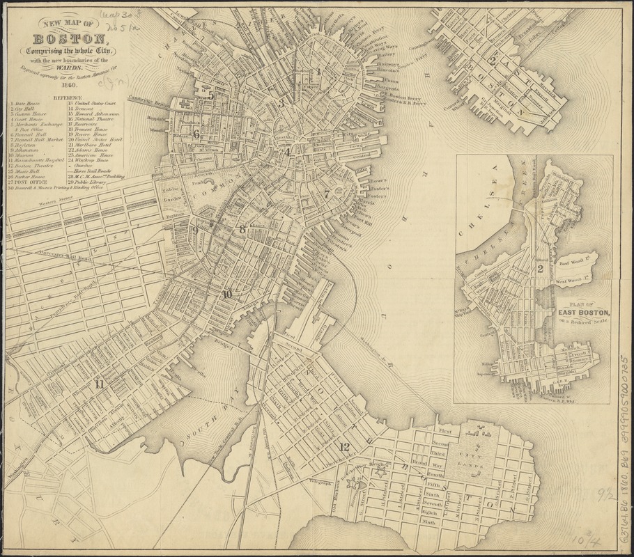
By the late 1840s, the marshland west of the Public Garden had become so polluted it was considered a health hazard, and officials had no choice but to act. The solution was to fill in the quagmire, in a land reclamation project that would double the size of the original Boston peninsula. The project began in 1858 and finished in 1882. This 1860 map illustrates proposed streets of the Back Bay. The area was designed as a grid with Commonwealth Avenue as the central boulevard of five east-west corridors, and eight north-south cross streets named for English nobility.
- Creator:
- Boynton, George W., d. 1884
- Name on Item:
-
engraved expressly for the Boston Almanac for 1860 ; engraved by G.W. Boynton.
- Date:
-
1860
- Format:
-
Maps/Atlases
- Location:
-
Boston Public Library
Norman B. Leventhal Map Center - Collection (local):
-
Norman B. Leventhal Map Center Collection
- Subjects:
-
Fortification--Massachusetts--Boston--Maps
Boston (Mass.)--Maps
- Places:
-
Suffolk (county)Boston
- Extent:
- 1 map ; 24 x 28 cm.
- Terms of Use:
-
No known copyright restrictions.
No known restrictions on use.
- Publisher:
-
Boston, Mass :
[s.n.]
- Scale:
-
Scale not given.
- Language:
-
English
- Notes:
-
Includes index to points of interest.
Inset: Plan of East Boston, on a reduced scale.
- Notes (exhibitions):
-
Exhibited: "Boston in the Gilded Age: Mapping Public Places" organized by the Norman B. Leventhal Map Center at the Boston Public Library, 2012-2013.
- Identifier:
-
06_01_003395
- Call #:
-
G3764.B6 1860 .B692
- Barcode:
-
39999059000735


