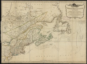
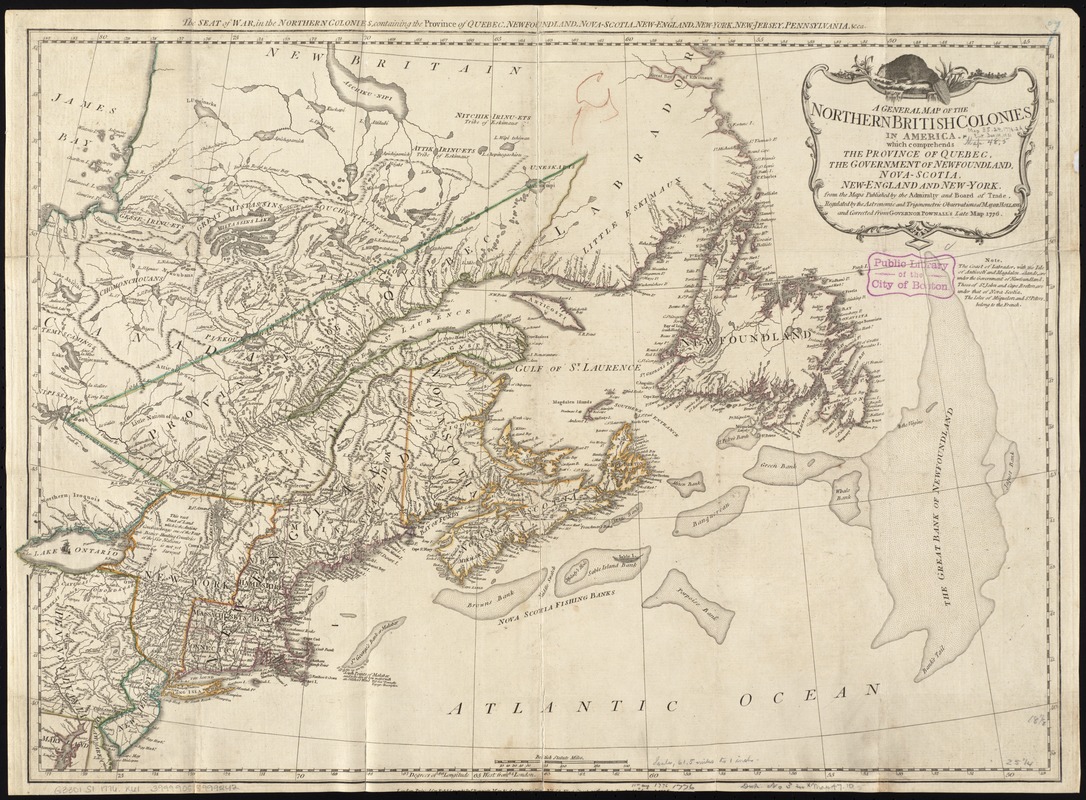
A general map of the northern British colonies in America : which comprehends the province of Quebec, the government of Newfoundland, Nova-Scotia, New-England and New-York
This map is also available in American Revolutionary Geographies Online (ARGO), a collections portal especially built for material relating to the American Revolutionary War Era. Visit ARGO to learn more about this item and explore the historical geography of North America in the late eighteenth century.
Item Information
- Title:
- A general map of the northern British colonies in America : which comprehends the province of Quebec, the government of Newfoundland, Nova-Scotia, New-England and New-York
- Title (alt.):
-
Seat of war in the northern colonies, containing the province of Quebec, Newfoundland, Nova-Scotia, New England, New-York, New-Jersey, Pennsylvania, &c
- Description:
-
Published by a prominent London firm, this map illustrates the extent of the British colonies in northern North America at the beginning of the American Revolutionary War. Britain was keenly interested in maintaining control of this region because the exportation of furs and cod fish generated sizable income for merchants back in England. Profitable natural resources were abundant in Canada, as suggested by the placement of a North American beaver atop the cartouche, and the detailed depiction of the fishing banks off the coast of Newfoundland and Nova Scotia.
- Creator:
- Robert Sayer and John Bennett (Firm)
- Name on Item:
-
from the maps published by the Admiralty and Board of Trade, regulated by the astronomic and trigonometric observations of Major Holland, and corrected from Governor Pownall's late map 1776.
- Date:
-
1776
- Format:
-
Maps/Atlases
- Location:
-
Boston Public Library
Norman B. Leventhal Map Center - Collection (local):
-
Norman B. Leventhal Map Center Collection
- Subjects:
-
North America--History--Revolution, 1775-1783--Maps--Early works to 1800
- Places:
-
North America (area)
- Extent:
- 1 map : hand col. ; 47 x 65 cm.
- Terms of Use:
-
No known copyright restrictions.
No known restrictions on use.
- Publisher:
-
London :
Robt. Sayer & Jno. Bennett
- Scale:
-
Scale [ca. 1:3,750,000]
- Language:
-
English
- Notes:
-
Title in upper margin: The seat of war, in the northern colonies, containing the province of Quebec, Newfoundland, Nova-Scotia, New-England, New-York, New-Jersey, Pennsylvania, &ca.
1st state.
Relief shown pictorially.
From the author's The American military pocket atlas [1776], pl. 3.
Cataloging, conservation, and digitization made possible in part by The National Endowment for the Humanities: Exploring the human endeavor.
- Identifier:
-
06_01_010509
- Call #:
-
G3301.S1 1776 .R61
- Barcode:
-
39999058999242
- LCCN:
-
74693190