Map of New England
Item Information
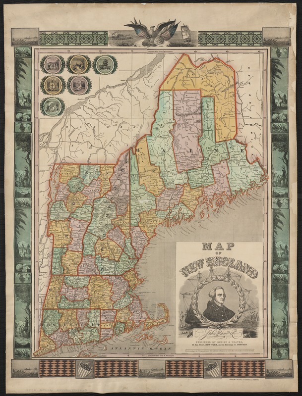
- Title:
- Map of New England
- Creator:
- Lossing & Barritt
- Name on Item:
-
Lossing-Barritt, sc.
- Date:
-
1847
- Format:
-
Maps/Atlases
- Location:
-
Boston Public Library
Norman B. Leventhal Map Center - Collection (local):
-
Norman B. Leventhal Map Center Collection
- Subjects:
-
New England--Maps
- Places:
-
New England (area)
- Extent:
- 1 map : hand col. ; 62 x 50 cm.
- Terms of Use:
-
No known copyright restrictions.
No known restrictions on use.
- Publisher:
-
New York :
Ensigns & Thayer
- Scale:
-
Scale [ca. 1:1,150,000]
- Language:
-
English
- Notes:
-
Relief shown by hachures.
"Entered according to act of Congress in the year 1847, by Ensigns & Thayer in the Clerk's office, for the Southern District of New York."
Includes portrait of John Hancock in decorative cartouche, ill. in border, and seals of New England states in upper left corner.
- Identifier:
-
06_01_003044
- Call #:
-
G3720 1847 .L6
- Barcode:
-
39999058997360


