Plan and profiles of surveys from Farm Pond in Framingham and Long Pond in Natick, for supplying water to the City of Boston
Item Information
- Title:
- Plan and profiles of surveys from Farm Pond in Framingham and Long Pond in Natick, for supplying water to the City of Boston
- Description:
-
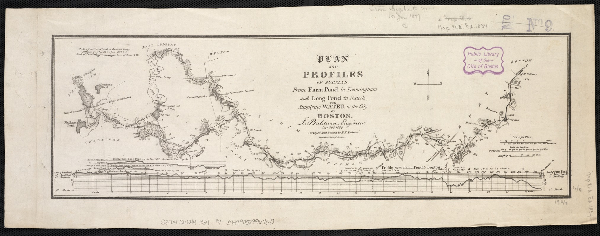
Beneath Our Feet: From the colonial settlement of Boston in 1630 until 1796, the City’s water supply came from underground wells and cisterns that collected rainwater. To alleviate the effects of using unhealthy and dirty water, the City installed the first underground water pipes in the late 1790s, drawing water from Jamaica Pond. An updated water supply plan, illustrated in this map, was conceived by civil engineer Loammi Baldwin in 1834. Baldwin’s plan called for water to be transported from Long Pond (now Lake Cochituate) in Natick via an above and below ground gravity aqueduct that would deposit good-quality water into a reservoir. From there, lead and cast iron pipes transported the water throughout the city.
- Creator:
- Perham, Benjamin Franklin, 1806-ca. 1837
- Name on Item:
-
L. Baldwin, engineer ... ; surveyed and drawn by B.F. Perham.
- Date:
-
1834
- Format:
-
Maps/Atlases
- Location:
-
Boston Public Library
Norman B. Leventhal Map Center - Collection (local):
-
Norman B. Leventhal Map Center Collection
- Subjects:
-
Water-supply--Massachusetts--Boston--Maps
Water-supply--Massachusetts--Natick--Maps
Water-supply--Massachusetts--Framingham--Maps
Boston (Mass.)--Maps
- Places:
-
Suffolk (county)Boston
Middlesex (county)Framingham
Middlesex (county)Natick
- Extent:
- 1 plan ; 16 x 50 cm.
- Terms of Use:
-
No known copyright restrictions.
No known restrictions on use.
- Publisher:
-
Boston, Mass :
Pendleton's Lithogy
- Scale:
-
Scale [ca. 1:75,000].
- Language:
-
English
- Notes:
-
Relief shown by hachures.
"Sept. 30th, 1834."
Includes 4 profiles.
- Notes (exhibitions):
-
Exhibited: "Beneath Our Feet: Mapping the World Below" organized by the Norman B. Leventhal Map Center at the Boston Public Library, 2017-2018.
- Identifier:
-
06_01_002657
- Call #:
-
G3764.B6N44 1834 .P4
- Barcode:
-
39999058996750


