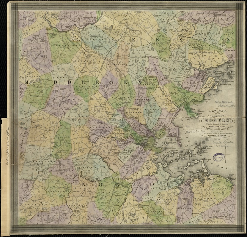
New map of the vicinity of Boston, with the dates of settlement, population in 1840, and distance from the capital
Item Information
- Title:
- New map of the vicinity of Boston, with the dates of settlement, population in 1840, and distance from the capital
- Creator:
- Lewis, Alonzo, 1794-1861
- Name on Item:
-
drawn by Alonzo Lewis.
- Date:
-
1841
- Format:
-
Maps/Atlases
- Location:
-
Boston Public Library
Norman B. Leventhal Map Center - Collection (local):
-
Norman B. Leventhal Map Center Collection
- Subjects:
-
Boston (Mass.)--Maps
Massachusetts--Maps
- Places:
-
Suffolk (county)Boston
- Extent:
- 1 map : col. ; 38 x 38 cm.
- Terms of Use:
-
No known copyright restrictions.
No known restrictions on use.
- Publisher:
-
Boston, Mass :
Nathaniel Dearborn
- Scale:
-
Scale [ca. 1:158,400].
- Language:
-
English
- Notes:
-
Shows railways.
- Identifier:
-
06_01_002656
- Call #:
-
G3764.B6 1841 .L4
- Barcode:
-
39999058996743


![[Boston and Northwestern Junction Railroad]](https://bpldcassets.blob.core.windows.net/derivatives/images/commonwealth:x059cc74n/image_thumbnail_300.jpg)

