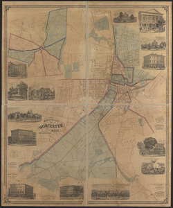
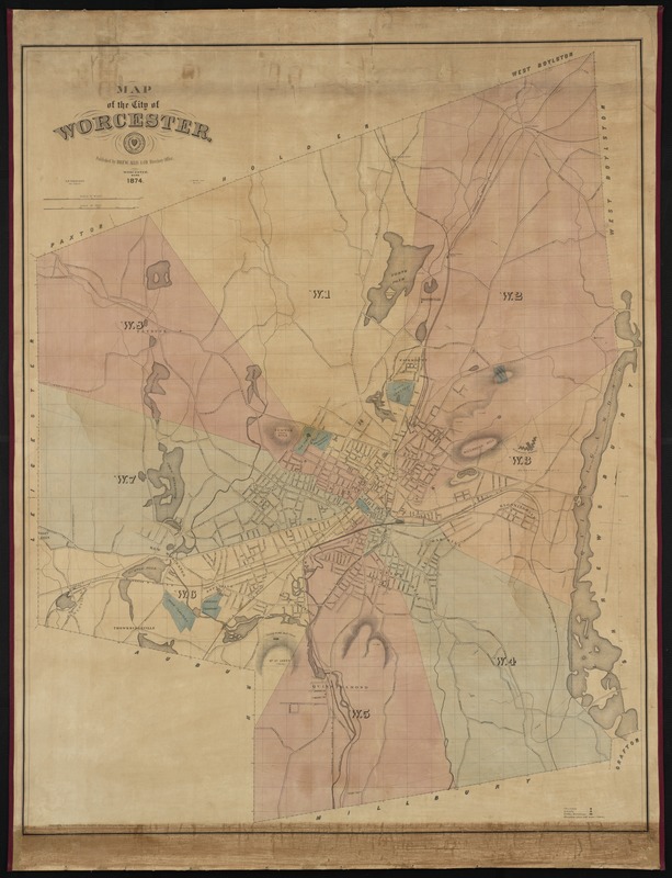
Map of the city of Worcester
Item Information
- Title:
- Map of the city of Worcester
- Creator:
- Triscott, S. P. Rolt (Samuel Peter Rolt), 1846-1925
- Name on Item:
-
S.P. Triscott ; A. Meisel, Lith.
- Date:
-
1874
- Format:
-
Maps/Atlases
- Location:
-
Boston Public Library
Norman B. Leventhal Map Center - Collection (local):
-
Norman B. Leventhal Map Center Collection
- Subjects:
-
Worcester (Mass.)--Maps
- Places:
-
Worcester (county)Worcester
- Extent:
- 1 map : col. ; 106 x 84 cm.
- Terms of Use:
-
No known copyright restrictions.
No known restrictions on use.
- Publisher:
-
Worcester, Mass :
Drew, Allis & Co.
- Scale:
-
Scale [ca. 1:12,000]
- Language:
-
English
- Notes:
-
Relief shown by hachures.
Includes references to points of interest.
"Entered according to an Act of Congress in the year 1873, by Drew Allis & Co., in the Office of the Librarian of Congress at Washington."
- Identifier:
-
06_01_000888
- Call #:
-
G3764.W9 1874 .T75
- Barcode:
-
39999058989029