Boston Harbour : from the survey of A.S. Wadsworth, Esq., U.S.N. and the chart of Des Barres
Item Information
- Title:
- Boston Harbour : from the survey of A.S. Wadsworth, Esq., U.S.N. and the chart of Des Barres
- Title (alt.):
-
Boston Harbor
- Description:
-
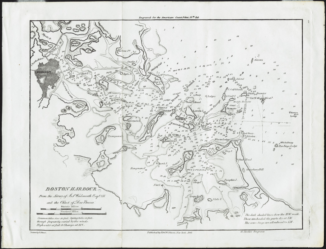
Although published in 1847, this chart of Boston Harbor was based on much earlier surveys - a U.S. Navy survey of 1817 and British surveys from the Revolutionary War period. The American Coast Pilot, in which the chart appeared, was first published in 1796 by Edmund March Blunt of Newburyport. He and his sons published 21 editions of the Pilot up to 1861. This commercially published guide became a standard navigational aid for American coastal waters during the first half of the 19th century, when it was replaced by federally-funded charts produced by the U.S. Coast Survey.
- Creator:
- Blunt, Edmund, 1799-1866
- Engraver:
- Hooker, W.
- Name on Item:
-
drawn by E. Blunt ; W. Hooker, engraver
- Date:
-
1847
- Format:
-
Maps/Atlases
- Location:
- Private Collection
- Collection (local):
-
Mapping Boston Collection
- Subjects:
-
Nautical charts--Massachusetts--Boston Harbor
Boston Harbor (Mass.)--Maps
- Places:
-
Boston Harbor
- Extent:
- 1 chart ; 21 x 26 cm.
- Terms of Use:
-
No known copyright restrictions.
This work is licensed for use under a Creative Commons Attribution Non-Commercial Share Alike License (CC BY-NC-SA).

- Publisher:
-
New York :
E. & G.W. Blunt
- Scale:
-
Scale not given
- Language:
-
English
- Notes:
-
Depths shown by soundings.
Relief shown by hachures.
"Engraved for The American Coast Pilot. 15th Ed."
- Identifier:
-
06_01_001243
- Barcode:
-
39999052508593


