Boston Harbor, Massachusetts
Item Information
- Title:
- Boston Harbor, Massachusetts
- Description:
-
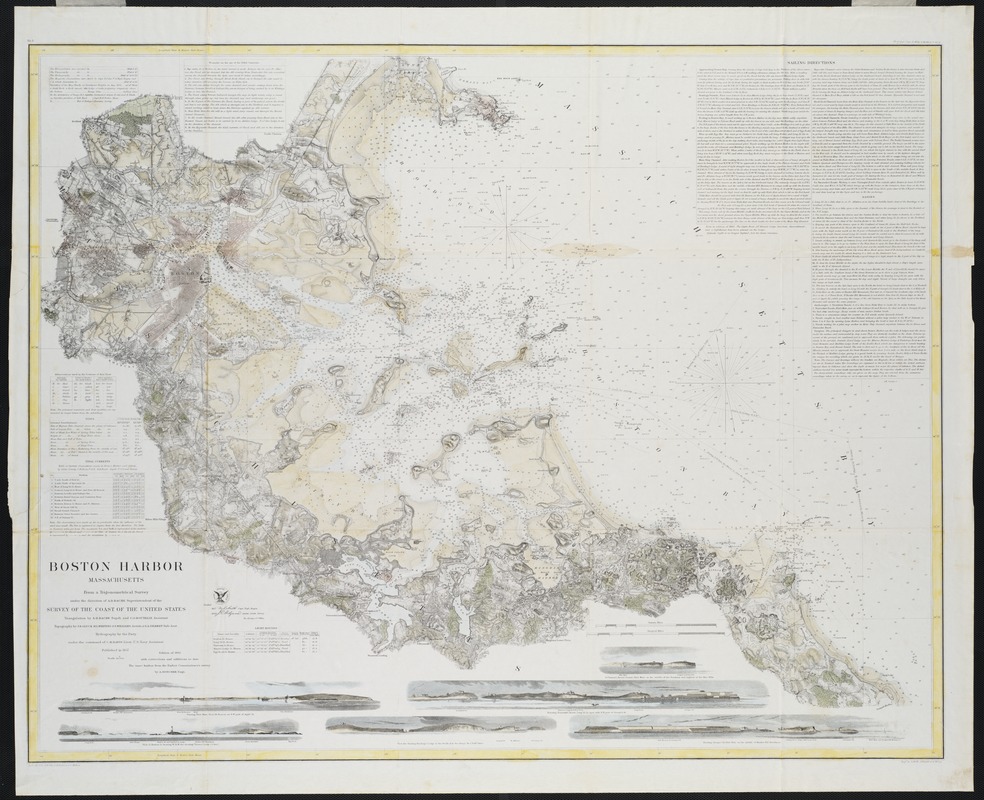
The U.S. Coast Survey's first nautical chart of Boston Harbor was published in 1857. The original chart was based on the first truly scientific and comprehensive surveys of the entire harbor. These included elaborate triangulation surveys, which provided accurate geodetic positions, as well as separate topographic and hydrographic surveys. This particular edition was updated with corrections and additions accurate to 1863. The Office of Coast Survey, as it is known today, is the oldest U.S. scientific organization, dating from 1807 when the U. S. Congress directed that a "survey of the coast" be carried out.
- Creator:
- United States Coast Survey
- Name on Item:
-
from a trigonometrical survey under the direction of A.D. Bache, superintendent of the Survey of the Coast of the United States.
- Date:
-
[1863]
- Format:
-
Maps/Atlases
- Location:
- Private Collection
- Collection (local):
-
Mapping Boston Collection
- Subjects:
-
Nautical charts--Massachusetts--Boston Harbor
Nautical charts--Massachusetts--Boston Bay
Boston Harbor (Mass.)--Maps
Boston Bay (Mass.)--Maps
- Places:
-
Boston Harbor
- Extent:
- 1 map ; 70 x 88 cm.
- Terms of Use:
-
No known copyright restrictions.
This work is licensed for use under a Creative Commons Attribution Non-Commercial Share Alike License (CC BY-NC-SA).

- Publisher:
-
[Washington, D.C.] :
U.S. Coast Survey Office
- Edition:
- Ed. of 1863.
- Scale:
-
Scale 1:40,000.
- Language:
-
English
- Notes:
-
Published in 1857.
Relief shown by hachures.
Depths shown by soundings and shading.
In upper right margin: Electrotype copy no. 10 by G. Mathiot, U.S.C.S.
Prime meridian: Massachusetts State House.
Includes sailing directions, tables of tides, lighthouses, and bottom types, and 6 coastal views.
In upper left margin: No. 337.
- Notes (date):
-
This date is inferred.
- Identifier:
-
06_01_001158
- Barcode:
-
39999052508148


