This website is optimized for a larger screen size. Please use landscape mode, expand your browser window, or switch to a larger device.
Remapping the World in Japan
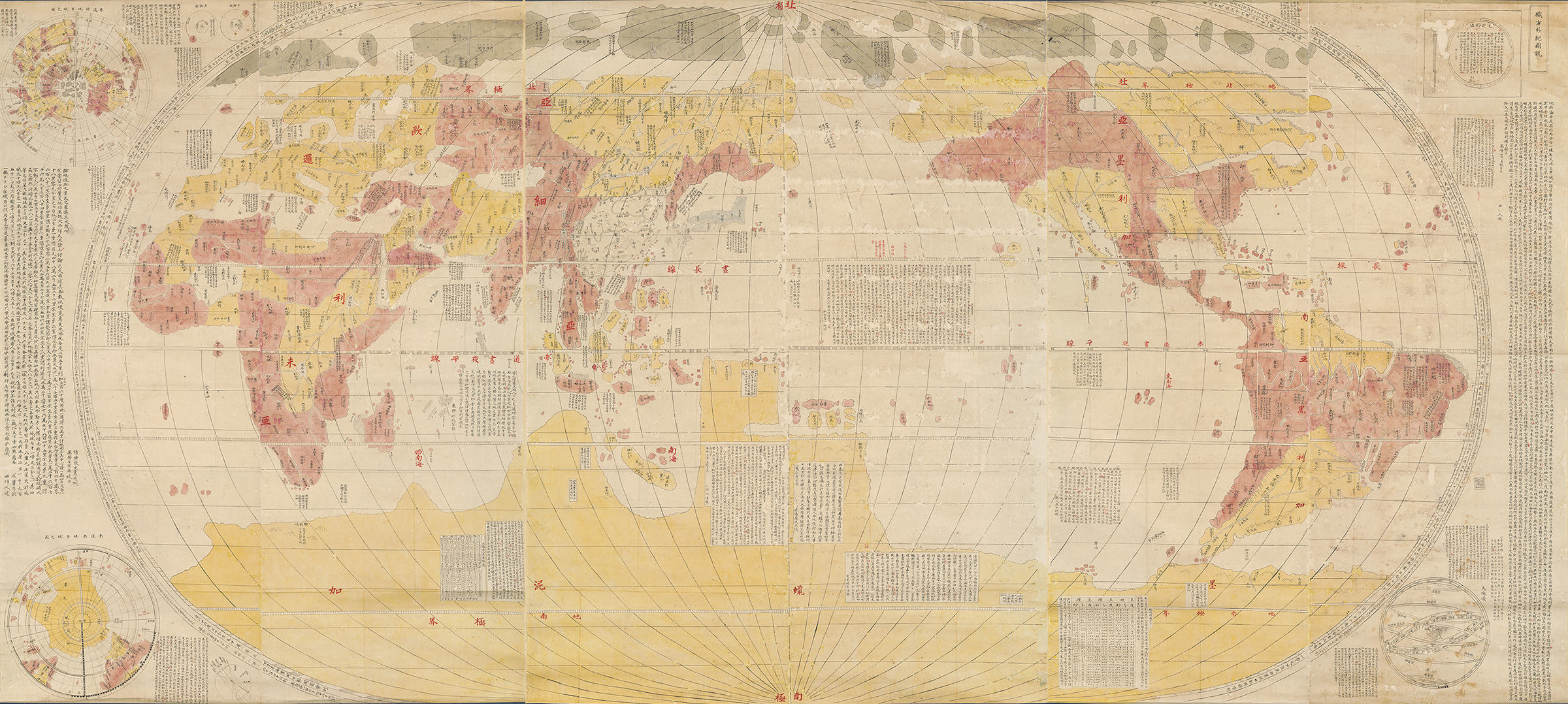
Imagine entering a room and seeing a large, beautiful map mounted as three scrolls hanging on a wall. It is so large you have to keep your distance to see the entire map. It is colored in yellow and red, which nicely contrasts the dark blue brocade mounted around the map.
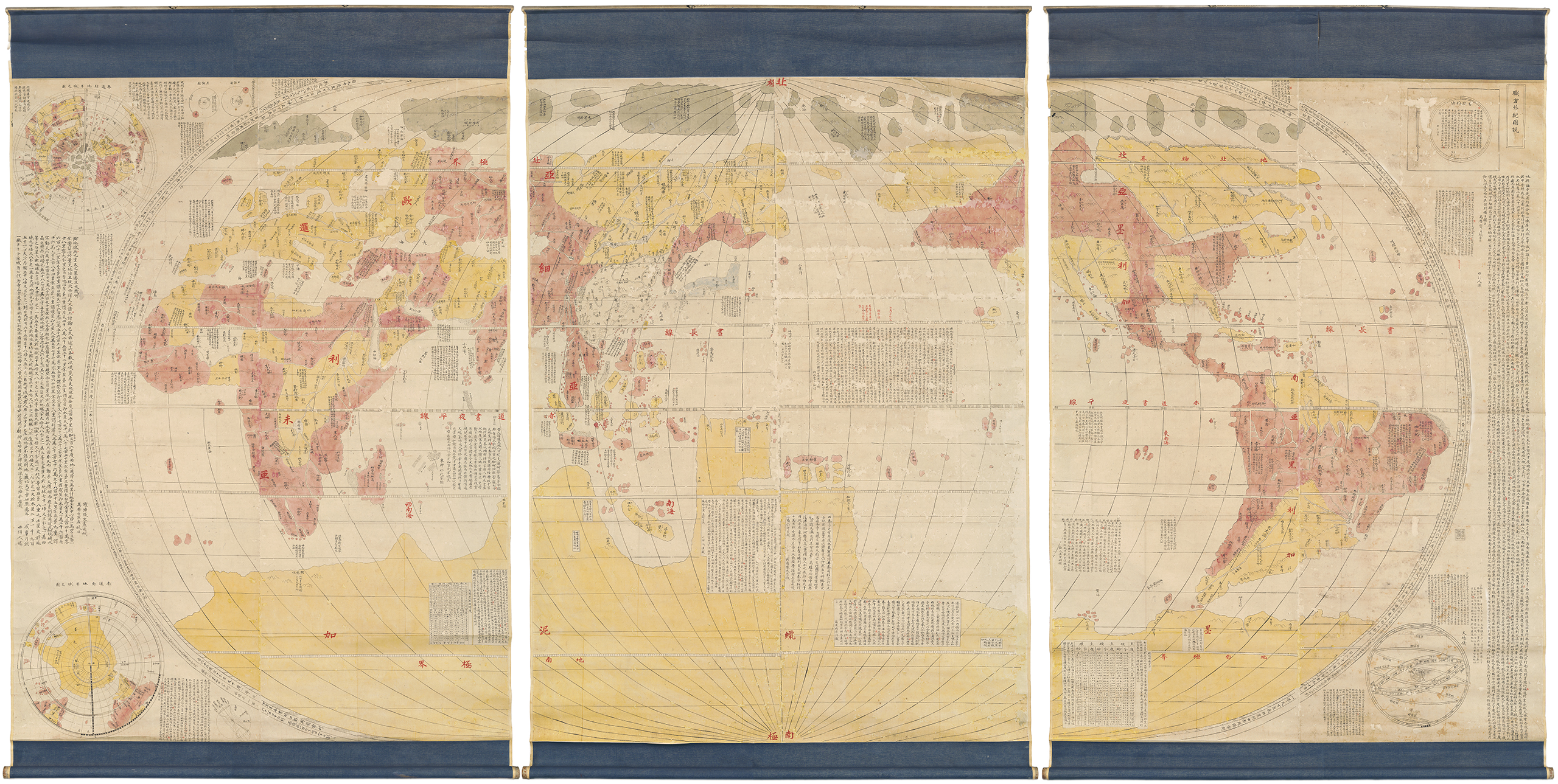
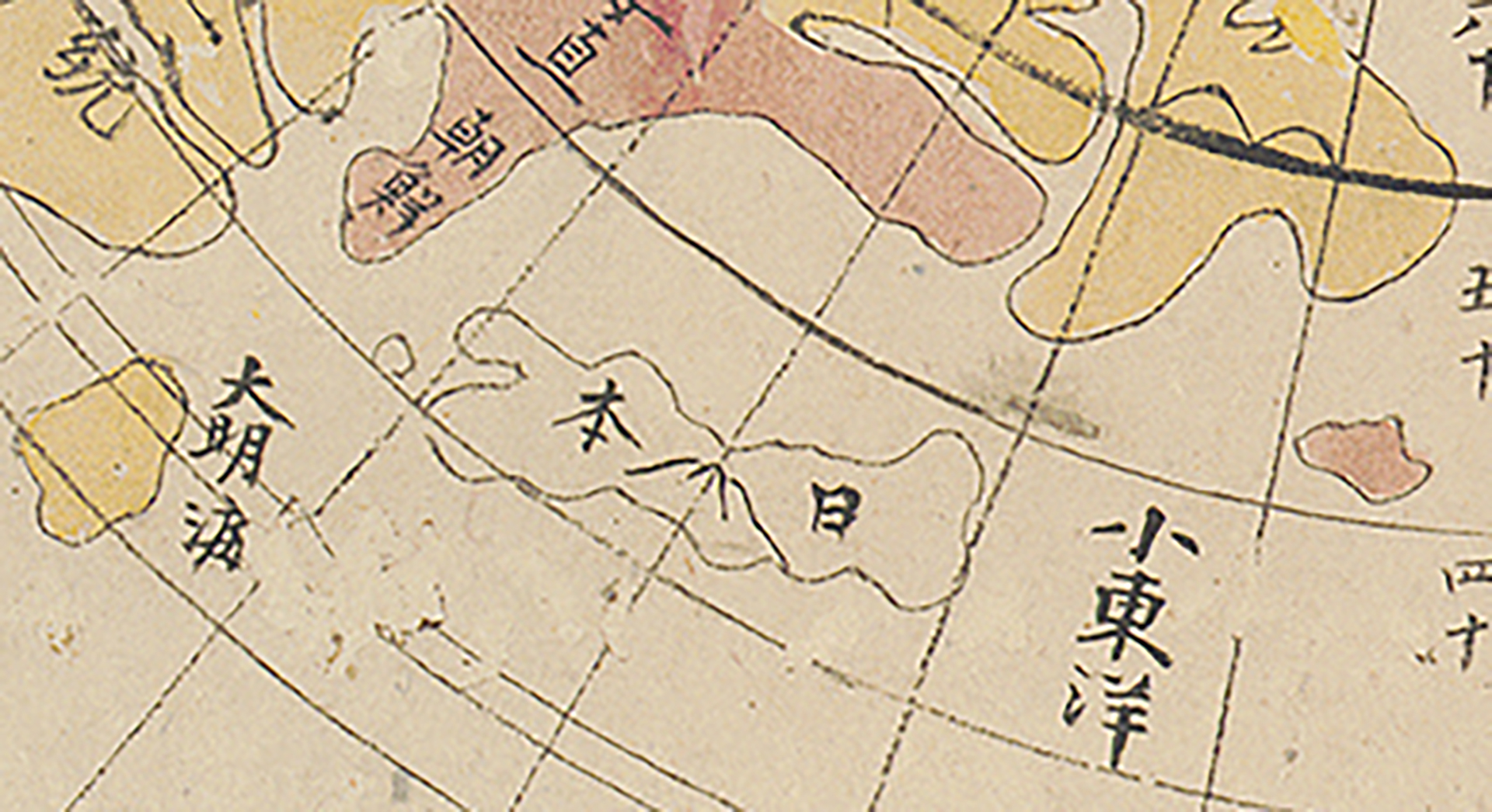
A few steps closer, allows you to read the many textual annotations on the map written using Chinese characters with a few annotations in the Japanese syllabic writing system of katakana. You discover that the map is not only yellow and red, but that in the upper center, Japan appears in a light blue, setting it apart visually from other landmasses.
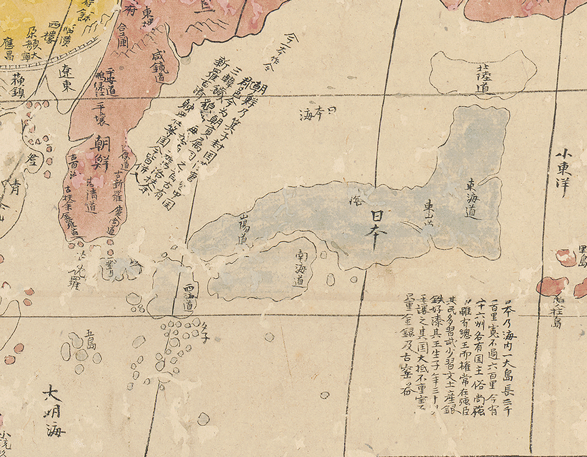
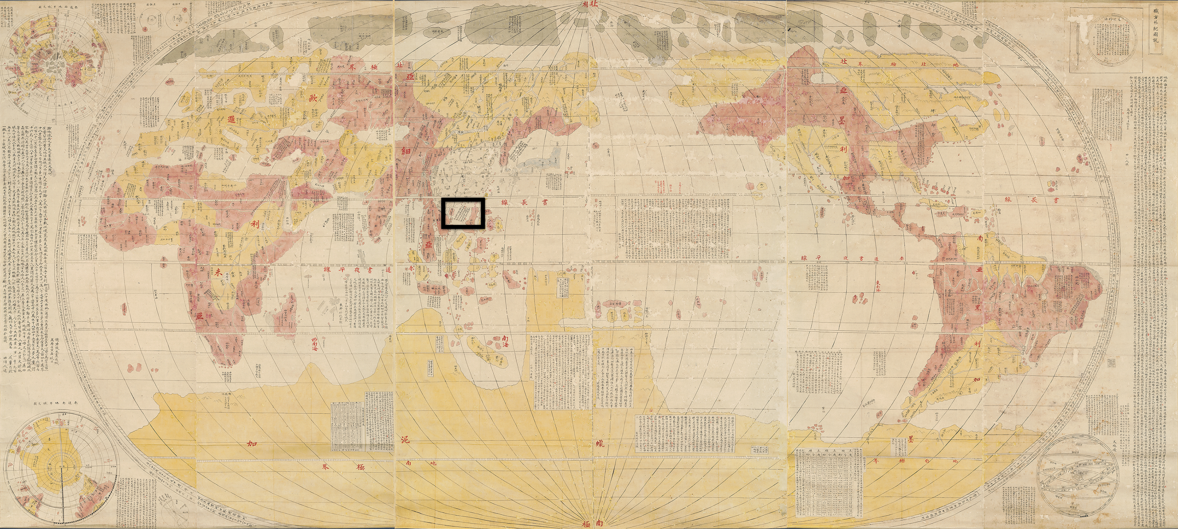
As you examine the hand-written text closely, you can discern that it is messy and irregular, the rows of text are not neatly aligned, and the black ink not always consistently dark. This is a manuscript map and whoever created the map, did not pay close attention to the calligraphy. Still, the content is incredibly fascinating. You learn about many places, countries, and continents around the world. Mexico, you read, produces bird feathers in every imaginable color, while tigers and panthers roam the continent of “Libya” (Africa). Precious stones are produced in India and a silver mountain in South America entices you with the promise of wealth.
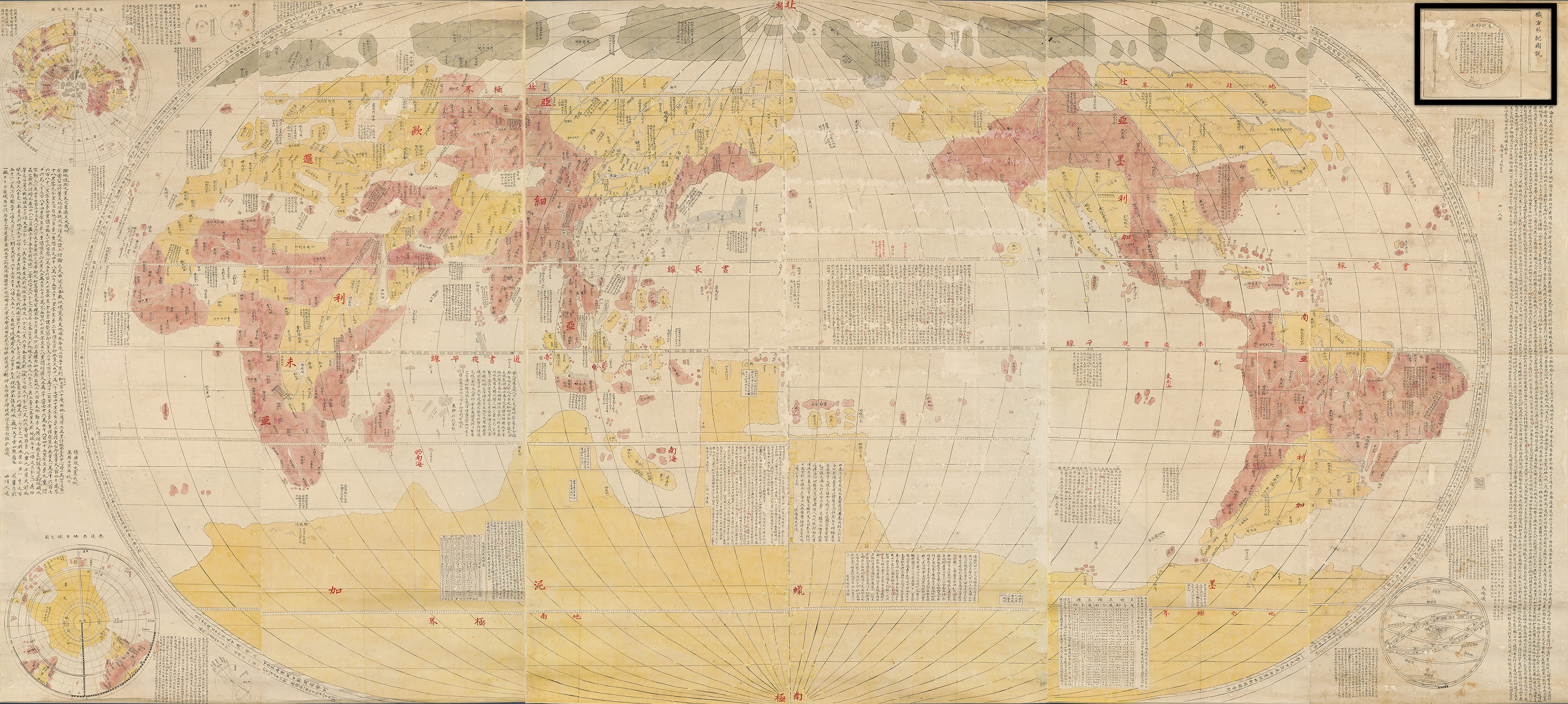
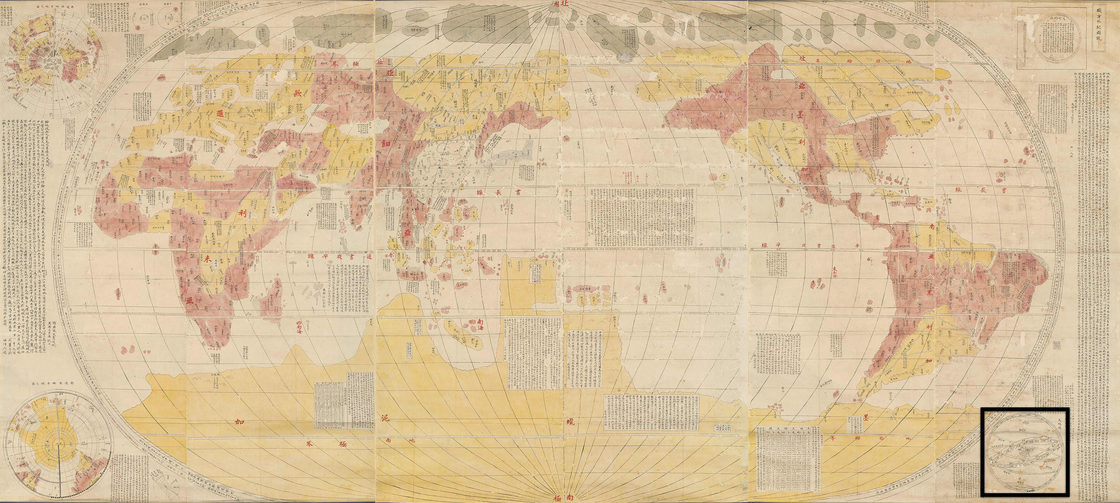
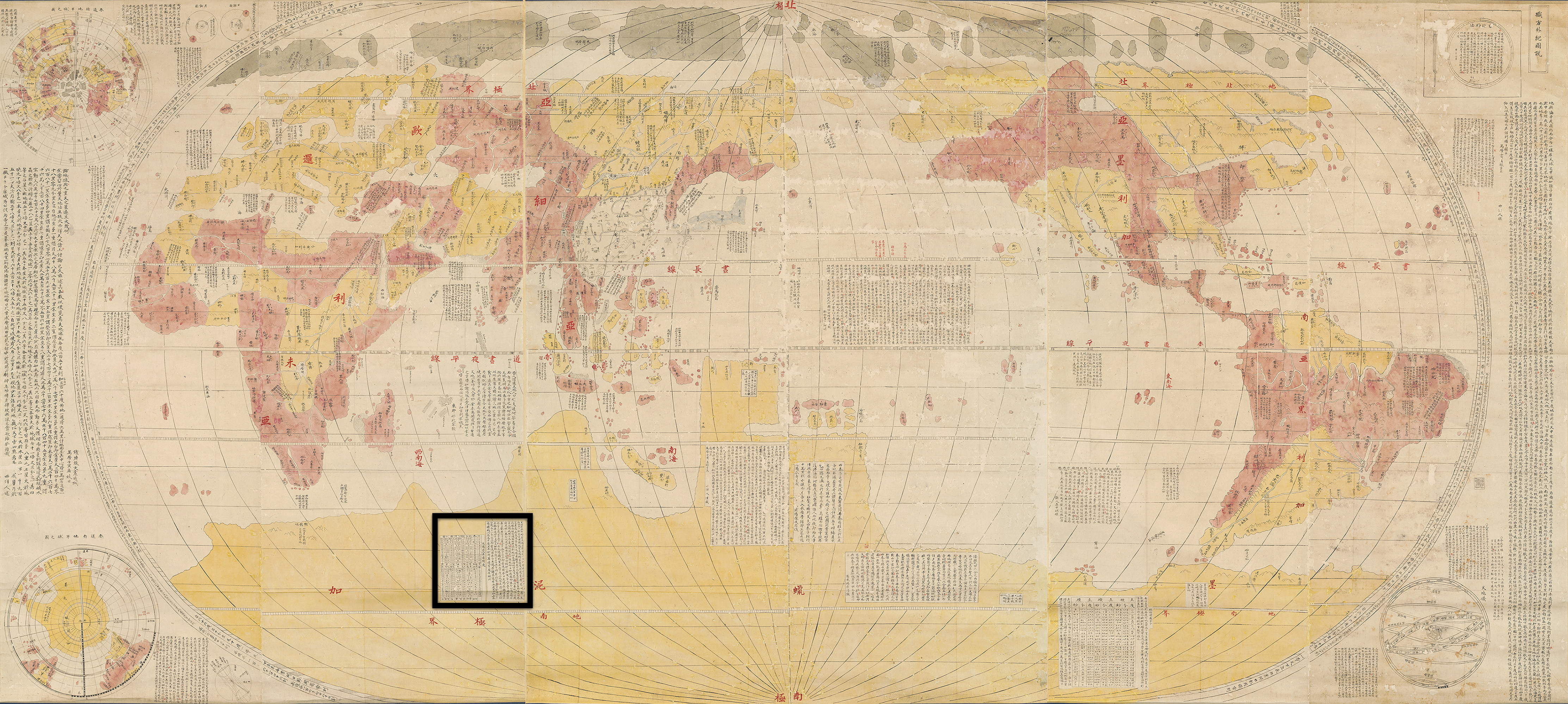
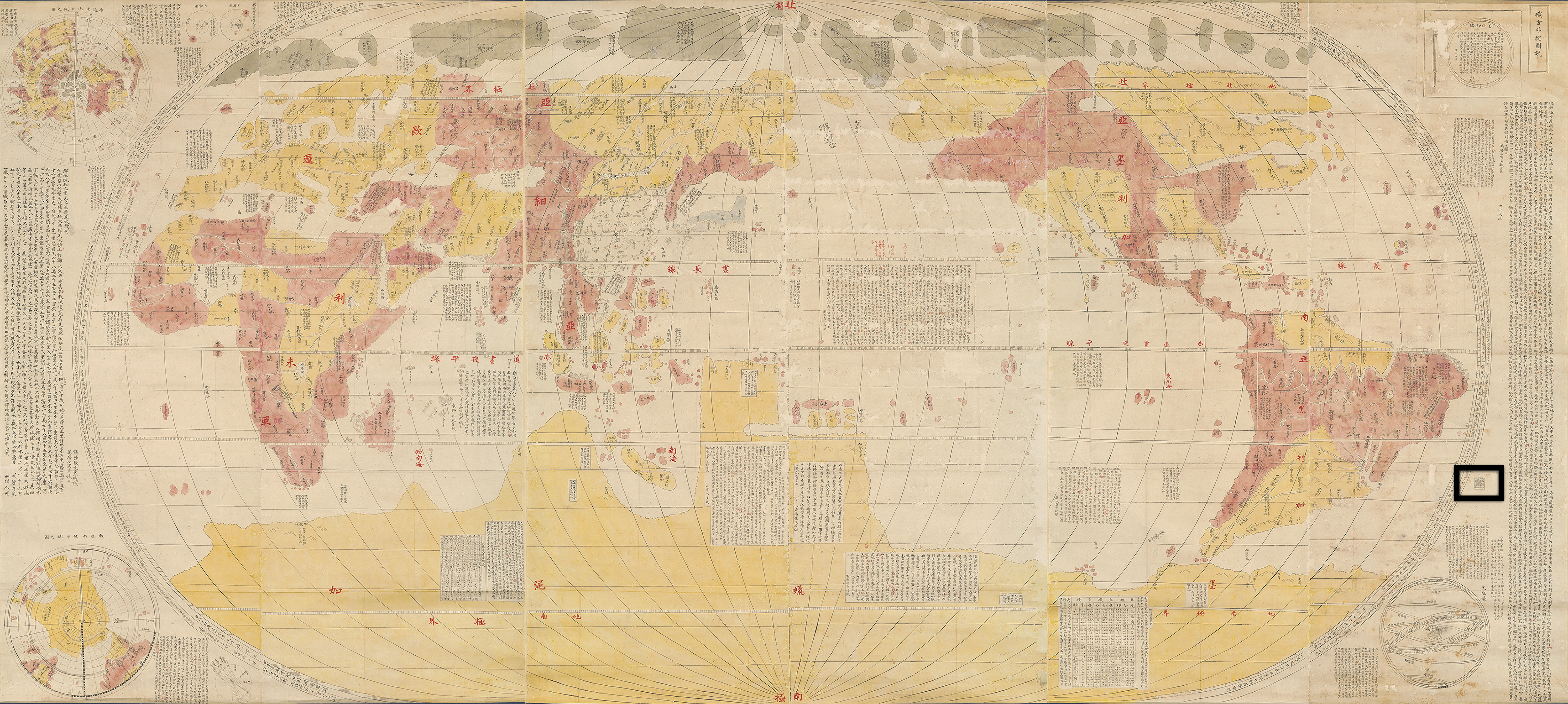
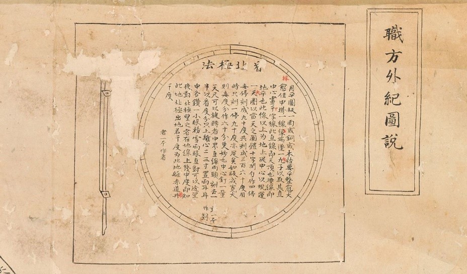
You find additional information at the flanking edges of the right and left scroll. A framed note in the upper right corner identifies the title of the map as Shokuhō Gaiki Zusetsu 職方外紀圖說 (Ch. Zhifang Waiji Tushuo), a title that becomes quite wordy when translated into English: Explanations of the Map of the Record of Everything beyond the Administration. Next to this title, a cartouche explains how to find north.
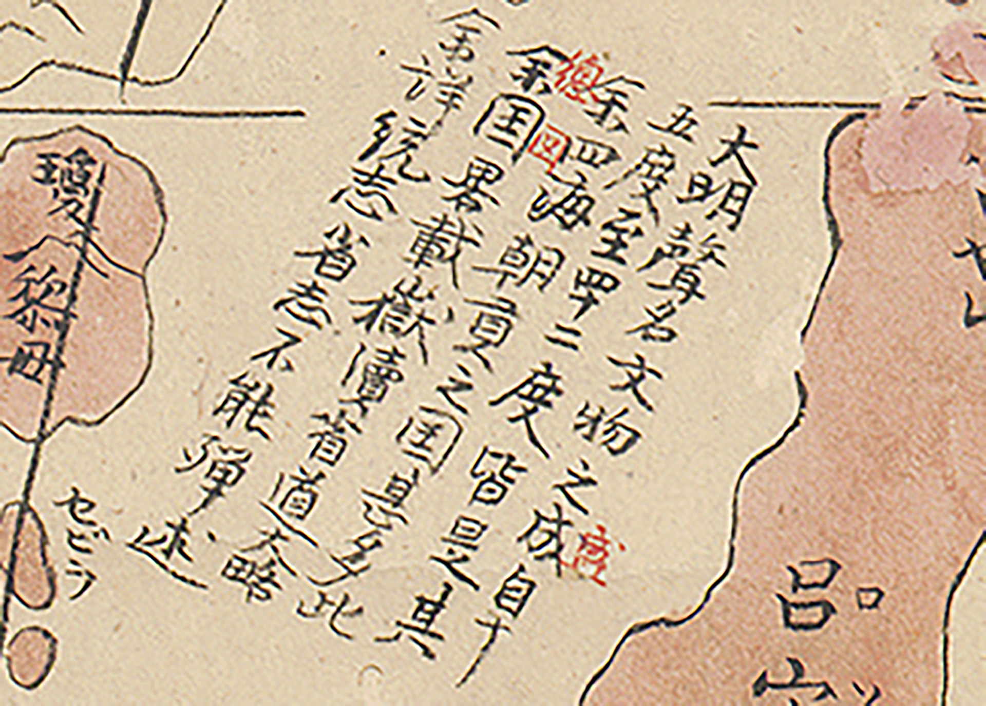
Below is a long text about the shape and size of the earth. It is signed by a “man from the Western Ocean” (seiyō jin 西洋人), meaning someone from Europe. It is dated to “an auspicious day, autumn of Wanli renyin”. The renyin year (according to the sexagenary cycle) of the Wanli reign (1572–1620) of the Ming dynasty (1368–1644) is 1602 in the Gregorian calendar. This date corresponds to the date found on the source map, and not the date when this three-scroll manuscript map was made.
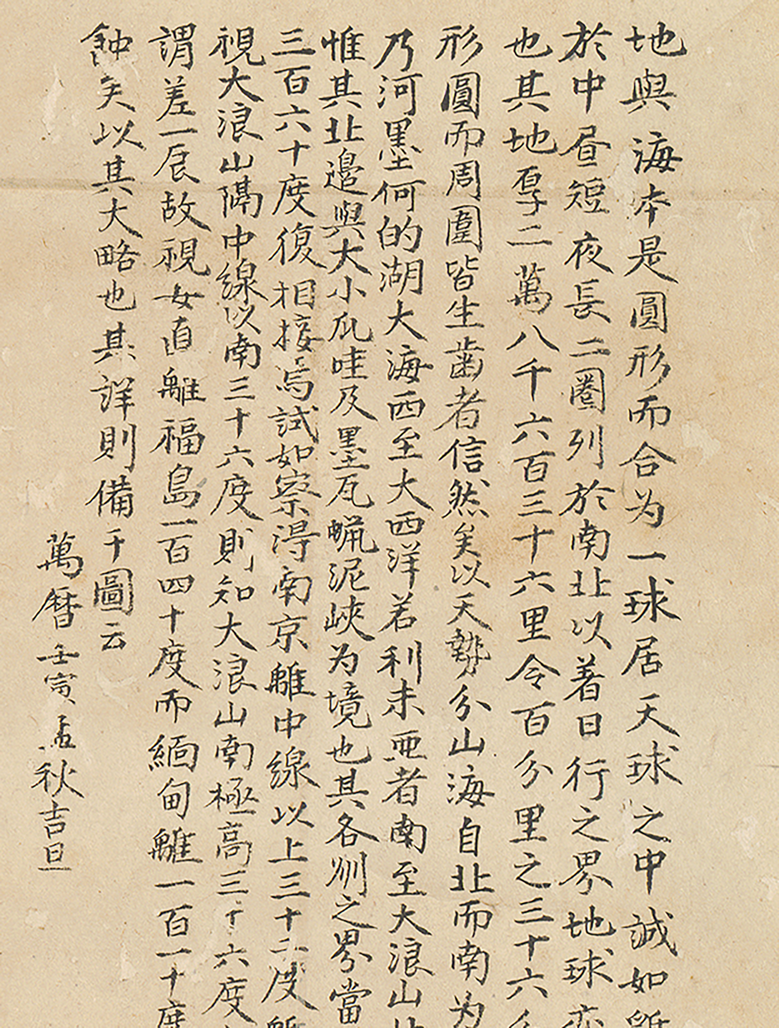
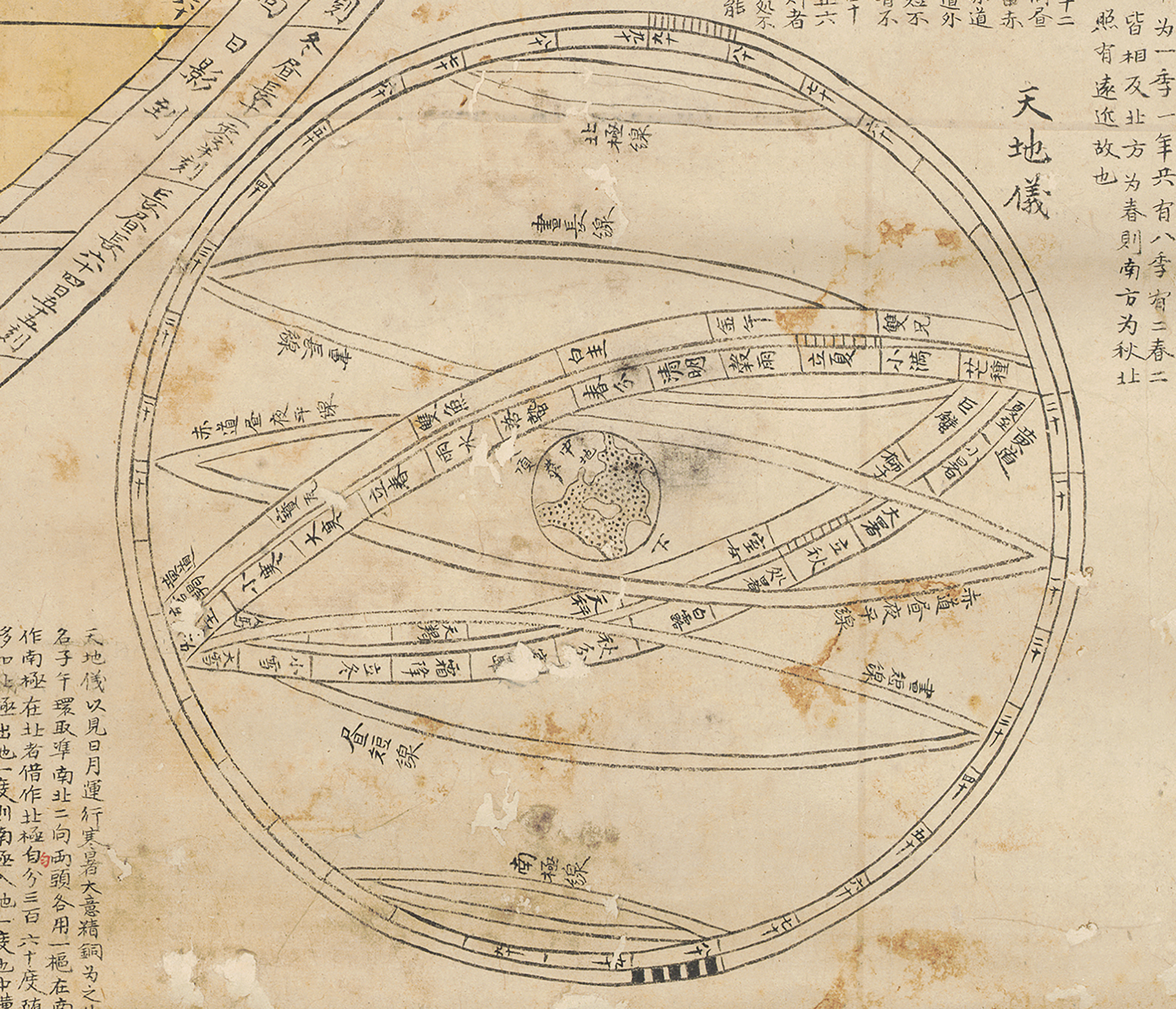
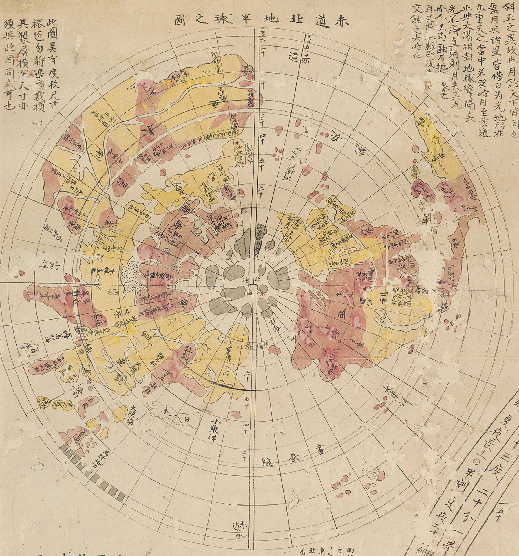
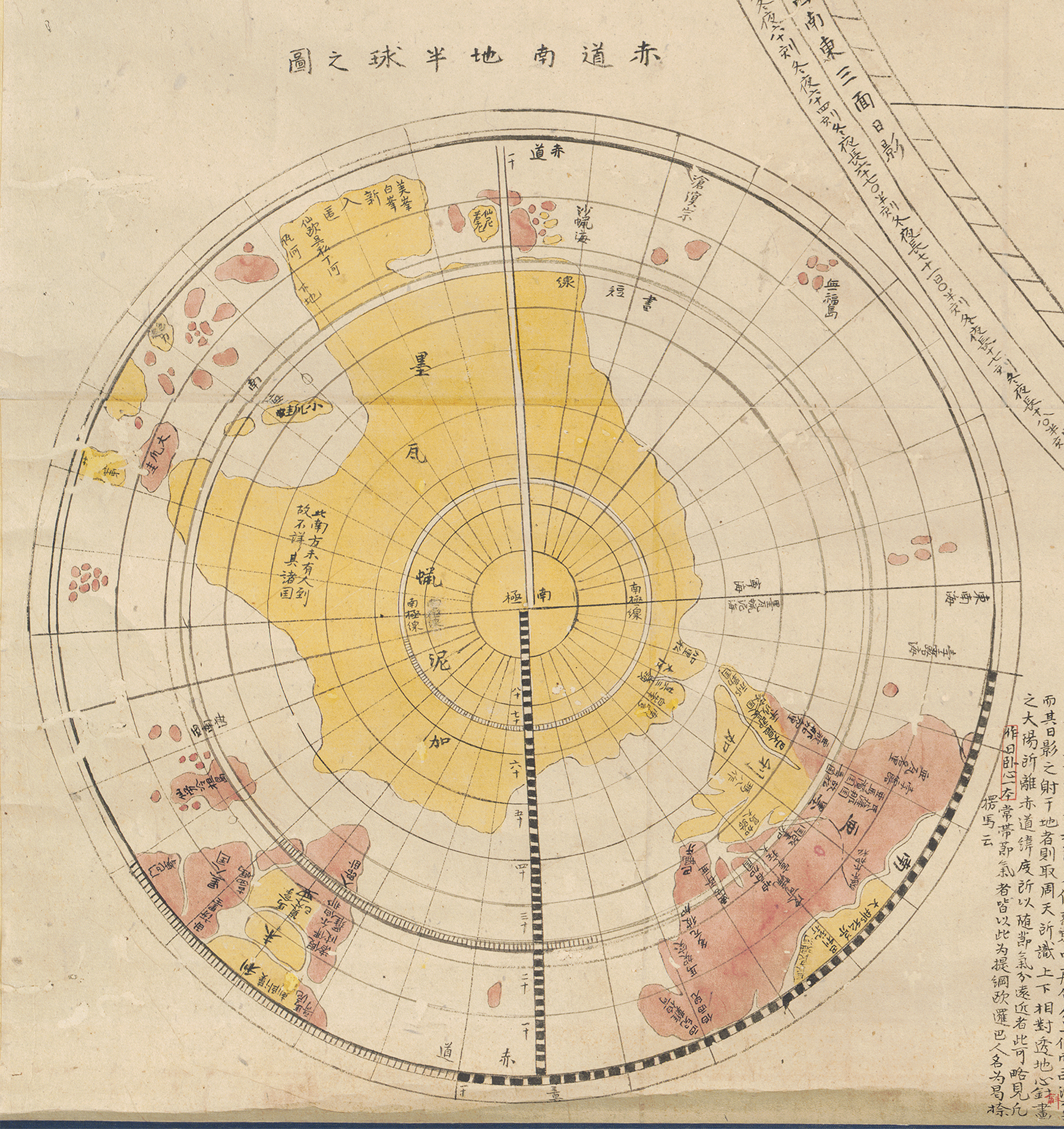
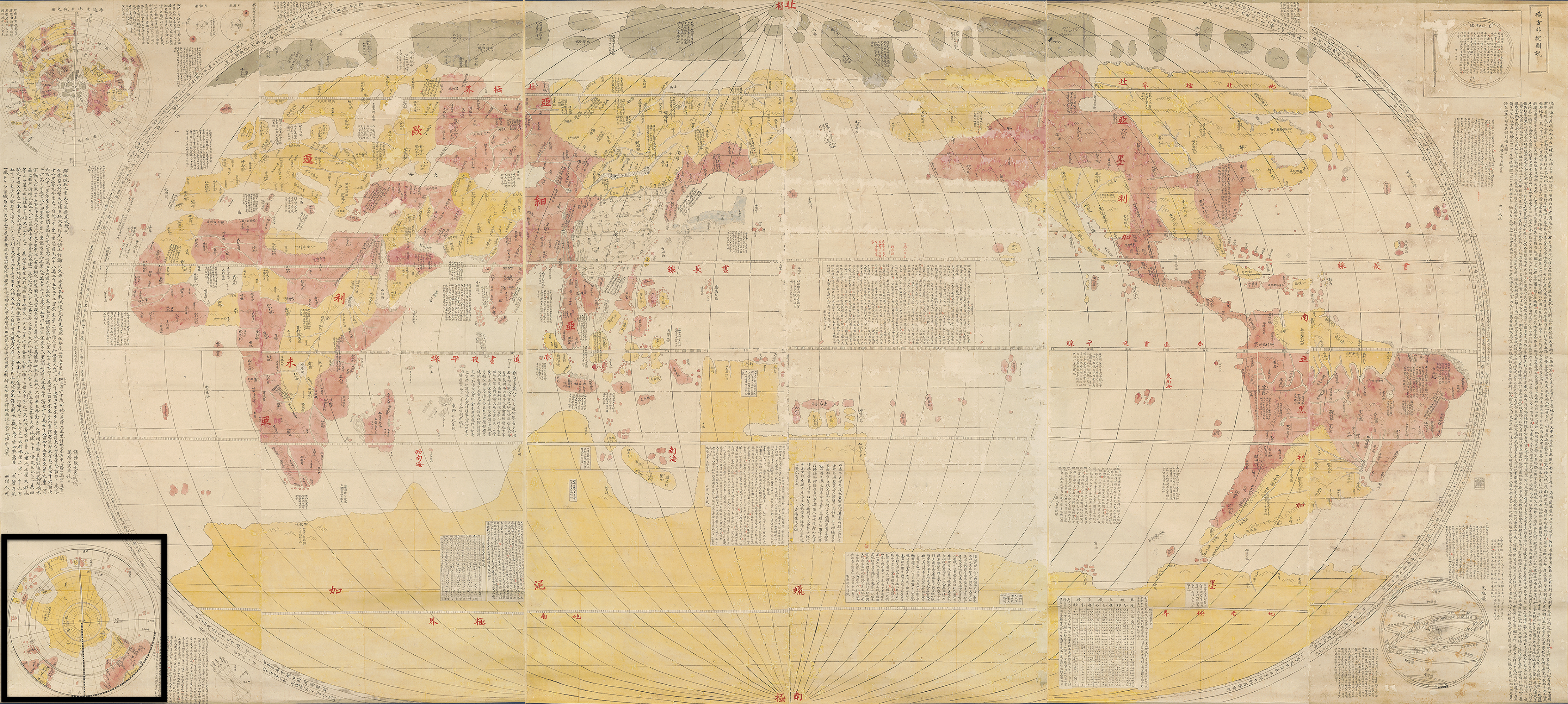
Looking at the center of the oval projection, you discover some of the empty spaces of the Pacific and Indian Oceans or the Southern continent that contain texts by several scholars, as well as additional explanations of geography and astronomy, such as using the declination of the sun to determine latitude.
In sum, these three scrolls show you an impressive world map in an oval projection flanked by useful and interesting information on geography, astronomy, and curiosities about the world.
The Chinese Map Kunyu Wanguo Quantu in Japan
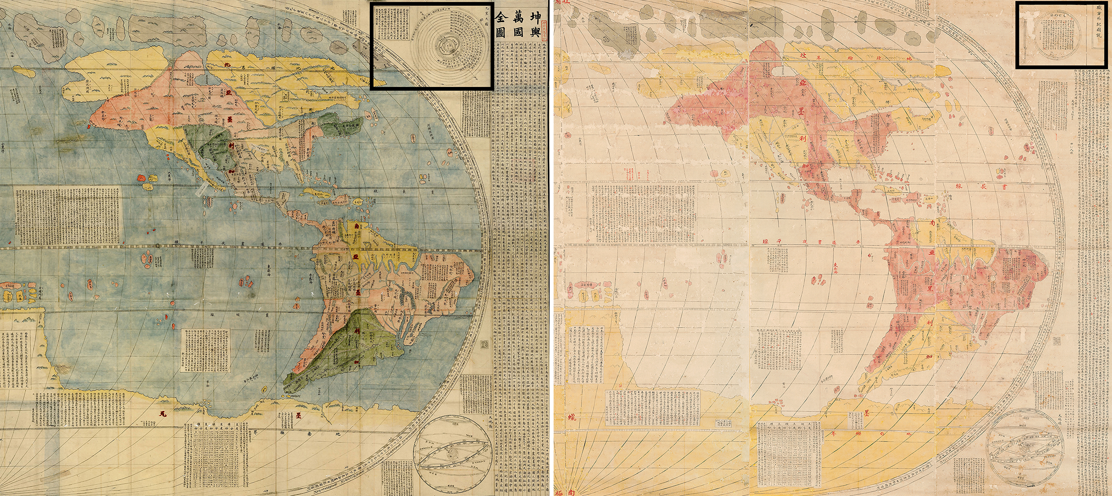
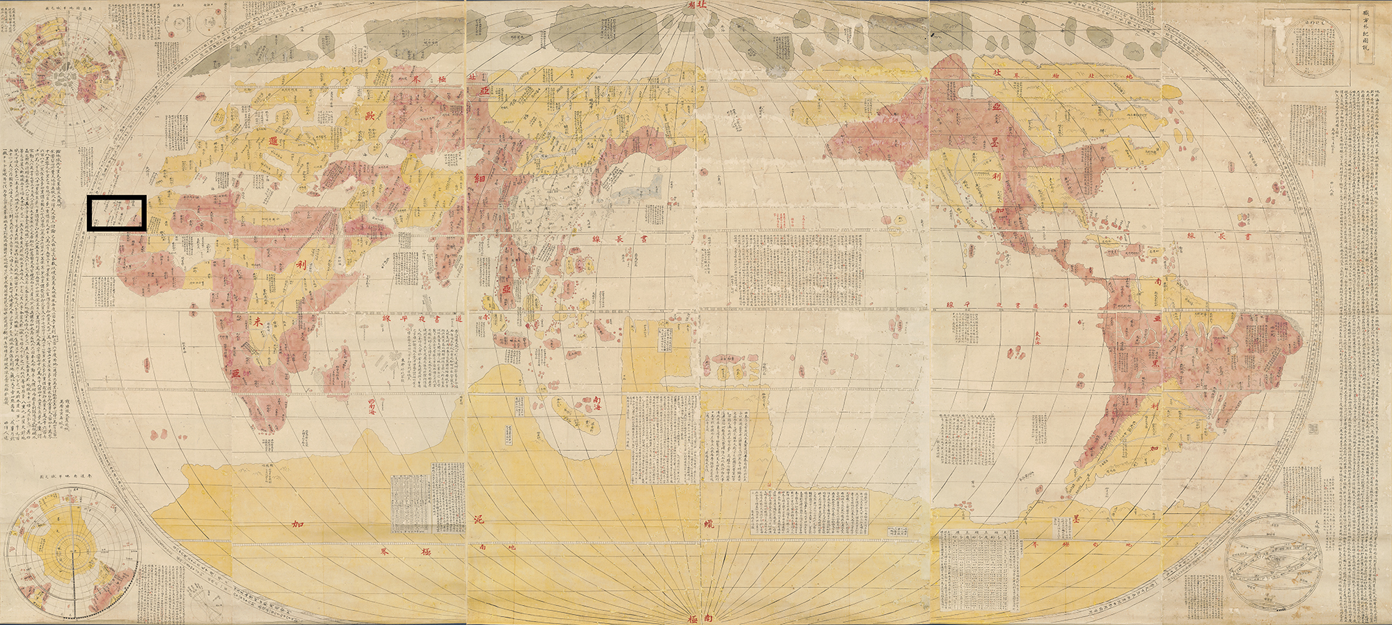
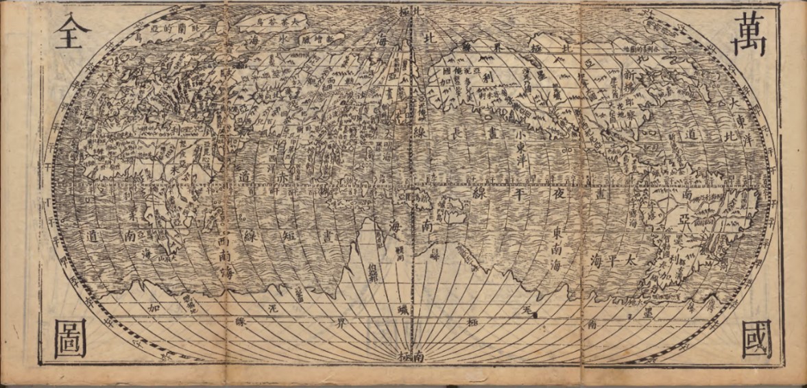
The map to the right, likely dating to the late eighteenth or early nineteenth century and now held by the MacLean Collection Map Library in Illinois, is one of many similar Japanese manuscript maps made in late Edo period Japan (1603–1868). In general, these Japanese copies retain most of the cartographic and textual information provided from a map, below, entitled “Complete Map of All Countries on Earth” (Ch. Kunyu Wanguo Quantu; J. Konyo Bankoku Zenzu 坤輿萬國全圖). This is the title given to a woodblock printed map made through the collaborative efforts of the Jesuit Matteo Ricci (1552–1610) and several of his Chinese colleagues in late Ming China.
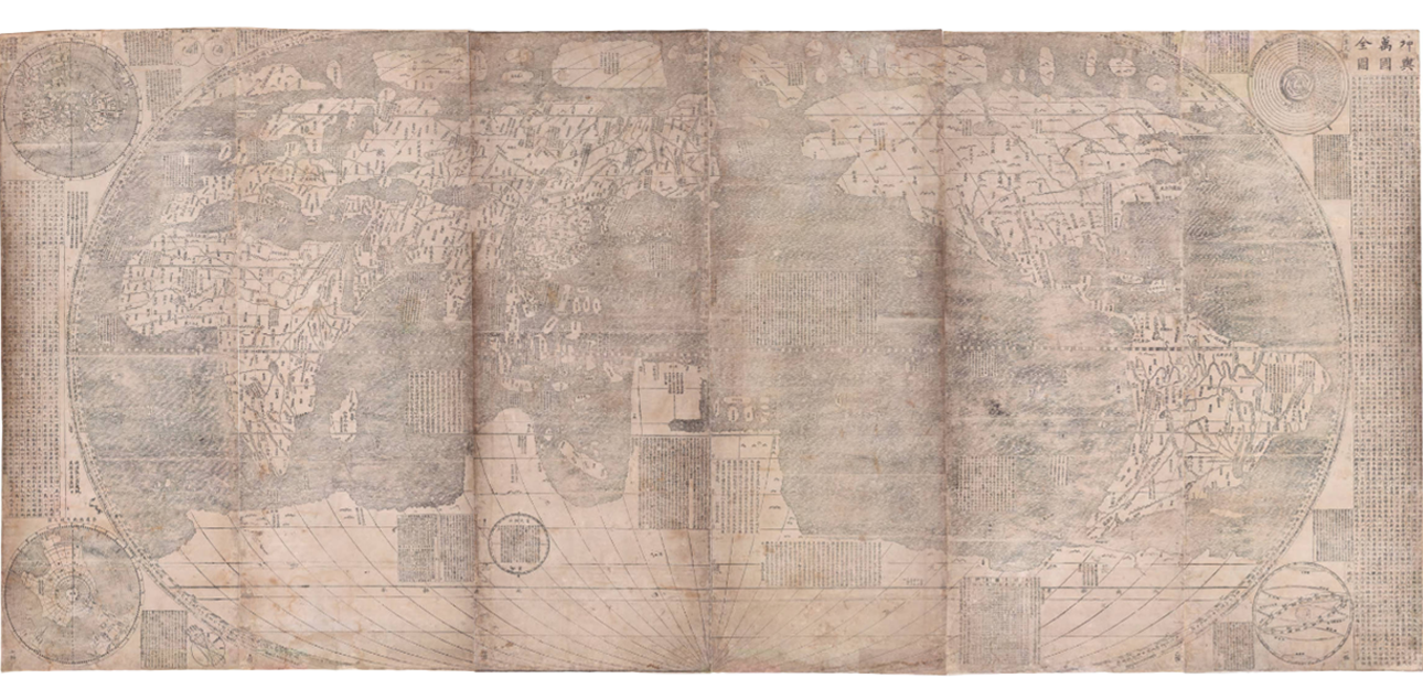
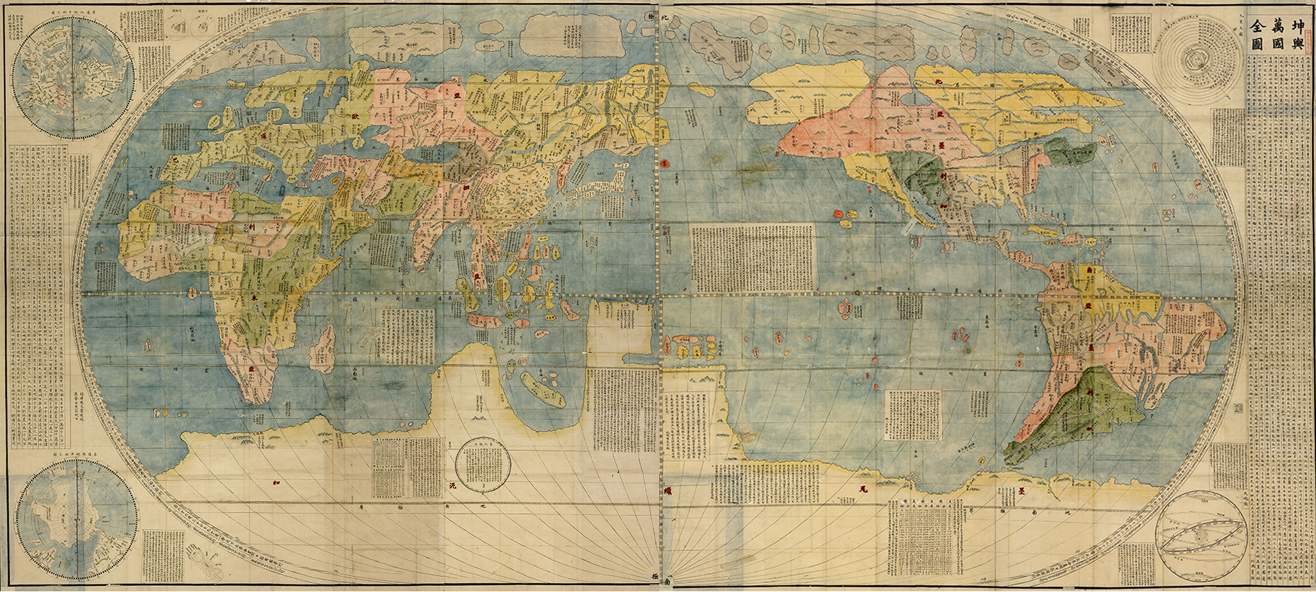
After having been published in Beijing in 1602, prints of the Kunyu Wanguo Quantu quickly arrived in Japan, where artists and scholars made beautiful manuscript replicas in various degrees of faithfulness to the 1602 edition. Today, more than twenty such Japanese Edo period manuscripts are still extant. Many of them are mounted as screens, using expensive materials such as mineral pigments and gold for color. Below is one of the best-known Japanese adaptations of the Kunyu Wanguo Quantu. It is a late seventeenth-century manuscript map now held in the Kanō Collection at Tōhoku University. The Tōhoku University version maintains the overall composition of the 1602 printed version but with a completely different impression due to its vibrant coloring.
Japanese Censorship
Circulation of the Kunyu Wanguo Quantu in Japan did not occur without problems.
The prohibition and censorship of Christianity, particularly between 1685 and 1720,
resulted in any documents with the name of Matteo Ricci being banned. This affected the circulation
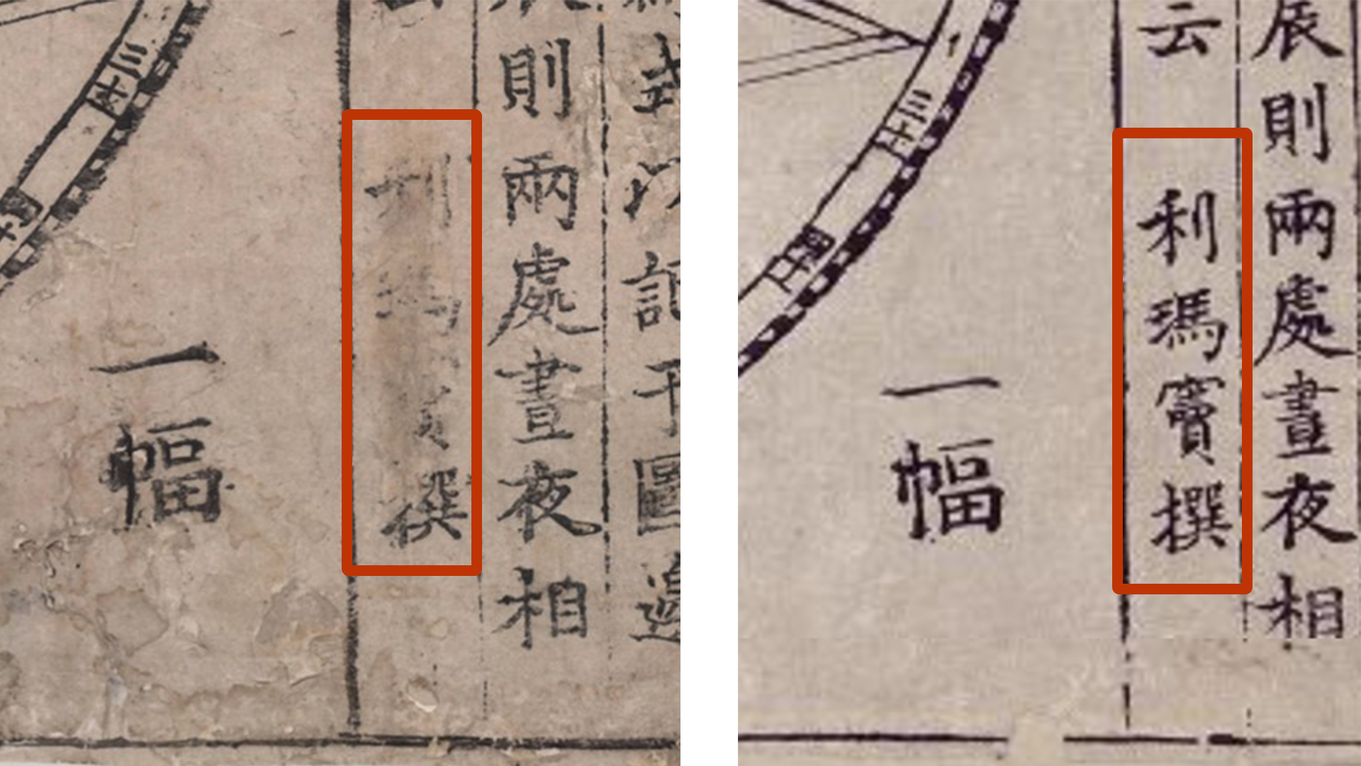
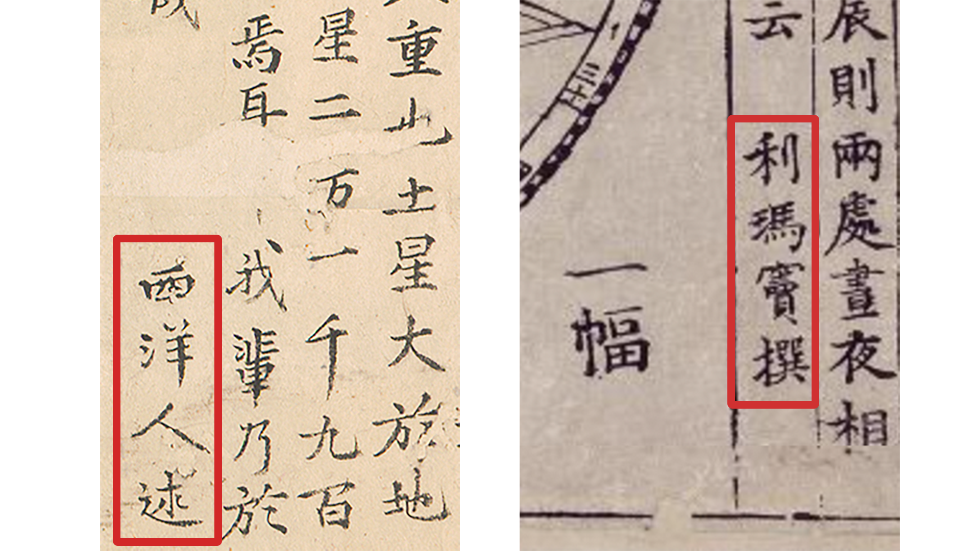
of the Kunyu Wanguo Quantu, which included three prefaces signed by Ricci using his Chinese name Li Madou 利瑪竇.
Some extant prints of the 1602 Kunyu Wanguo Quantu that were in Japan at that time show signs of tampering due to
censorship, such as scratching away the name "Li Madou" and the Jesuit seals.
On the Bell Library version, Matteo Ricci’s name was removed, while on the Miyagi Prefectural Library version, the name is still intact.
After 1720, restrictions loosened, and it is during this period that we see a renewed and widespread interest in copying the Kunyu Wanguo Quantu.
A Curious Case of Retitling
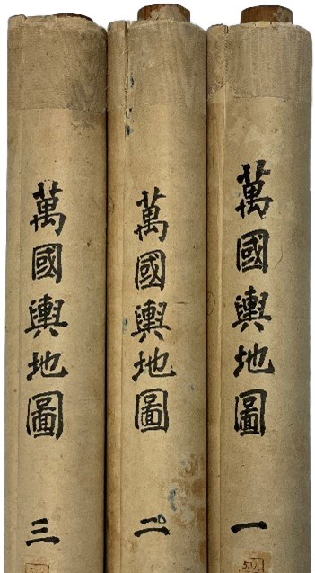
Despite being easily identifiable as one of the many Japanese manuscript maps after the Kunyu Wanguo Quantu, the title Kunyu Wanguo Quantu does not appear anywhere on the MacLean version. Instead, we can find two different titles attached to it. On the outside of the scrolls are hand-written titles that read Map of the Lands of All Countries (J. Bankoku Yochi Zu; Ch. Wanguo Yudi Tu, 萬國輿地圖).
The binomial term bankoku, or wanguo 萬國 in Chinese, literally “10,000 countries,” is what identifies the map as a world map to a Japanese audience. The vast majority of Japanese world maps made during the Edo period bear this term in their title.
The title in the upper right corner of the MacLean map, Shokuhō Gaiki Zusetsu (Ch. Zhifang Waiji Tushuo), is a curious one. Zhifang Waiji refers to the title of a relatively small book on world geography published in China in 1623, made by the Jesuit Giulio Aleni (1582–1649) and his Chinese collaborator Yang Tingyun 楊廷筠 (1557–1627). Despite being censored due to its connection with Christianity, this translation of a European atlas circulated widely in manuscript form in Japan.
The Zhifang Waiji does include several maps, among them is the map below entitled “Complete Map of All Countries” (Ch. “Wanguo Quantu”) as well as two polar projection maps. But the overall presentation of map and accompanying texts of the MacLean map clearly identifies it as an adaptation of the Kunyu Wanguo Quantu not the Zhifang Waiji's “Complete Map of All Countries.”
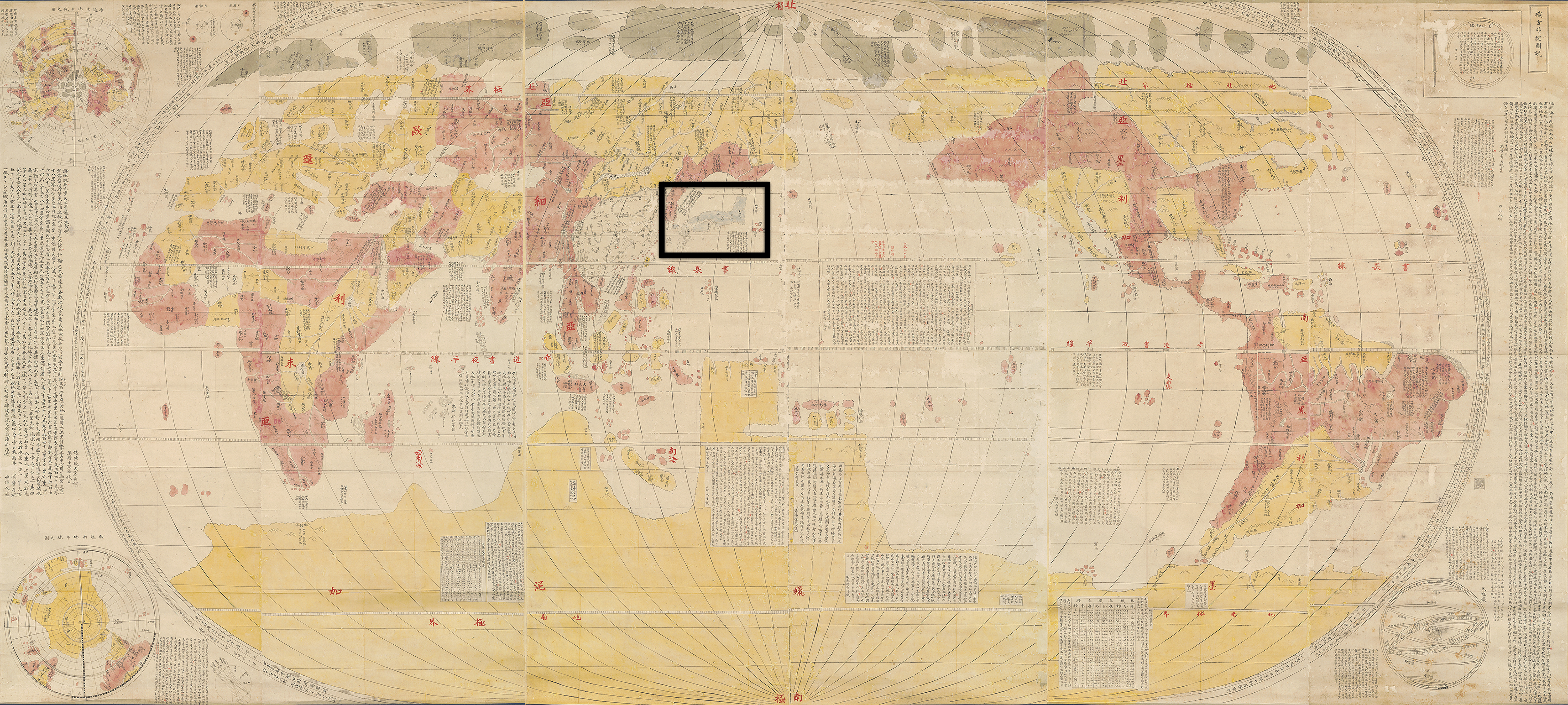
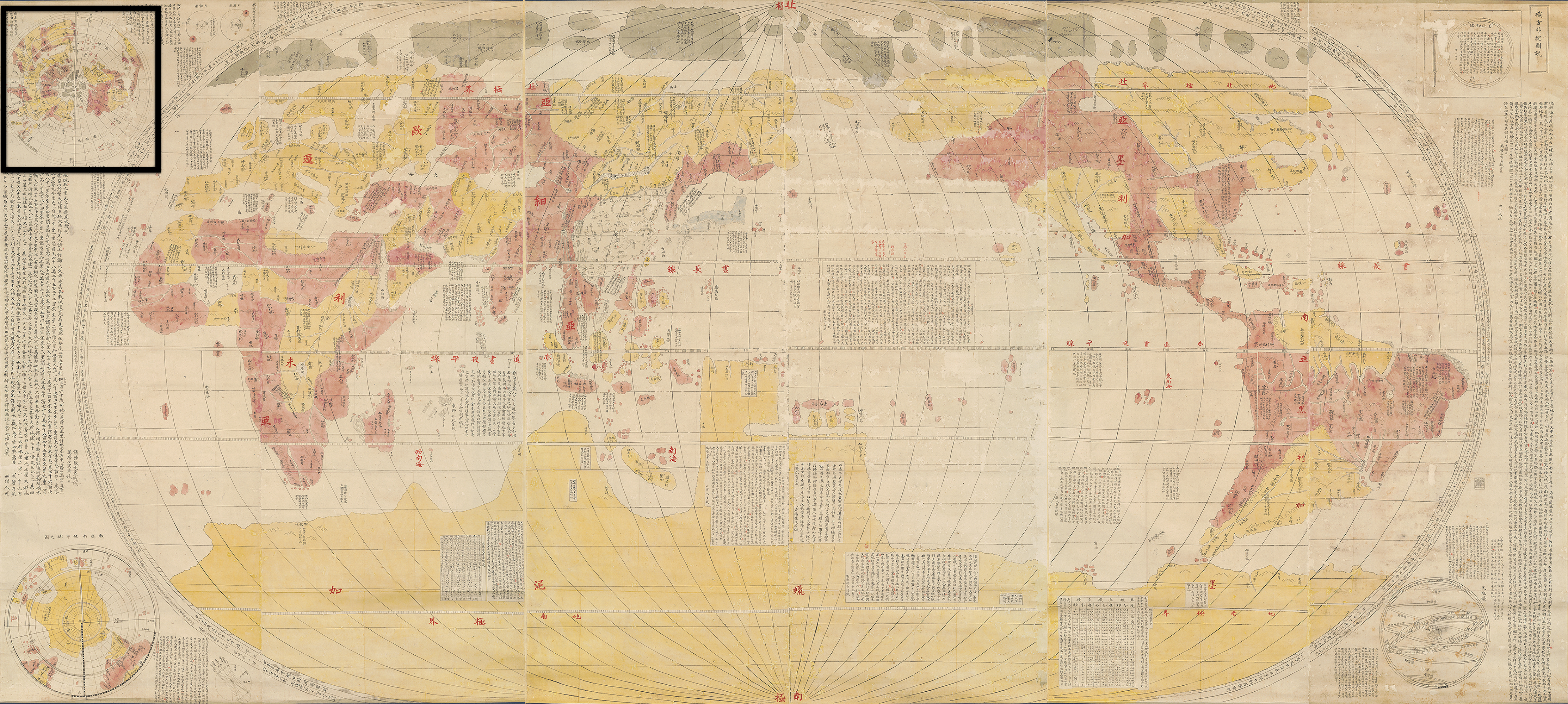
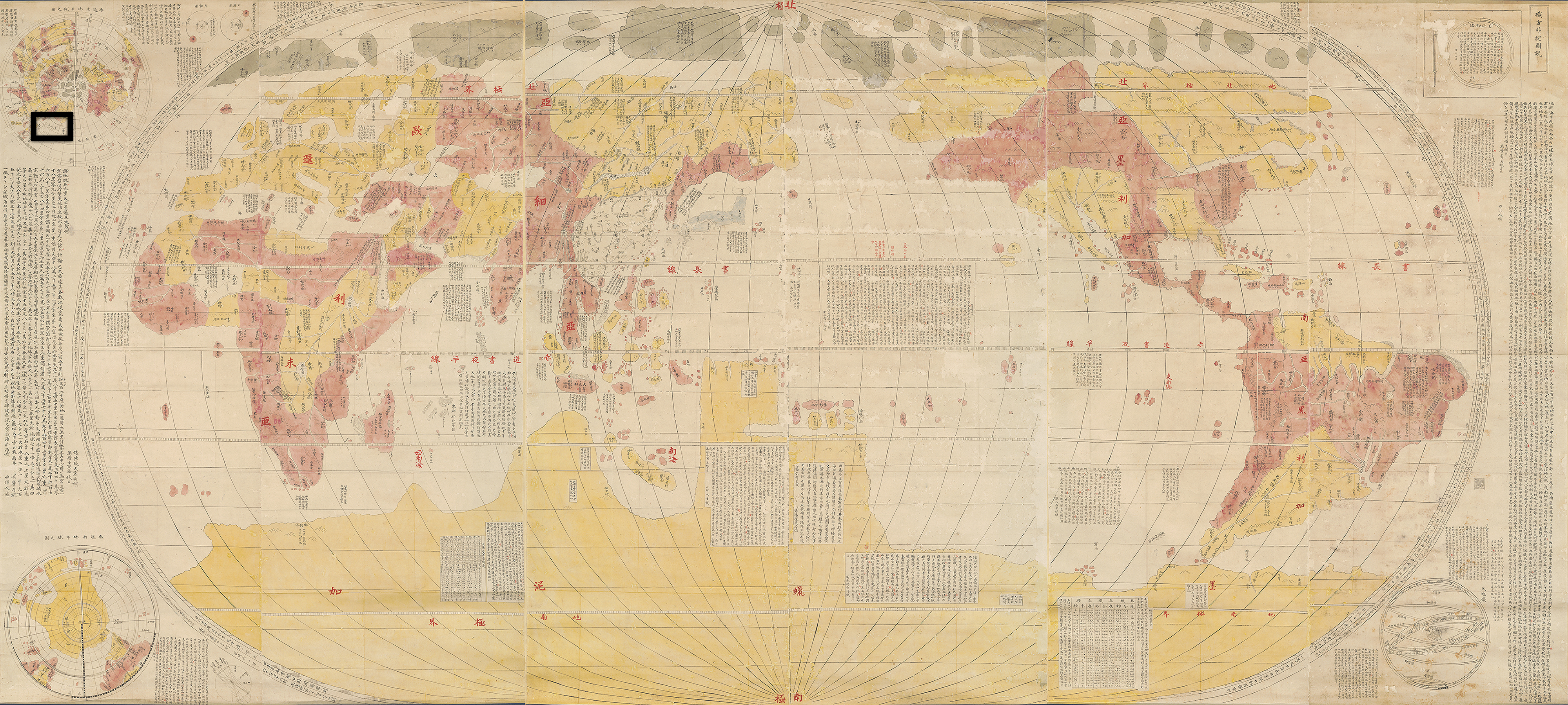
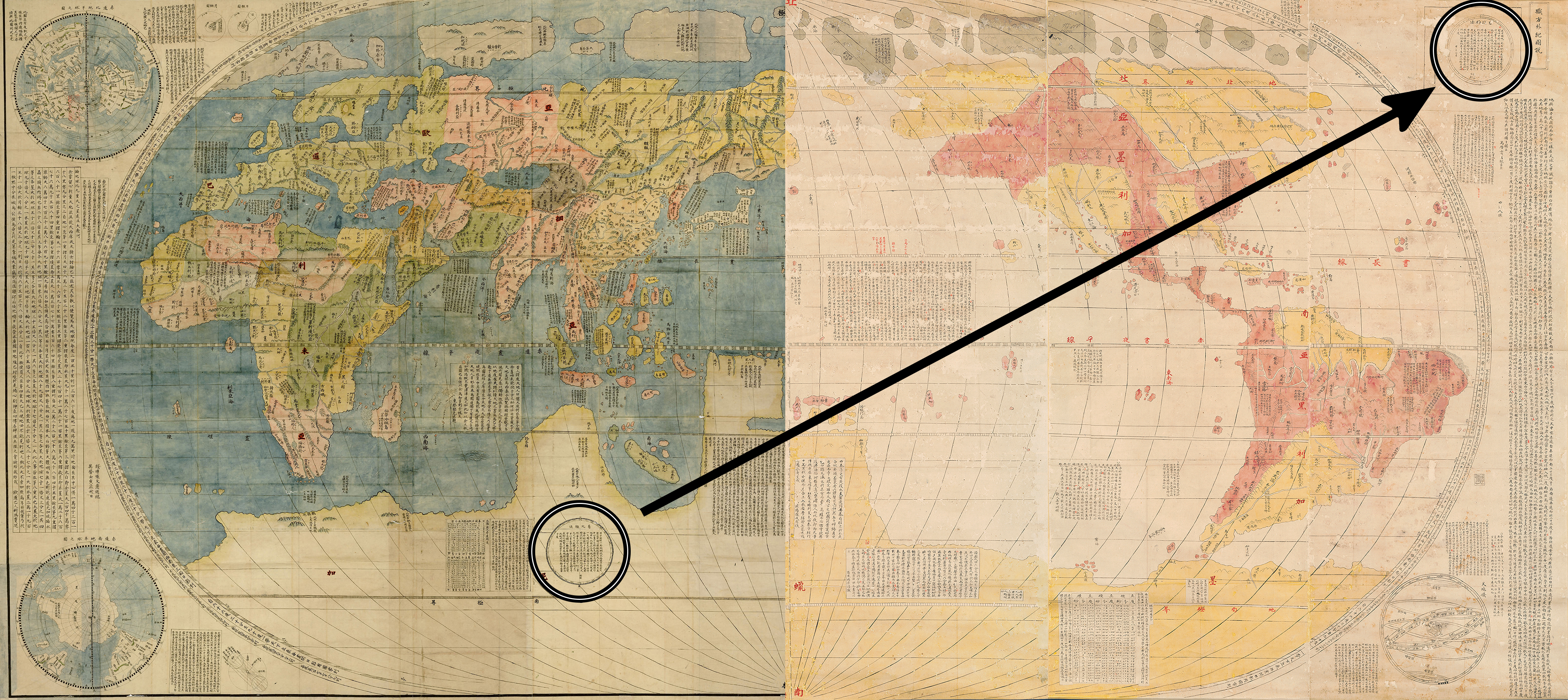
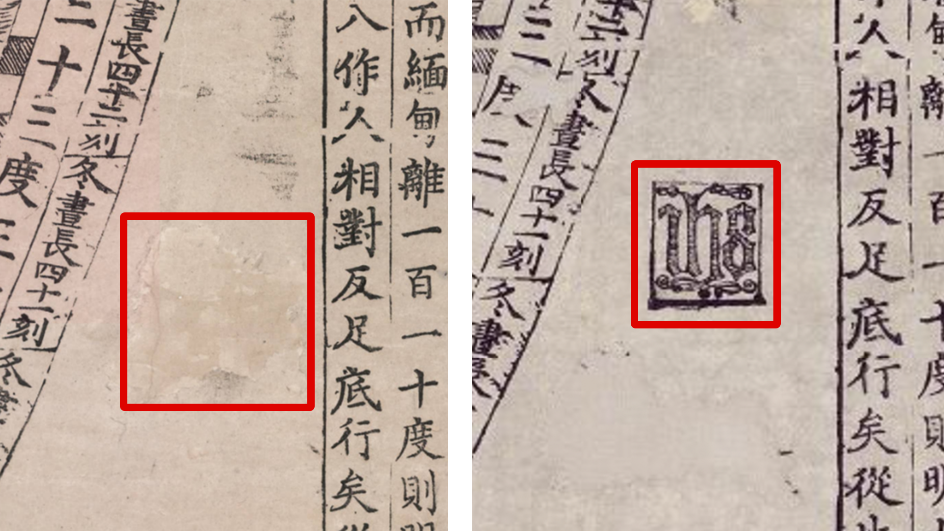
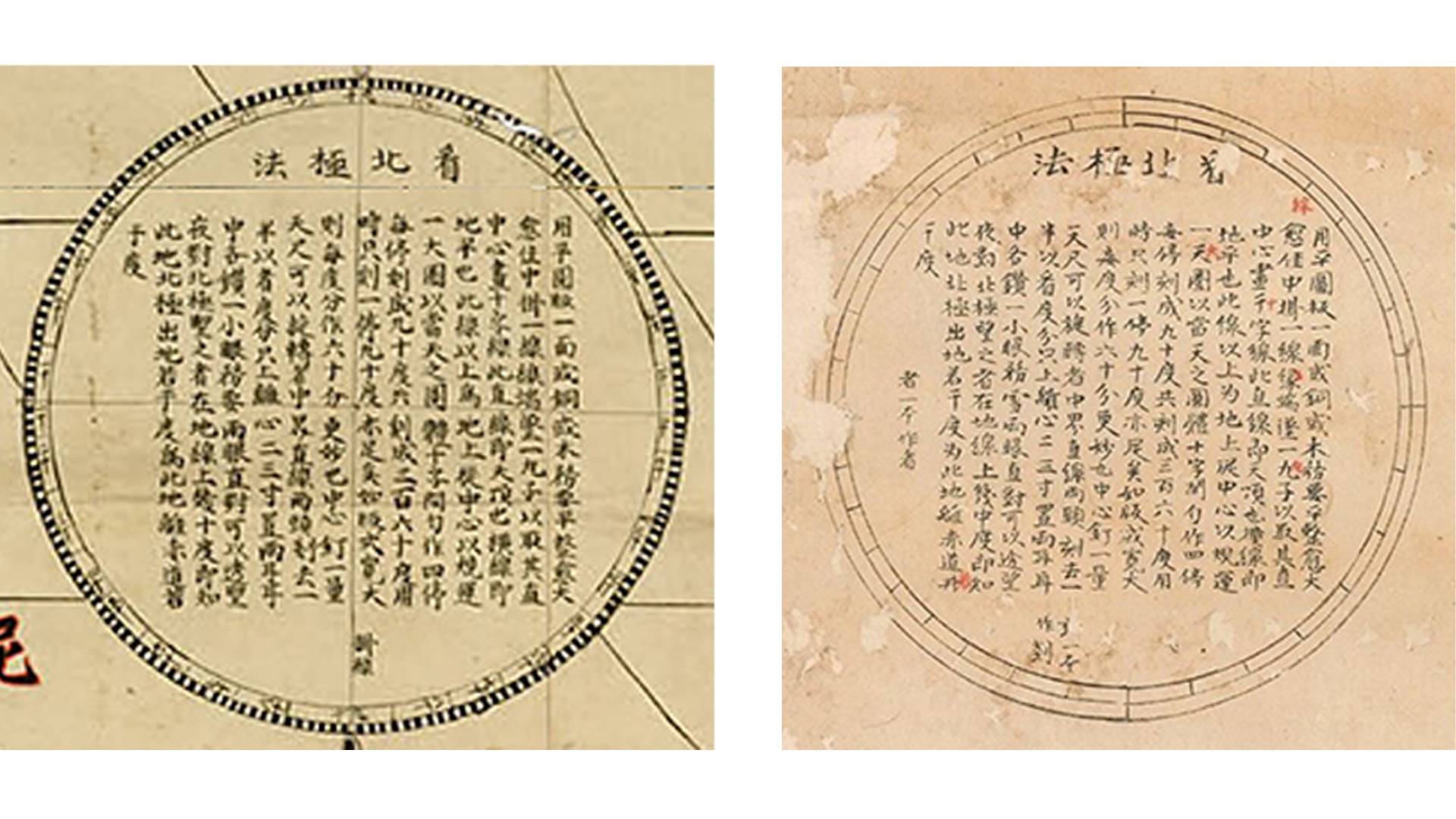
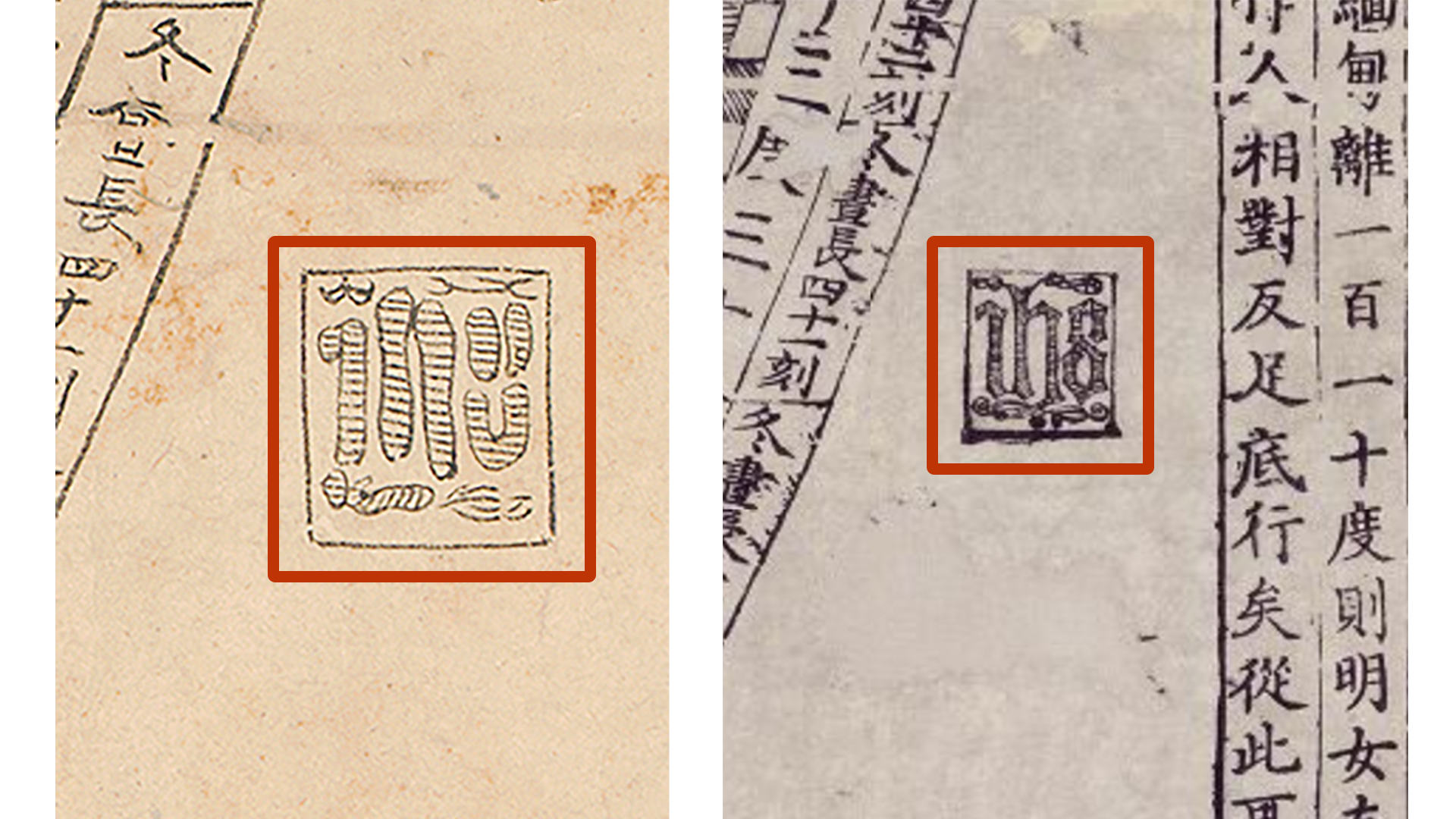
The puzzle of the title and what happened in the top right corner of the MacLean map does not appear to have a straightforward answer. The 1602 print, as well as most of the Japanese manuscript copies, include a diagram of the nine celestial spheres next to the map’s title.
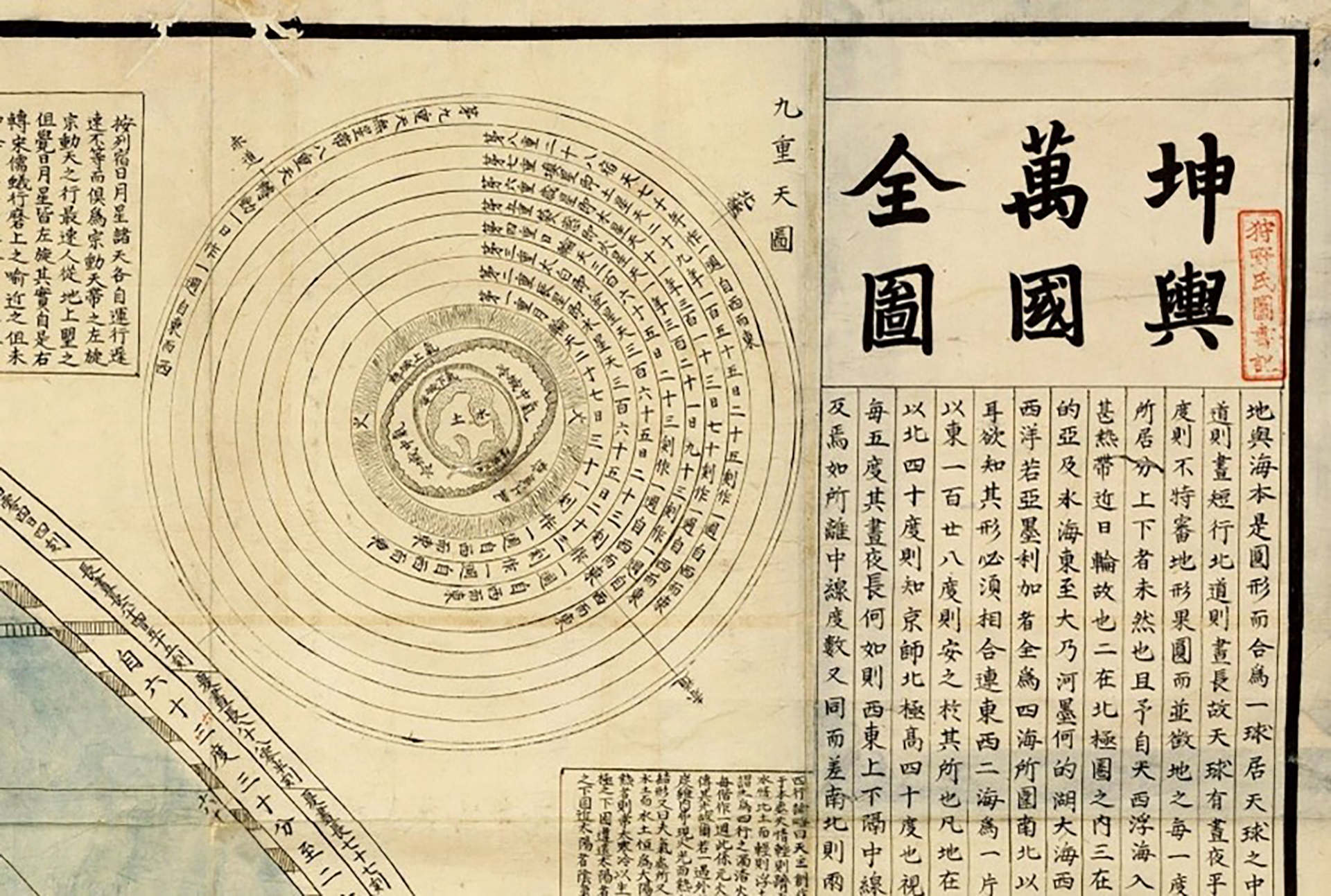
This diagram and title are missing on the MacLean manuscript map. Instead, the comparison image on the right shows that the mapmaker moved the diagram on how to find north, located in the southern continent of most versions of the Kunyu Wanguo Quantu, to the upper right corner.
And then there is the addition of a seemingly arbitrary but not completely unrelated new title on the MacLean manuscript. Perhaps the MacLean version mapmaker had a source map missing the upper right corner. Whatever the unknown reason, the MacLean version has an outside title of Bankoku Yochi Zu and an inside title of Shokuhō Gaiki Zusetsu on a map that an educated reader during the Edo period would expect to be titled Kunyu Wanguo Quantu.
Erasing Ricci
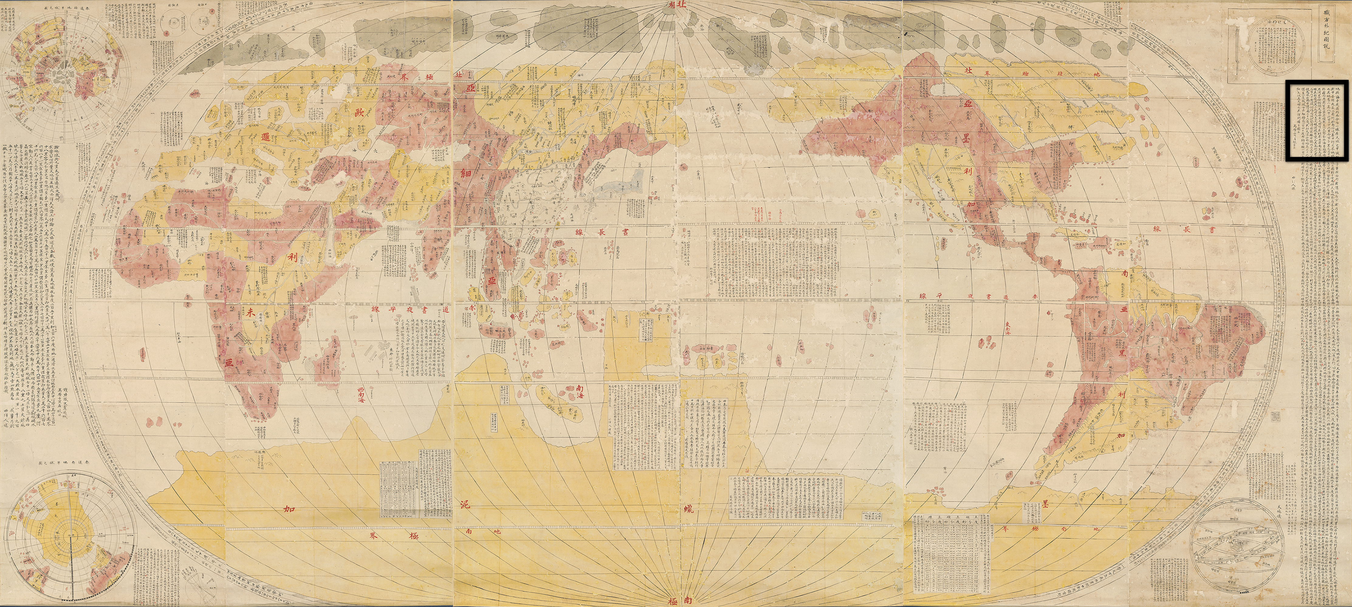
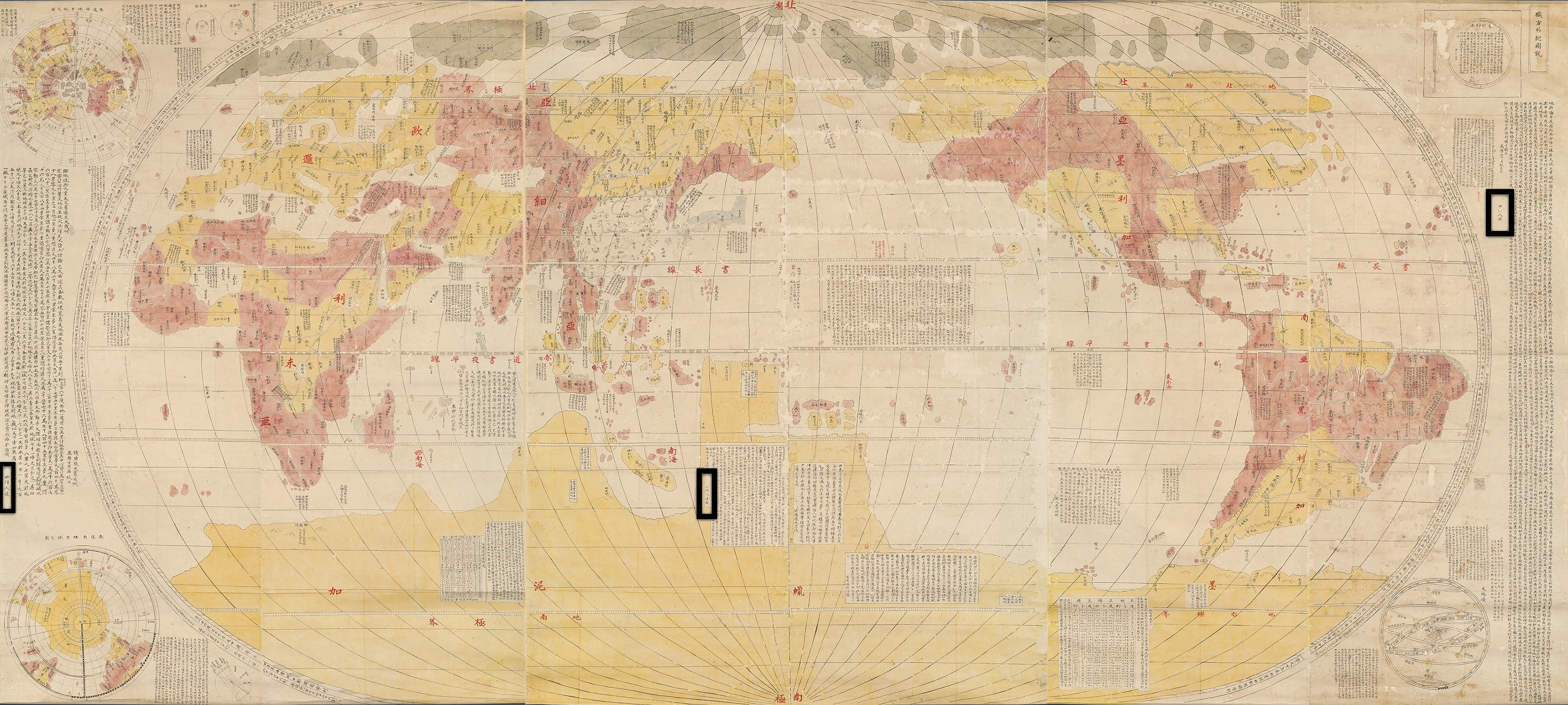
Additional minor changes, besides those related to the title, also confuse the genealogy of the MacLean map. The 1602 print includes three prefaces that Matteo Ricci signed using his Chinese name Li Madou: Two at the very edges of the map, and one in the southern continent. On the MacLean version, the mapmaker replaced all three instances of the name Li Madou with the generic term “man from the Western Ocean,” referring to someone from Europe.
Could the change be due to considerations of censorship? Was Matteo Ricci’s name still too sensitive a topic? This seems unlikely, as by the late eighteenth century censorship had long relaxed, and so such considerations were unlikely to have influenced the mapmaker, especially for a manuscript (versus print) map. In addition, the 1602 Kunyu Wanguo Quantu was never singled out as a document to be censored, while Aleni’s 1623 Zhifang Waiji did appear on the official list of censored books. The MacLean map also displays one of the, once censored, Jesuit seals found on the 1602 print.
If this all seems confusing, it is. Removing Ricci’s name but adding the title Zhifang Waiji would be two changes with a contrary effect in regard to the censorship rules. So the question remains, why confuse or disguise the source maps?
Revising & Mounting the Map
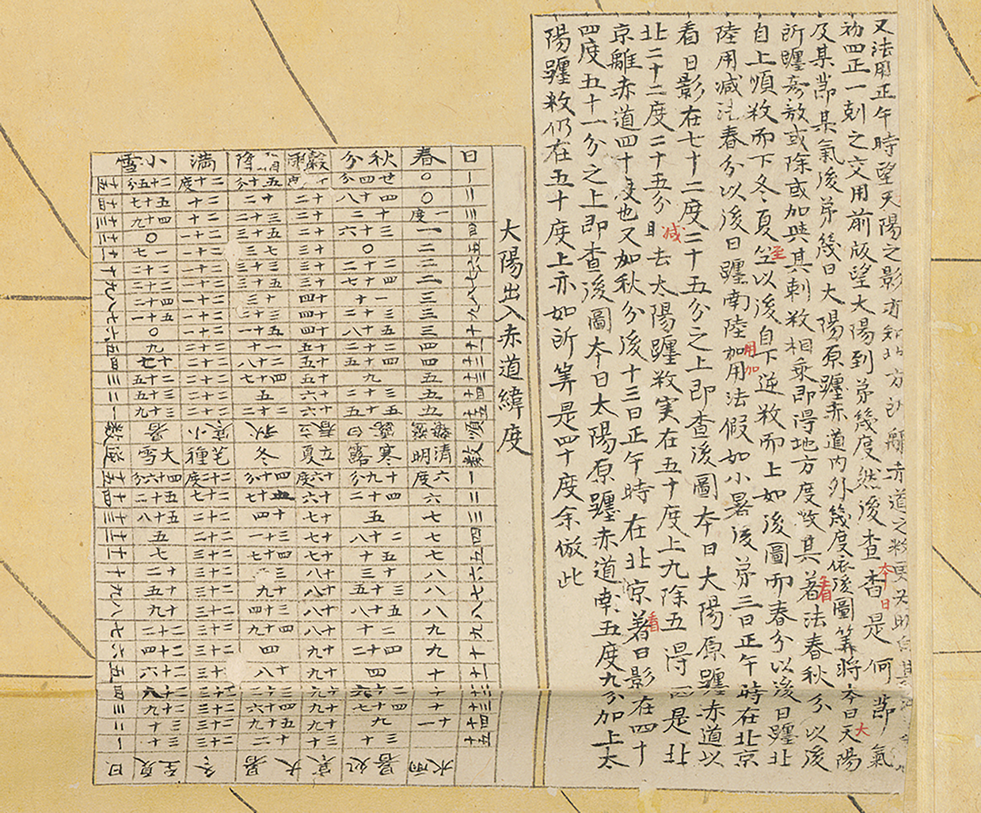
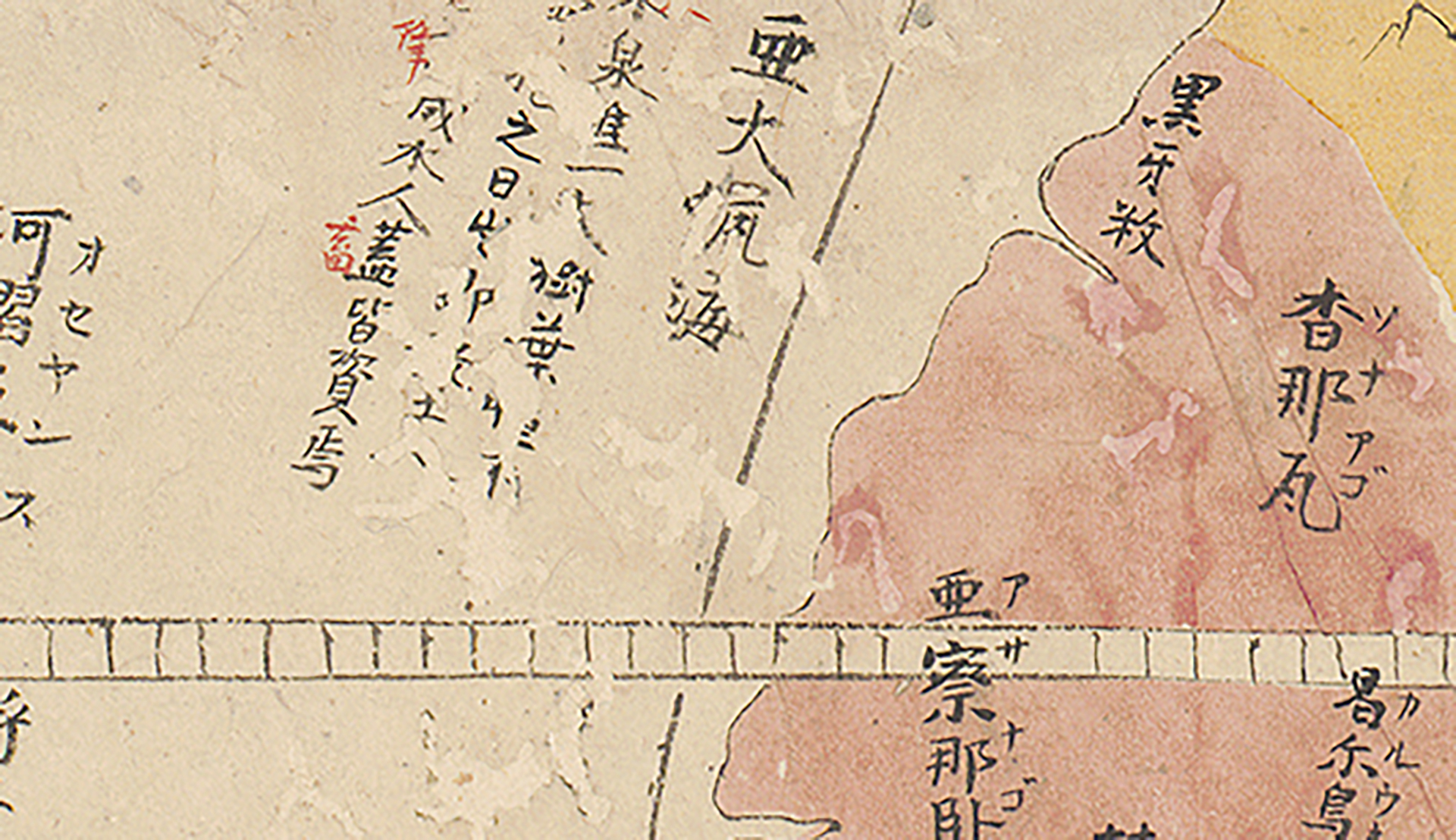
There are other interesting considerations regarding the production of the MacLean map. Many of the text blocks were edited after the manuscript was finished. In other words, somebody gave it another read through annotating, using red ink, character errors the copyist had made.
By looking closely, one can also learn about the history of the physical map. The paper has extensive wormhole damage. In places where landmasses had been colored, someone has added new red and yellow ink to infill worm-eaten losses.
However, there was no attempt to repair the lost text (neither black nor red). Before being mounted as a scroll in its current condition, the map had been folded for some time, as folds and related staining is still visible on the paper. This means, the map was produced in multiple stages: first, hand copying and coloring the whole map, then revising it, re-coloring it, and finally mounting it.
That the map was first folded speaks of a particular intention of the original maker. Creating a folded map using messy calligraphy with many errors that need to be corrected suggest that this map was not intended as a beautiful object to admire but as one of a scholarly endeavor, an object for study to learn about the earth. By re-coloring and mounting the map, this purpose was changed. Mounting the map as a set of three hanging scrolls with a nicely contrasting dark blue brocade border meant the map could now be hung on a wall as a decorative object.
The Konyo Bankoku Zenzu as a Japanese Artifact
Asking questions about when, why, how, and by whom Japanese manuscript maps were made often yields fascinating and unexpected results. The composition of this MacLean version is a unique compilation of sources. It is related to the Kunyu Wanguo Quantu, a map which was produced under the guidance of Matteo Ricci in Beijing in 1602 and was soon after imported into Japan. There it immediately developed into new iterations, its title now pronounced Konyo Bankoku Zenzu.
The MacLean map reminds us that there is more to the Japanese Konyo Bankoku Zenzu manuscripts than making simple copies of the 1602 Kunyu Wanguo Quantu. The original production context and the fact that Matteo Ricci had participated in the original stage had become completely irrelevant to the Japanese mapmaker two centuries later. This means that we should not ignore the materiality and production of any given map, nor the Japanese mapmakers themselves. Moreover, the MacLean map highlights that a map might never be finished and that any given map might signify different things to different people; as here what began as a scholarly map exercise became a decorative object to be hung in a Japanese home.
Credits
Elke Papelitzky was a 2018 MacLean Library Map Fellow. Currently, she is a postdoctoral fellow at KU Leuven
and conducts her research as part of the ERC-funded AdG project TRANSPACIFIC (Grant Agreement no. 833143). She received her
PhD from the University of Salzburg in 2017 and is the author of Writing World History in Late Ming China and the Perception
of Maritime Asia (Harrassowitz, 2020) and of several articles and book chapters.
Katie Osborne is a senior at Lake Forest College, and she has been working on Map Chat projects as a MacLean intern since August 2021. She is a self-design major studying independent media with a concentration in post-production editing.
Katie will earn her Bachelor of Arts in May 2023 after she completes her senior year at Columbia College in Chicago.
Jami Biddle is a junior at Case Western Reserve University. She is a summer 2022 Maclean intern studying computer science & linguistics. Jami will earn her Bachelor of Arts in May 2024.
Sources
Complete Map of All Countries on Earth (Kunyu wanguo quantu), China, 1602, woodblock print, hanging scrolls mounted and framed, ink on paper, 167 x 369 cm.Further Reading
For a wide range of Japanese world maps, including several manuscript Konyo bankoku zenzu, visit this website.