The Title
A title label is pasted to the silk on the cover that reads in Manchu Mukden-i dedun uden-i nirugan (Map
of the day and night stations to Mukden). Mukden has two meanings and a distinction should to be made
between the garrison town of Mukden that became the Manchu capital in 1625, and the Greater Mukden area
that marked the birthplace of the Manchu peoples. The town of Mukden was not the final destination of the
tour; the route ended at the memorial complex called the Eternal Tombs (M. Enteheme Munggan; C. Yongling).
This suggests that in this title, Mukden referred to Greater Mukden, an area spanning from the Liaodong
peninsula in the north, to Bedune and Ningguta in the south; and from the Willow Palisade on the West to
the Yalu and Tumen Rivers on the East (Elliott 2000). Mukden was an important place in Qing imperial
rituals marking Manchu identity, as a signifier of the origins of the Manchu peoples—along with the
Changbai Mountains. The term Mukden itself can be translated as “florescence” and derives from the verb
“muktembi”, which means “to arise.” In Chinese, the toponym “Shengjing” (盛京) also reflects this
meaning. An illustration of the territory corresponding to Greater Mukden first appeared in “the Complete
Map of Mukden” section of the so-called Jesuit Atlas (Huangyu quanlan tu 皇輿全覽圖) made from 1709-1712
The term dedun refers to the stations where the members of the entourage would stay overnight while uden designates the midday rest stops on the journey. The title thus emphasizes the logistics of the tour more than its ritualistic components, which is also reflected in the type of information included on the map. The map does not contain poems, artistic illustrations of ritual sites or mountains, or depictions of symbols. Instead, the map records the distances traveled each day, where the Emperor stopped to rest and where he stayed overnight.
The term dedun refers to the stations where the members of the entourage would stay overnight while uden designates the midday rest stops on the journey. The title thus emphasizes the logistics of the tour more than its ritualistic components, which is also reflected in the type of information included on the map. The map does not contain poems, artistic illustrations of ritual sites or mountains, or depictions of symbols. Instead, the map records the distances traveled each day, where the Emperor stopped to rest and where he stayed overnight.
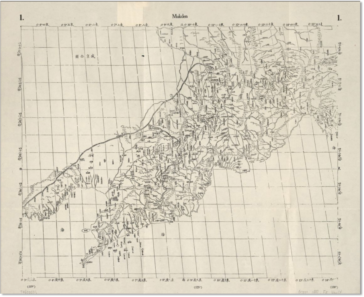
Kangxi Atlas (Huangyu Quanlantu), Jean Baptiste Regis, 1709-12, reprint 1941,
atlas sheet, ink on paper, 68 x 76 cm, Library of Congress, G7820 s0000 .R4
To view a reconstruction of the full map, visit the Qingmaps site
To view a reconstruction of the full map, visit the Qingmaps site
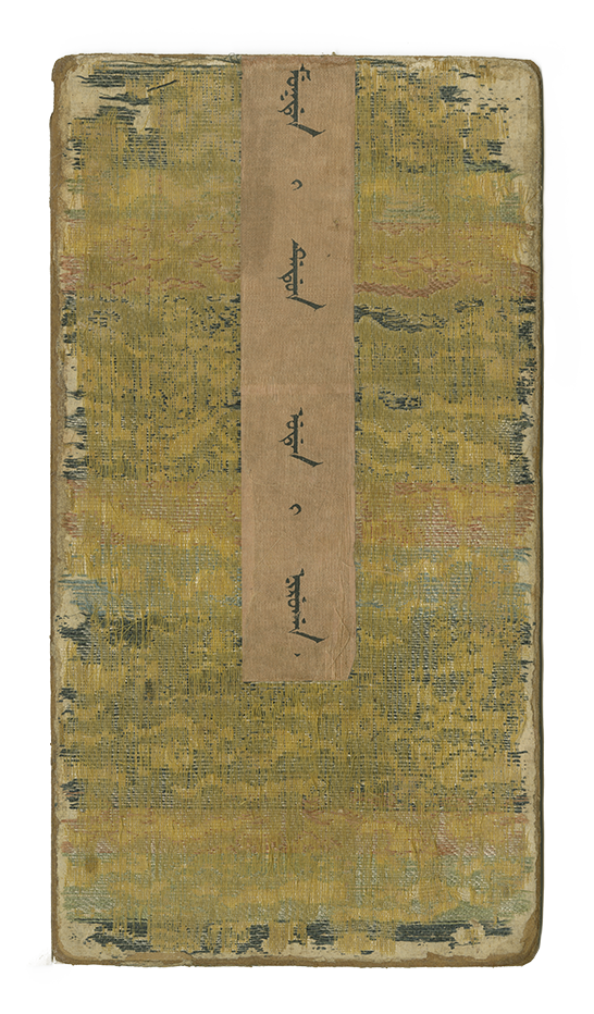
Cover | Mukden-i dedun uden-i nirugan