
July 21, 2025

In-Person (BPL Egleston Branch) · Gardens of Egleston Project Celebration · July 23, 6 pm ET
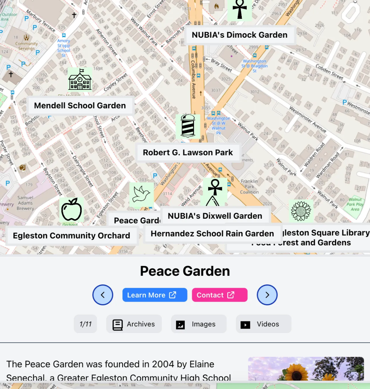
Join us to launch Gardens of Egleston, a creative storytelling and mapping project sponsored by MassHumanities, the Friends of the Egleston Square Branch Library, and the Citywide Friends of the Boston Public Library, with help from the Leventhal Map & Education Center and the BPL Community History Department. Gardens of Egleston explores this neighborhood’s rich history, culture, and resilience through gardens and gardeners.
The event will feature refreshments, videos, photos, presentations by a featured community gardener, and an interactive map display created by LMEC Assistant Curator of Digital & Participatory Geography, Ian Spangler. No registration necessary.

In-Person: Historic Currents: Charting the Evolution of Boston’s Ferry Routes · July 23, 2 pm ET
This event is a collaborative From The Vault between the Leventhal Map & Education Center and A Better City, the Seaport Transportation Management Association, and the Lower Mystic Transportation Management Association.
In celebration of Water Transit Month, Historic Currents explores Boston’s rich history of water transit routes connecting communities across the Mystic River and Boston Harbor. By looking at historic maps, we’ll discover the story of how transportation hubs, local industries, and travel patterns created the basis for a variety of successful ferry routes.
Today, new and improved water transportation has come to Quincy, Winthrop, East Boston, and many more parts of the Greater Boston region. Historic Currents will allow you to visualize the past and present side-by-side and envision the future of water transit.
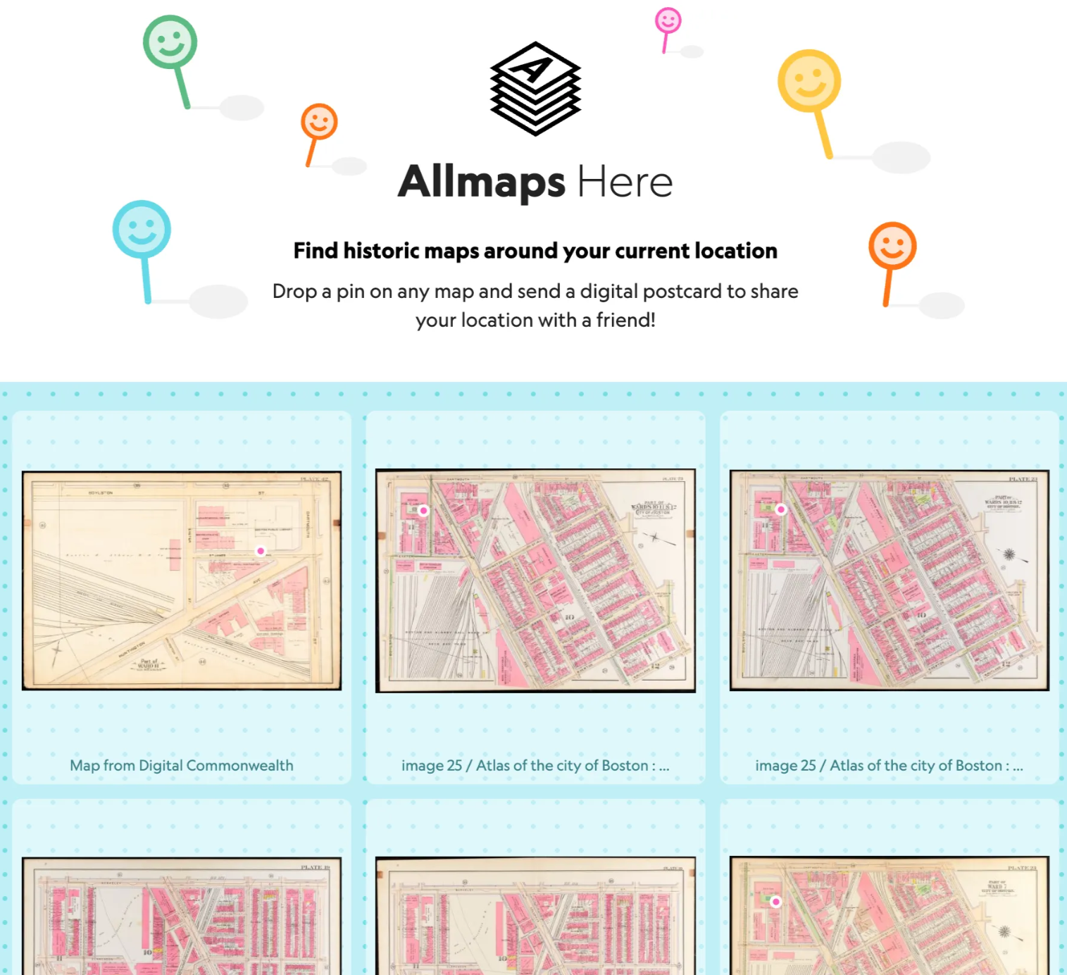
Introducing: Allmaps Here
A few weeks ago, we shared an update about our NEH grant to support institutional infrastructure for libraries, museums, and other digitized map collections through the Allmaps project. The Allmaps team has continued their work and recently released an exciting new tool: Allmaps Here.
With Allmaps Here, you can see your current location on top of maps from many different collections that have already been georeferenced. If you don’t see a map for your area, it might be time for you to georeference a new one from our collections! (Pro tip: our team is a big fan of using Allmaps Here if you are traveling by train!)
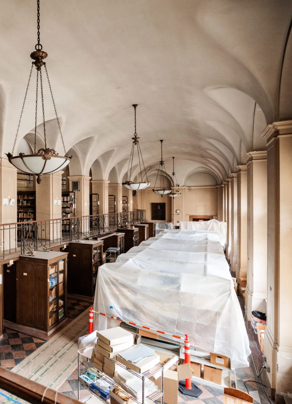
Boston Public Library Launches Restoration Planning Process
The Boston Public Library recently announced the launch of a comprehensive, five-year planning process for the renovation of the Central Library’s historic McKim building. The process, funded by a transformational $5.5 million gift made by an anonymous donor through the Boston Public Library Fund, will bring renovation plans to a design-ready phase.
At present, nearly 40 percent of the McKim Building is currently closed to the public, due to its accessibility challenges and disrepair. This generous gift with lay the foundation for a reimagined Central Library complex that will serve the needs of patrons from Boston and beyond.

Newsletter Trivia: Cambridge Parks
What park (the largest in Cambridge!) used to be a brick-producing clay pit, a landfill, and dump site for the Alewife Red Line extension in the 1970s and 80s before it was converted into a park space? (Hint: Look at the map image to the left and at our recent social media posts for a clue about the answer to each week’s trivia!)
- Danehy Park
- Alewife Brook Reservation
- North Point Park
- Cambridge Common
The answer to last newsletter’s question about was about which station name was not a former Red Line stop in the Harvard Square area and the answer is Harvard/Kennedy.
Correct answers will be included in a random draw—the winner will receive the next three Map of the Month club postcards for free. Congratulations to our last winner, José! In order to enter, make sure you follow us on Bluesky, Instagram or Facebook and direct message or email us the answer to the following question. We’ll accept answers until July 28 at 9 am ET.

Gift Shop Fun!
For everything from postcards and exhibition catalogs to map reproductions, use the code TERRAINS throughout the month of July for 15% off your total order. With a great selection of Revolutionary War-era map reproductions recently added to our online shop—including some from our current show Terrains of Independence—there’s something for all the map lovers in your life.
The Leventhal Map & Education Center is an independent nonprofit. We rely on the contributions of donors like you to support our mission of preserving the past and advancing the future of maps and geography.
View this email in your browser
Leventhal Map & Education Center at the Boston Public Library
617.859.2387 · info@leventhalmap.org
{{SenderInfoLine}}