
March 3, 2025

Just over 250 years ago, in February 1775, the British Parliament turned its attention to “the province of the Massachuset’s Bay,” and reported to King George III that “a rebellion at this time actually exists within the said province.” Parliament didn’t focus on specific acts of rebellion or name political leaders. Their concern was directed at an entire place on the map: the province of Massachusetts. In our next exhibition at the Leventhal Center, Terrains of Independence, we take geography as the starting point for reconsidering the familiar story of the American Revolution. Why did Massachusetts become the center of Revolutionary action against British rule in 1775—why not the Carolinas, or Quebec, or Jamaica? And how did the terrain of Boston and its surrounding areas shape the strategy, the politics, and the ideas of the movement that lead to independence for the United States?
To delve deeper into these questions, we hope you’ll visit Terrains of Independence soon. Co-curated by Dr. Katy Lasdow, the exhibition is not only visually rich but it also takes a different approach to the Revolutionary anniversary that we think will change your perspective on this historical moment. Terrains of Independence opens April 3 in our gallery at the Central Library, and, as always, admission is free.

— Garrett Dash Nelson, President and Head Curator

A look inside Terrains of Independence
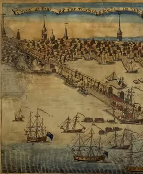
As a subscriber to our newsletter, we wanted to offer you a chance to get a first peek into the exhibition before it opens to the public. Here’s how we describe William Price’s 1769 map of Boston, which will be on display. It will also serve as the basis for a new annotated map created by our teen curators from Boston Public Schools.
“Only a few North American cities were mapped on this scale and at this level of detail before the Revolution. The carefully labeled streets, wharves, and public buildings reveal a prosperous port city where different social classes lived near each other, with churches, meeting houses, and schools densely dotted throughout the urban core. Yet the very features that made Boston valuable to Britain—its deep harbor, network of wharves, and location in the New England region—would soon help transform it into a center of resistance.”
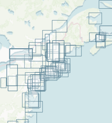
Searching maps by scale in the ARGO portal
Terrains of Independence is organized around the different scales of geography that shaped people’s experiences during the Revolutionary era. The maps in the Leventhal Center’s collections for this period range in scale from hand-drawn plans of forts and battlements to vast depictions of the western hemisphere. In the show, five scales—Empire, Region, City, Landmark, and Nation—become a powerful framework for understanding how place matters in shaping historical events.
In the ARGO (American Revolutionary Geographies Online) portal homepage, you’ll find a search feature that allows you to explore digitized maps by geographic scale. You can focus on each region or scale down to the tiniest plans of forts and individual buildings. Can you imagine how different scales of map were originally used for different purposes?
Spotlight: Brown Seminar on Geographies of Contact between Soldiers and Civilians
Listen to scholar John McCurdy discuss the human-scaled geographies of contact between soldiers and civilians—from urban squares to barracks and lodging houses—during the Revolutionary War. McCurdy’s work examines the intimate spaces where the everyday realities of life during an imperial conflict became personalized.
This talk was hosted in the Richard H. Brown Seminar on the Historical Geography of the American Revolutionary Era and features maps that can be found in the ARGO (American Revolutionary Geographies Online) portal.

Revolutionary War map reproductions now available as print reproductions
Shop for all of your history, geography, and cartographic interests at the Leventhal Map & Education Center online gift shop. With two Revolutionary War-era maps added to the shop, there’s something for everyone! With everything from postcards and exhibition catalogs to frame quality maps, use the code TERRAINS for 25% off your total order until the exhibition opens on April 3.
The Leventhal Map & Education Center is an independent nonprofit. We rely on the contributions of donors like you to support our mission of preserving the past and advancing the future of maps and geography.
View this email in your browser
Leventhal Map & Education Center at the Boston Public Library
617.859.2387 · info@leventhalmap.org
{{SenderInfoLine}}