Plan des environs de New York (manuscrit) - Position du camp de l'armée combinée à Philippsburg du 6 juillet au 19 août - double
This map is also available in American Revolutionary Geographies Online (ARGO), a collections portal especially built for material relating to the American Revolutionary War Era. Visit ARGO to learn more about this item and explore the historical geography of North America in the late eighteenth century.
Item Information
- Title:
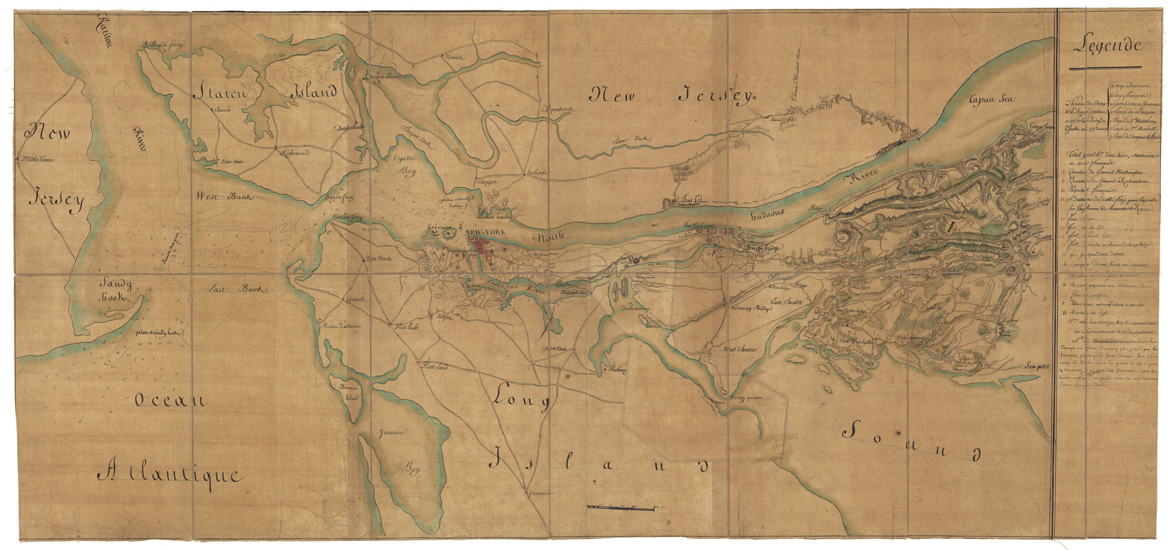
- Plan des environs de New York (manuscrit) - Position du camp de l'armée combinée à Philippsburg du 6 juillet au 19 août - double
- Description:
-
Manuscript map in watercolor and ink showing the French and American armies around New York City from July 6 to August 19, 1781. Shows troop positions and strengths, fortifications, batteries and other battle information.
- Creator:
- Berthier, Louis-Alexandre, 1753-1815
- Cartographer:
- Berthier, Louis-Alexandre, 1753-1815
- Date:
-
[1781]
- Format:
-
Maps/Atlases
Manuscripts
- Location:
- George Washington's Mount Vernon
- Collection (local):
-
Richard H. Brown Revolutionary War Map Collection at Mount Vernon
- Subjects:
-
New York (N.Y.)--History--Revolution, 1775-1783--Maps--Early works to 1800
Military maps
- Places:
-
New York
- Extent:
- 1 map ; 48 x 103 cm
- Terms of Use:
-
No known copyright restrictions.
This work is licensed for use under a Creative Commons Attribution Non-Commercial Share Alike License (CC BY-NC-SA).

- Scale:
-
Scale approximately 1:97,450
- Language:
-
French
- Catalog Record:
-
MVLA record
- Notes:
-
Relief shown by hachures. Depths shown by soundings and isolines.
Oriented with north toward the upper right.
Title from manuscript on verso.
Map is drawn by multiple hands, and attribution is based on comparison to other maps by Berthier.
Includes references.
- Notes (date):
-
This date is inferred.
- Identifier:
-
Rochambeau_ny_1781
- Barcode:
-
30000006169009