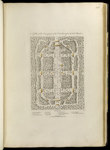
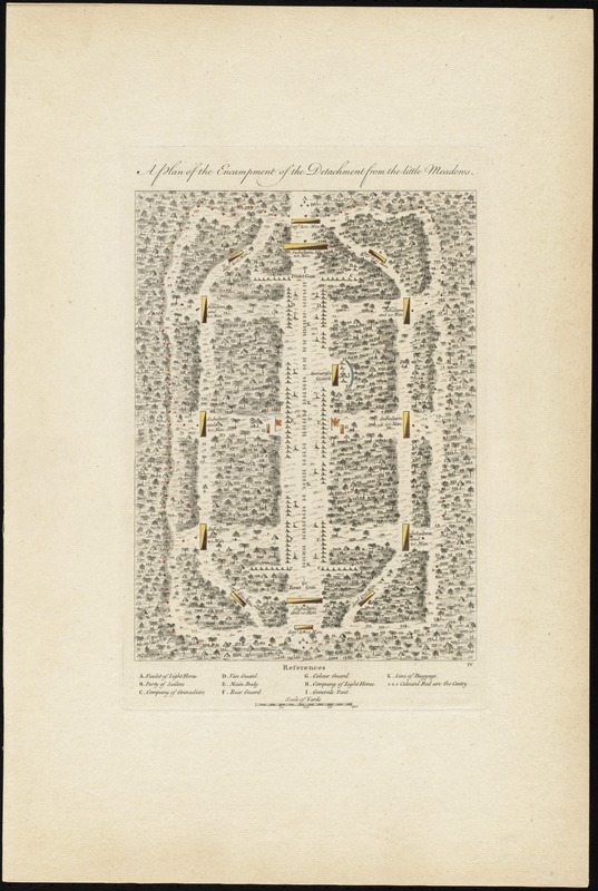
A plan of the encampment of the detachment from the little Meadows
This map is also available in American Revolutionary Geographies Online (ARGO), a collections portal especially built for material relating to the American Revolutionary War Era. Visit ARGO to learn more about this item and explore the historical geography of North America in the late eighteenth century.
Item Information
- Title:
- A plan of the encampment of the detachment from the little Meadows
- Creator:
- Orme, Robert, -1781
- Contributor:
- Jefferys, Thomas, -1771
- Contributor:
- Sayer, Robert, 1725-1794
- Date:
-
[1768]
- Format:
-
Maps/Atlases
- Location:
- George Washington's Mount Vernon
- Collection (local):
-
Richard H. Brown Revolutionary War Map Collection at Mount Vernon
- Subjects:
-
Tactics--Maps--Early works to 1800
Military camps--Maps--Early works to 1800
Braddock's Campaign, 1755--Maps
United States--History--French and Indian War, 1754-1763--Maps
- Places:
-
- Extent:
- 1 map : hand col. ; 29 x 21 cm.
- Terms of Use:
-
No known copyright restrictions.
This work is licensed for use under a Creative Commons Attribution Non-Commercial Share Alike License (CC BY-NC-SA).

- Publisher:
-
London :
Printed for Robert Sayer, ... and Thomas Jefferys
- Scale:
-
Scale [ca. 1:3,180]
- Language:
-
English
- Catalog Record:
-
MVLA record
- Notes:
-
Shows the layout of an encampment in Braddock's campaign on Fort Duquesne.
In lower right: IV.
Appears in Jefferys' General topography of North America and the West Indies. London: Printed for Robert Sayer, ... and Thomas Jefferys, 1768.
- Notes (date):
-
This date is inferred.
- Notes (citation):
-
Phillips. List of maps of America, p. 269
Phillips, 1196
- Identifier:
-
06_01_011880
- Barcode:
-
30000003254672