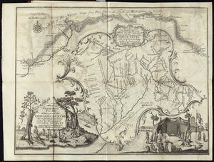
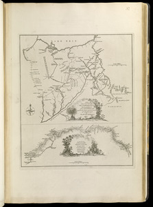
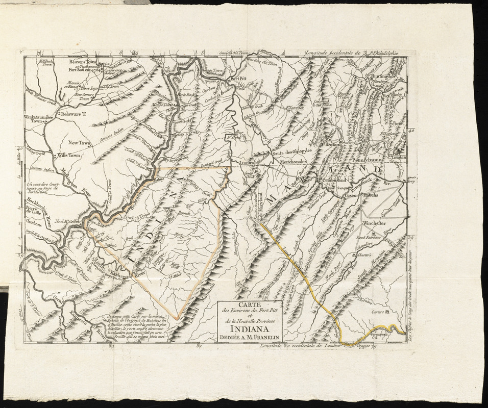
Carte des environs du Fort Pitt et de la nouvelle province Indiana : dediée a M. Franklin
This map is also available in American Revolutionary Geographies Online (ARGO), a collections portal especially built for material relating to the American Revolutionary War Era. Visit ARGO to learn more about this item and explore the historical geography of North America in the late eighteenth century.
Item Information
- Title:
- Carte des environs du Fort Pitt et de la nouvelle province Indiana : dediée a M. Franklin
- Creator:
- Hutchins, Thomas, 1730-1789
- Date:
-
[1781]
- Format:
-
Maps/Atlases
- Location:
- George Washington's Mount Vernon
- Collection (local):
-
Richard H. Brown Revolutionary War Map Collection at Mount Vernon
- Subjects:
-
Ohio--Maps--Early works to 1800
Pennsylvania--Maps--Early works to 1800
Virginia--Maps--Early works to 1800
West Virginia--Maps--Early works to 1800
- Places:
-
Pennsylvania
Ohio
Virginia
West Virginia
- Extent:
- 1 map ; 24 x 31 cm.
- Terms of Use:
-
No known copyright restrictions.
This work is licensed for use under a Creative Commons Attribution Non-Commercial Share Alike License (CC BY-NC-SA).

- Publisher:
-
Paris :
Chez Le Rouge
- Scale:
-
Scale [ca. 1:1,300,000]
- Language:
-
French
- Catalog Record:
-
MVLA record
- Notes:
-
In Description topographique de la Virginie, de la Pensylvanie, du Maryland et de la Caroline Septentrionale (Paris : Le Rouge, 1781); Le Rouge's translation of Hutchin's A topographical description of Virginia, Pennsylvania, Maryland, and North Carolina (London : Hutchins, 1778).
Oriented with north towards the upper left.
Relief shown by hachures and pictorially.
Prime meridians: Philadelphia and London.
Le Rouge's French translation of a portion of Hutchin's New map of the western parts of Virginia, Pennsylvania, Maryland and North-Carolina.
- Notes (date):
-
This date is inferred.
- Notes (citation):
-
Sabin, 34055
- Identifier:
-
06_01_011756
- Barcode:
-
30000004224773