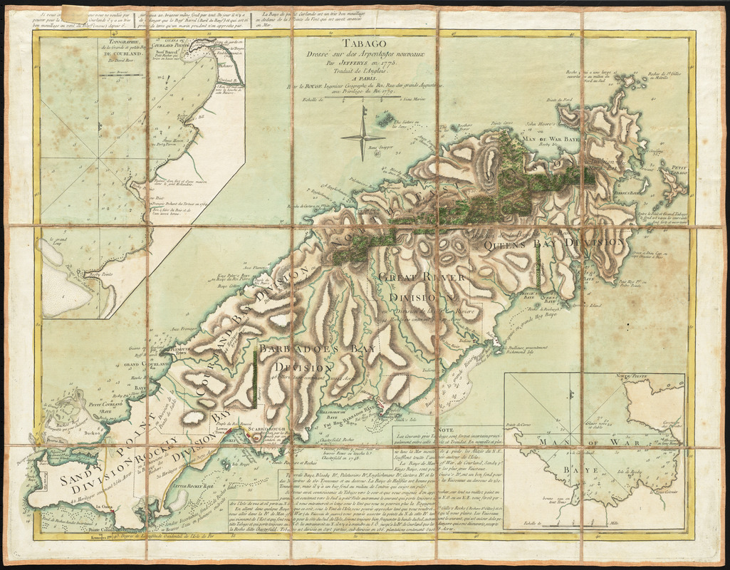
Tabago
This map is also available in American Revolutionary Geographies Online (ARGO), a collections portal especially built for material relating to the American Revolutionary War Era. Visit ARGO to learn more about this item and explore the historical geography of North America in the late eighteenth century.
Item Information
- Title:
- Tabago
- Creator:
- Le Rouge, Georges-Louis
- Contributor:
- Jefferys, Thomas, -1771
- Name on Item:
-
dressé sur des Arpentages nouveaux par Jefferys en 1775 ; traduit de l'Anglois [par Le Rouge]
- Date:
-
1779
- Format:
-
Maps/Atlases
- Location:
- George Washington's Mount Vernon
- Collection (local):
-
Richard H. Brown Revolutionary War Map Collection at Mount Vernon
- Subjects:
-
Tobago (Trinidad and Tobago)--Administrative and political divisions--Maps--Early works to 1800
- Places:
-
Tobago (island)
- Extent:
- 1 map : hand color ; 46 x 62 cm.
- Terms of Use:
-
No known copyright restrictions.
This work is licensed for use under a Creative Commons Attribution Non-Commercial Share Alike License (CC BY-NC-SA).

- Publisher:
-
Paris :
Le Rouge
- Scale:
-
Scale [ca. 1:63,000]
- Language:
-
French
- Catalog Record:
-
MVLA record
- Notes:
-
Shows divisions, settlements, bays, anchorages, topography and shoals.
Relief shown by hachures. Depths shown by soundings.
Prime meridian: Ferro.
Insets: Topographie de la Grande et petite Baye de Courland par David Ross -- [Man of War Baye].
Includes notes on navigation.
Includes text in upper left margin.
Manuscript label on verso: No. 54. Isle de Tabago.
From the Library of the Ducs de Luynes from the Château de Dampierre.
- Identifier:
-
06_01_010490
- Barcode:
-
30000003568123


![[A map of part of Pennsylvania & Maryland intended to shew, at one view, the several places proposed for opening a communication between the waters of the Delaware & Chesopeak Bays]](https://bpldcassets.blob.core.windows.net/derivatives/images/commonwealth:z603vt12v/image_thumbnail_300.jpg)


