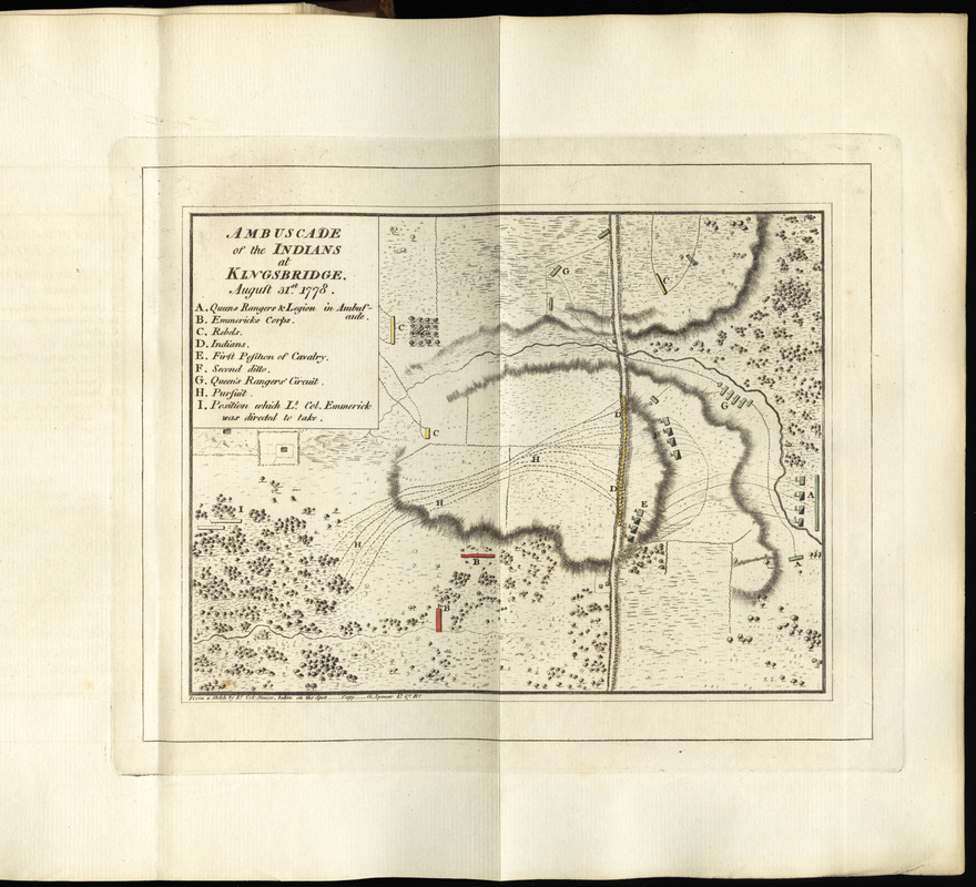
Ambuscade of the Indians at Kingsbridge : August 31st. 1778
This map is also available in American Revolutionary Geographies Online (ARGO), a collections portal especially built for material relating to the American Revolutionary War Era. Visit ARGO to learn more about this item and explore the historical geography of North America in the late eighteenth century.
Item Information
- Title:
- Ambuscade of the Indians at Kingsbridge : August 31st. 1778
- Creator:
- Simcoe, John Graves, 1752-1806
- Contributor:
- Spencer, G.
- Name on Item:
-
from a sketch by Lt. Col. Simcoe taken on the spot ; copy G. Spencer Lt. Q. Rs.
- Date:
-
[1787]
- Format:
-
Maps/Atlases
- Location:
- George Washington's Mount Vernon
- Collection (local):
-
Richard H. Brown Revolutionary War Map Collection at Mount Vernon
- Subjects:
-
Kingsbridge (New York, N.Y.)--History--Revolution, 1775-1783--Maps--Early works to 1800
- Places:
-
New York
- Extent:
- 1 map : hand col. ; 15 x 20 cm.
- Terms of Use:
-
No known copyright restrictions.
This work is licensed for use under a Creative Commons Attribution Non-Commercial Share Alike License (CC BY-NC-SA).

- Publisher:
-
Exeter :
Printed for the author
- Scale:
-
Scale not given
- Language:
-
English
- Catalog Record:
-
MVLA record
- Notes:
-
Relief shown by hachures.
Includes references identifying the deployment of units.
In Simcoe's A journal of the operations of the Queen's rangers (Exeter : Printed for the author, [1787]), facing p. 54.
- Notes (date):
-
This date is inferred.
- Identifier:
-
06_01_010196

![[A map of part of Pennsylvania & Maryland intended to shew, at one view, the several places proposed for opening a communication between the waters of the Delaware & Chesopeak Bays]](https://bpldcassets.blob.core.windows.net/derivatives/images/commonwealth:z603vt12v/image_thumbnail_300.jpg)


