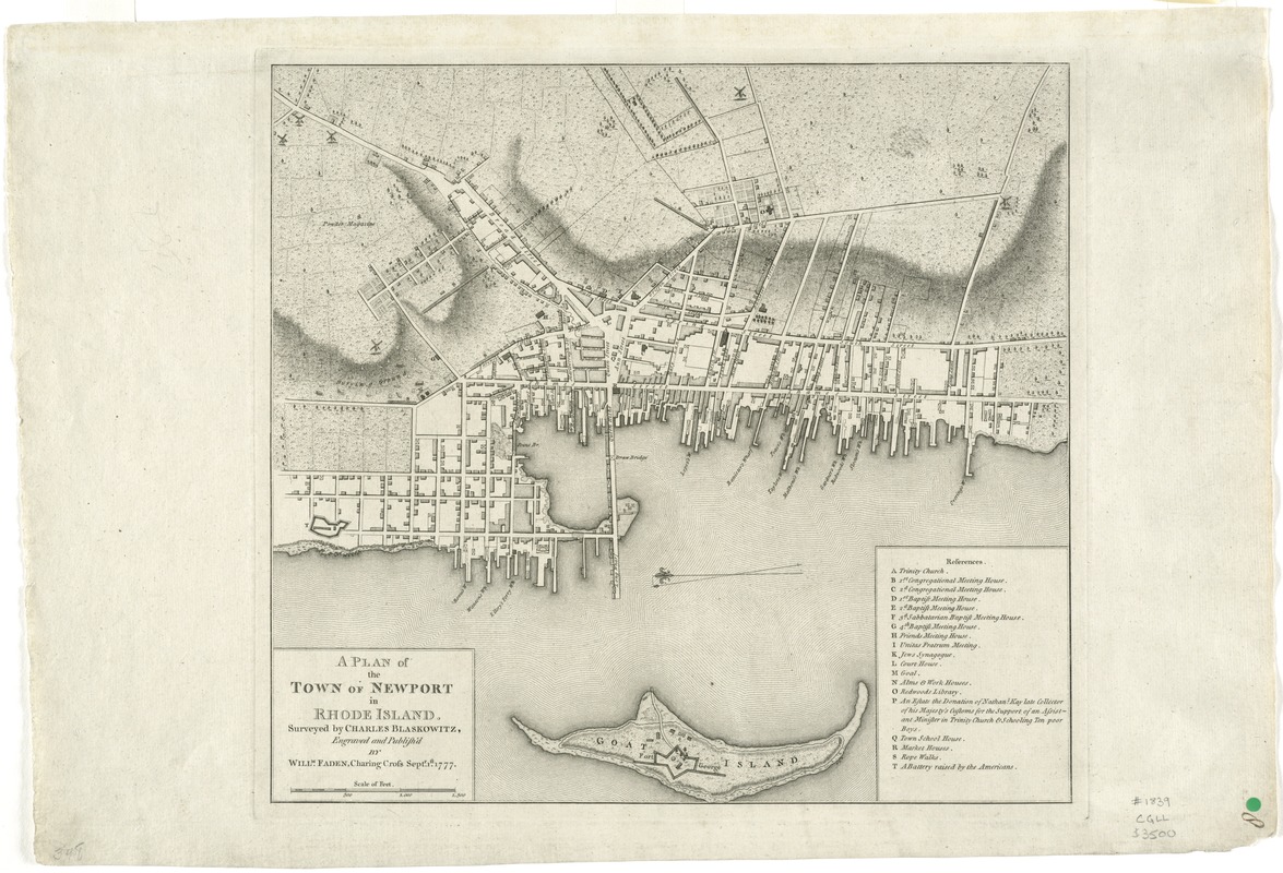
A plan of the town of Newport in Rhode Island
This map is also available in American Revolutionary Geographies Online (ARGO), a collections portal especially built for material relating to the American Revolutionary War Era. Visit ARGO to learn more about this item and explore the historical geography of North America in the late eighteenth century.
Item Information
- Title:
- A plan of the town of Newport in Rhode Island
- Creator:
- Blaskowitz, Charles
- Name on Item:
-
surveyed by Charles Blaskowitz ; engraved and publish'd by Willm. Faden.
- Date:
-
1777
- Format:
-
Maps/Atlases
- Location:
- George Washington's Mount Vernon
- Collection (local):
-
Richard H. Brown Revolutionary War Map Collection at Mount Vernon
- Subjects:
-
Newport (R.I.)--History--Revolution, 1775-1783--Maps--Early works to 1800
- Places:
-
Rhode IslandNewport (county)Newport
- Extent:
- 1 map ; 34 x 37 cm.
- Terms of Use:
-
No known copyright restrictions.
This work is licensed for use under a Creative Commons Attribution Non-Commercial Share Alike License (CC BY-NC-SA).

- Publisher:
-
[London] :
Willm. Faden
- Scale:
-
Scale [ca. 1:6,000]
- Language:
-
English
- Catalog Record:
-
MVLA record
- Notes:
-
Oriented with north to the left.
Relief shown by hachures.
Includes references.
From Faden's North American atlas.
- Identifier:
-
06_01_008228
- Barcode:
-
30000002522216

![[A map of part of Pennsylvania & Maryland intended to shew, at one view, the several places proposed for opening a communication between the waters of the Delaware & Chesopeak Bays]](https://bpldcassets.blob.core.windows.net/derivatives/images/commonwealth:z603vt12v/image_thumbnail_300.jpg)


