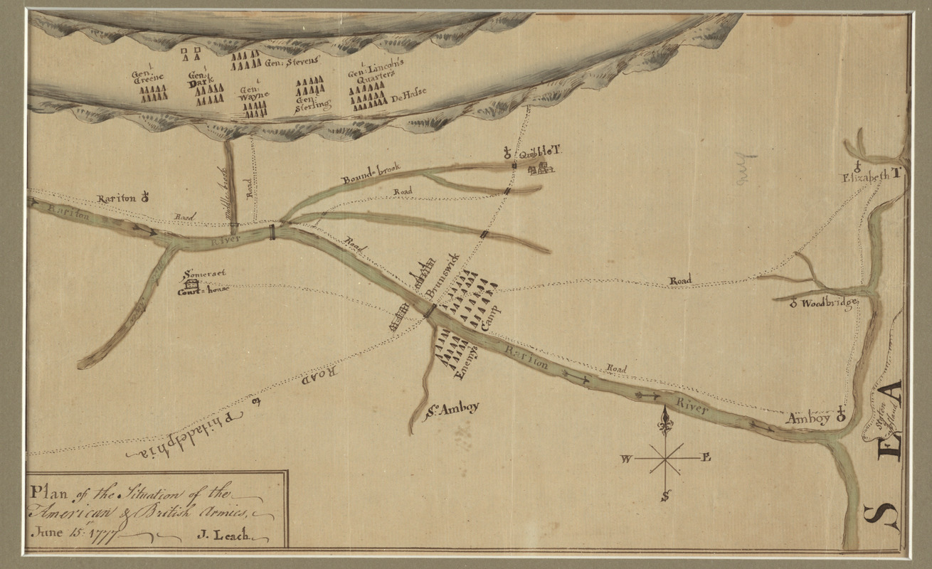
Plan of the situation of the American & British armies, June 15st 1777
This map is also available in American Revolutionary Geographies Online (ARGO), a collections portal especially built for material relating to the American Revolutionary War Era. Visit ARGO to learn more about this item and explore the historical geography of North America in the late eighteenth century.
Item Information
- Title:
- Plan of the situation of the American & British armies, June 15st 1777
- Creator:
- Leach, J.
- Name on Item:
-
J. Leach.
- Date:
-
1777
- Format:
-
Maps/Atlases
Manuscripts
- Location:
- George Washington's Mount Vernon
- Collection (local):
-
Richard H. Brown Revolutionary War Map Collection at Mount Vernon
- Subjects:
-
Philadelphia Campaign, 1777-1778--Maps--Early works to 1800
Short Hills, Battle of, NJ., 1777--Maps--Early works to 1800
New Jersey--History--Revolution, 1775-1783--Maps--Early works to 1800
- Places:
-
New Jersey
- Extent:
- 1 ms. map : hand col. ; 19 x 31 cm.
- Terms of Use:
-
No known copyright restrictions.
This work is licensed for use under a Creative Commons Attribution Non-Commercial Share Alike License (CC BY-NC-SA).

- Scale:
-
Scale [ca. 1:87,000]
- Language:
-
English
- Catalog Record:
-
MVLA record
- Notes:
-
American manuscript map showing forces near New Brunswick and the Raritan River during Howe's attempt to draw the Continental army into battle and shortly before the Battle of Short Hills.
Relief shown pictorially.
- Identifier:
-
06_01_009573