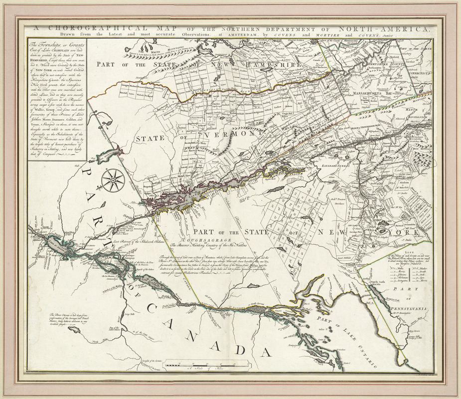
A chorographical map of the northern department of North-America
This map is also available in American Revolutionary Geographies Online (ARGO), a collections portal especially built for material relating to the American Revolutionary War Era. Visit ARGO to learn more about this item and explore the historical geography of North America in the late eighteenth century.
Item Information
- Title:
- A chorographical map of the northern department of North-America
- Creator:
- Romans, Bernard, 1741?-ca. 1784
- Contributor:
- Klockhoff, H.
- Publisher:
- Covens et Mortier et Covens, junior
- Name on Item:
-
drawn from the latest and most accurate observations ; H. Klockhoff, sculp.
- Date:
-
1780
- Format:
-
Maps/Atlases
- Location:
- George Washington's Mount Vernon
- Collection (local):
-
Richard H. Brown Revolutionary War Map Collection at Mount Vernon
- Subjects:
-
Land grants--New Hampshire--Maps--Early works to 1800
Real property--New Hampshire--Maps--Early works to 1800
Land grants--New York (State)--Maps--Early works to 1800
Real property--New York (State)--Maps--Early works to 1800
Land grants--Vermont--Maps--Early works to 1800
Real property--Vermont--Maps--Early works to 1800
New Hampshire--Maps--Early works to 1800
New York (State)--Maps--Early works to 1800
Vermont--Maps--Early works to 1800
- Places:
-
New Hampshire
New York
Vermont
- Extent:
- 1 map : hand col. ; 51 x 62 cm.
- Terms of Use:
-
No known copyright restrictions.
This work is licensed for use under a Creative Commons Attribution Non-Commercial Share Alike License (CC BY-NC-SA).

- Publisher:
-
Amsterdam :
Covens and Mortier and Covens, junior
- Scale:
-
Scale [ca. 1:768,000]
- Language:
-
English
- Catalog Record:
-
MVLA record
- Notes:
-
Relief shown pictorially.
Oriented with north toward the lower left.
Shows land grants and purchases in northeastern New York State and granted townships in Vermont and parts of New Hampshire, and Massachusetts.
- Identifier:
-
06_01_009548


