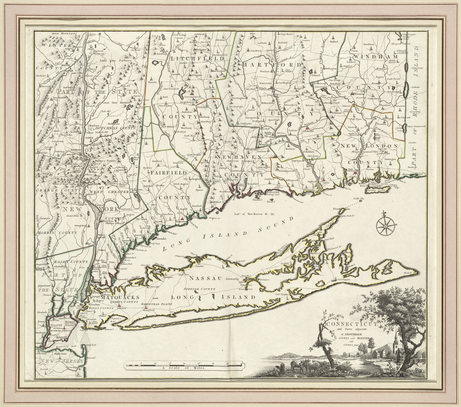
Connecticut and parts adjacent
This map is also available in American Revolutionary Geographies Online (ARGO), a collections portal especially built for material relating to the American Revolutionary War Era. Visit ARGO to learn more about this item and explore the historical geography of North America in the late eighteenth century.
Item Information
- Title:
- Connecticut and parts adjacent
- Creator:
- Romans, Bernard, 1741?-ca. 1784
- Contributor:
- Klockhoff, H.
- Publisher:
- Covens et Mortier et Covens, junior
- Name on Item:
-
H. Klockhoff, sculp.
- Date:
-
1780
- Format:
-
Maps/Atlases
- Location:
- George Washington's Mount Vernon
- Collection (local):
-
Richard H. Brown Revolutionary War Map Collection at Mount Vernon
- Subjects:
-
Connecticut--Maps--Early works to 1800
Long Island (N.Y.)--Maps--Early works to 1800
- Places:
-
Long Island (island)
Connecticut
- Extent:
- 1 map : hand col. ; 53 x 59 cm.
- Terms of Use:
-
No known copyright restrictions.
This work is licensed for use under a Creative Commons Attribution Non-Commercial Share Alike License (CC BY-NC-SA).

- Publisher:
-
Amsterdam :
Covens and Mortier and Covens junior
- Scale:
-
Scale [ca. 1:372,000]
- Language:
-
English
- Catalog Record:
-
MVLA record
- Notes:
-
State 2.
Relief shown pictorially.
Shows counties, towns, rivers, and post roads.
- Identifier:
-
06_01_009549