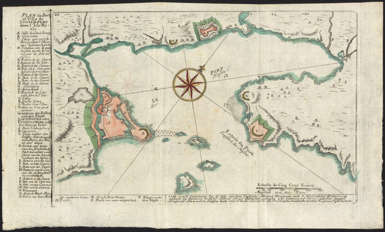
Plan du fort et ville de Louisbourg dans l'Isle Roale
This map is also available in American Revolutionary Geographies Online (ARGO), a collections portal especially built for material relating to the American Revolutionary War Era. Visit ARGO to learn more about this item and explore the historical geography of North America in the late eighteenth century.
Item Information
- Title:
- Plan du fort et ville de Louisbourg dans l'Isle Roale
- Title (alt.):
-
Plan du fort et ville de Louisbourg dans l'Isle Royale
- Creator:
- Heiden, Christian Friedrich von der
- Date:
-
[ca. 1760]
- Format:
-
Maps/Atlases
- Location:
- George Washington's Mount Vernon
- Collection (local):
-
Richard H. Brown Revolutionary War Map Collection at Mount Vernon
- Subjects:
-
Louisbourg (N.S.)--History--Siege, 1758--Maps--Early works to 1800
United States--History--French and Indian War, 1754-1763--Maps--Early works to 1800
- Places:
-
CanadaLouisbourg
- Extent:
- 1 map : hand col. ; 16 x 26 cm.
- Terms of Use:
-
No known copyright restrictions.
This work is licensed for use under a Creative Commons Attribution Non-Commercial Share Alike License (CC BY-NC-SA).

- Publisher:
-
Augsburg :
Christian Friedrich von der Heiden
- Scale:
-
Scale [ca. 1:18,000]
- Language:
-
German
French
- Catalog Record:
-
MVLA record
- Notes:
-
Oriented with north to the upper right.
Relief shown by hachures.
Includes references and text.
From von der Heiden's Americanische urquelle.
In upper left: 28.
In German and French.
- Identifier:
-
06_01_009541