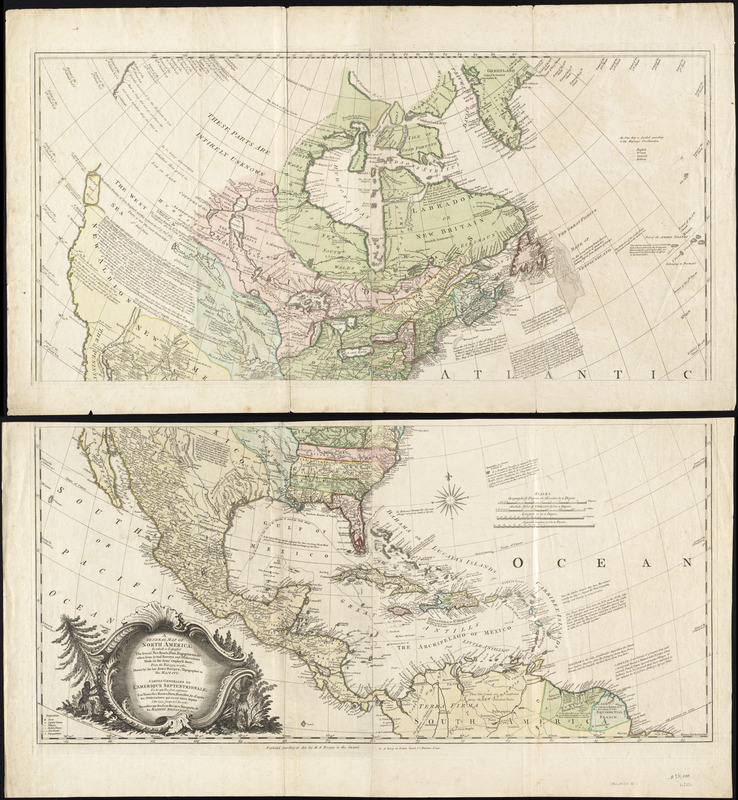
A general map of North America : in which is express'd the several new roads, forts, engagements, &c, taken from actual surveys and observations made in the army employ'd there, from the years 1754, to 1761
This map is also available in American Revolutionary Geographies Online (ARGO), a collections portal especially built for material relating to the American Revolutionary War Era. Visit ARGO to learn more about this item and explore the historical geography of North America in the late eighteenth century.
Item Information
- Title:
- A general map of North America : in which is express'd the several new roads, forts, engagements, &c, taken from actual surveys and observations made in the army employ'd there, from the years 1754, to 1761
- Title (alt.):
-
Cartes generales de l'Amérique Septentrionale
- Creator:
- Rocque, John, d. 1762
- Publisher:
- Dury, Andrew
- Publisher:
- Rocque (M. A.) (Firm)
- Name on Item:
-
drawn by the late John Rocque, topographer to his majesty.
- Date:
-
[1762]
- Format:
-
Maps/Atlases
- Location:
- George Washington's Mount Vernon
- Collection (local):
-
Richard H. Brown Revolutionary War Map Collection at Mount Vernon
- Subjects:
-
North America--Maps--Early works to 1800
United States--History--French and Indian War, 1754-1763--Maps--Early works to 1800
- Places:
-
North America (area)
- Extent:
- 1 map on 2 sheets : hand col. ; 85 x 89 cm., on sheets 54 x 98 cm.
- Terms of Use:
-
No known copyright restrictions.
This work is licensed for use under a Creative Commons Attribution Non-Commercial Share Alike License (CC BY-NC-SA).

- Publisher:
-
London :
published acording to the act by M.A. Rocque ... & A. Dury
- Scale:
-
Scale [ca. 1:9,500,000]
- Language:
-
English
French
- Catalog Record:
-
MVLA record
- Notes:
-
Relief shown pictorially.
Identifies pre- and post-war boundaries.
Title in French and English.
- Notes (date):
-
This date is inferred.
- Identifier:
-
06_01_008544