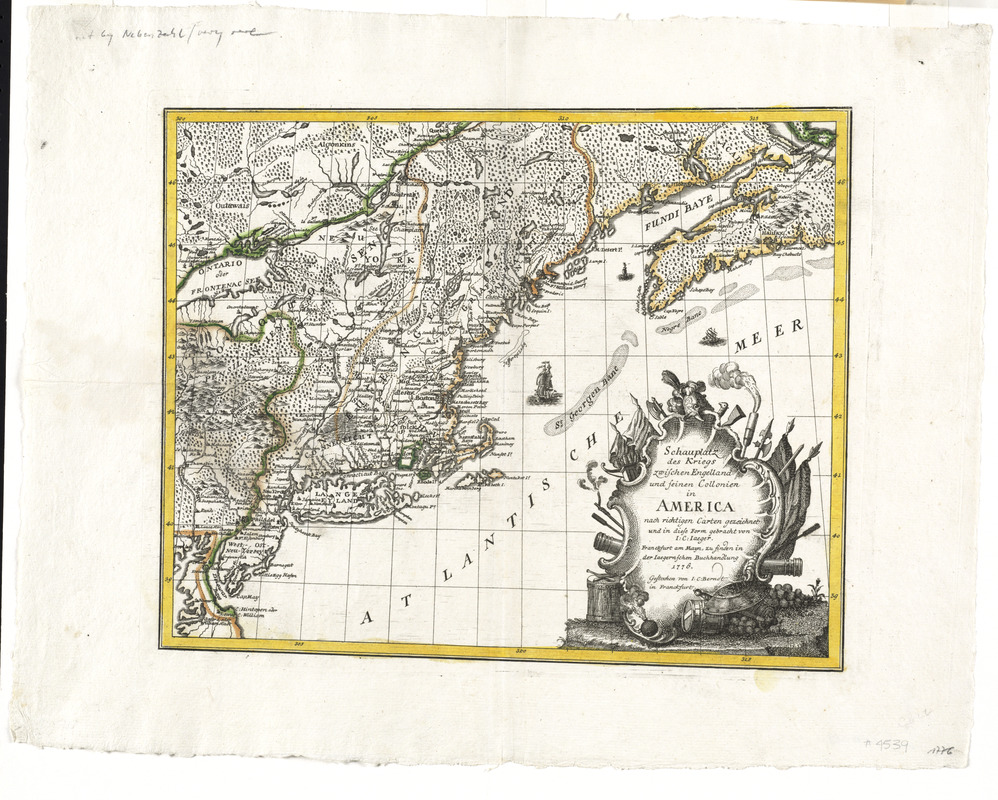
Schauplatz des Kriegs zwischen Engelland und seinen Collonien in America
This map is also available in American Revolutionary Geographies Online (ARGO), a collections portal especially built for material relating to the American Revolutionary War Era. Visit ARGO to learn more about this item and explore the historical geography of North America in the late eighteenth century.
Item Information
- Title:
- Schauplatz des Kriegs zwischen Engelland und seinen Collonien in America
- Creator:
- Jaeger, Johann Christian
- Contributor:
- Berndt, Johann Christian, 1748-1812
- Contributor:
- Iaegernsche Buchhandlung
- Name on Item:
-
nach richtigen Carten gezeichnet und in diese form gebracht von I.C. Jaeger ; gestochen von I.C. Berndt
- Date:
-
1776
- Format:
-
Maps/Atlases
- Location:
- George Washington's Mount Vernon
- Collection (local):
-
Richard H. Brown Revolutionary War Map Collection at Mount Vernon
- Subjects:
-
New England--Maps--Early works to 1800
- Places:
-
New England (area)
- Extent:
- 1 map : hand col. ; 28 x 34 cm.
- Terms of Use:
-
No known copyright restrictions.
This work is licensed for use under a Creative Commons Attribution Non-Commercial Share Alike License (CC BY-NC-SA).

- Publisher:
-
Franckfurt am Mayn :
Zu finden in der Iaegernschen Buchhandlung
- Scale:
-
Scale [ca. 1:3,750,000]
- Language:
-
German
- Catalog Record:
-
MVLA record
- Notes:
-
North east sheet of the map.
Relief shown pictorially.
Meridians numbered eastward from unspecified prime (Long Island at 305°E).
Does not show military features.
Includes decorative title cartouche and illustrations of ships.
Differs from assembled map by lack of compass rose.
In German.
- Identifier:
-
06_01_008533
- Barcode:
-
30000003816735


