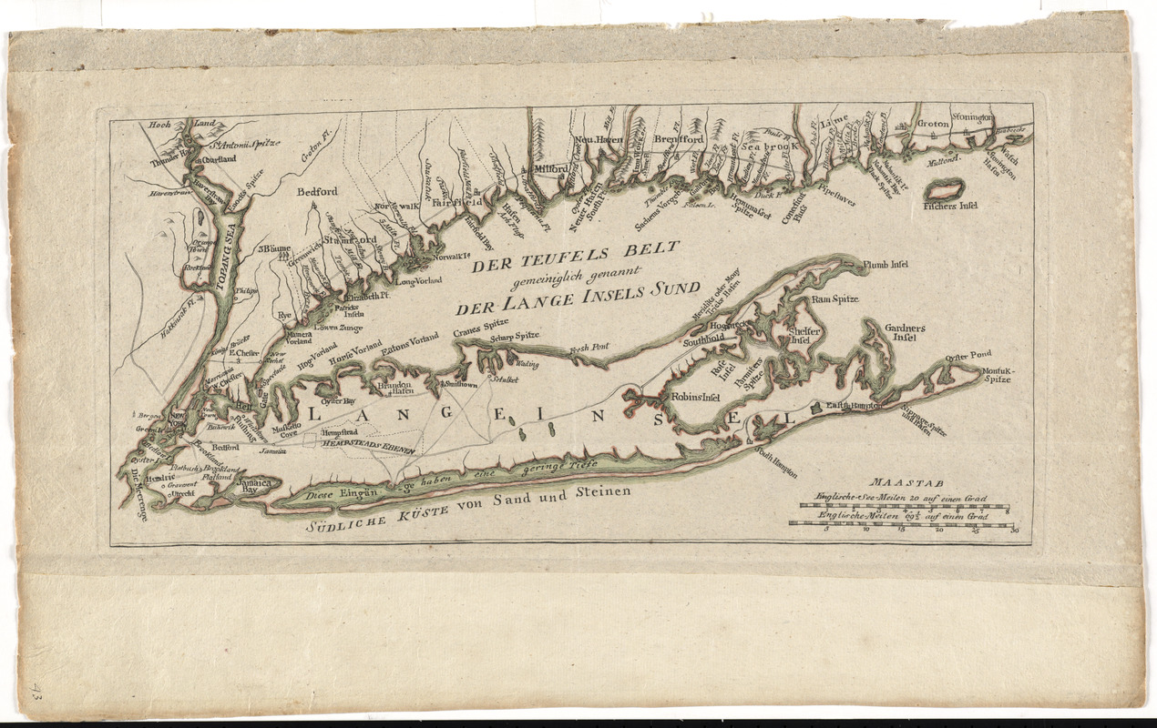
Der Teufels Belt gemeiniglich genannt der Lange Insels Sund
This map is also available in American Revolutionary Geographies Online (ARGO), a collections portal especially built for material relating to the American Revolutionary War Era. Visit ARGO to learn more about this item and explore the historical geography of North America in the late eighteenth century.
Item Information
- Title:
- Der Teufels Belt gemeiniglich genannt der Lange Insels Sund
- Title (alt.):
-
Geographische belustigungen zur erlauterung der neuesten weltgeschichte : mit landkarten, planen und kupfern nach den neuesten und besten originalen (zum besten einer Freyschule in Sachsen)
- Description:
-
This rare map depicts Long Island, New York City, and the Connecticut coastline north to Stonington Bay. Muller took the geography on this map directly from Thomas Jeffery's 1755 map titled "A Map of the Most Inhabited Part of New England ..." The copy displayed here was most likely issued separately from its original pamphlet, and may have been bound unfolded into a folio composite atlas produced during the American Revolutionary War era.
- Creator:
- Müller, J. C. (Johann Carl)
- Date:
-
[1776]
- Format:
-
Maps/Atlases
- Location:
- George Washington's Mount Vernon
- Collection (local):
-
Richard H. Brown Revolutionary War Map Collection at Mount Vernon
- Subjects:
-
Long Island (N.Y.)--Maps--Early works to 1800
- Places:
-
Long Island (island)
- Extent:
- 1 map : hand col. ; 21 x 44 cm.
- Terms of Use:
-
No known copyright restrictions.
This work is licensed for use under a Creative Commons Attribution Non-Commercial Share Alike License (CC BY-NC-SA).

- Publisher:
-
Leipzig :
Johann Carl Muller
- Scale:
-
Scale [ca. 1:450,000]
- Language:
-
German
- Catalog Record:
-
MVLA record
- Notes:
-
Relief shown pictorially.
Appears in Muller's Geographische belustigungen zur erläuterung der neuesten weltgeschichte.
In German.
- Notes (date):
-
This date is inferred.
- Identifier:
-
06_01_008509


