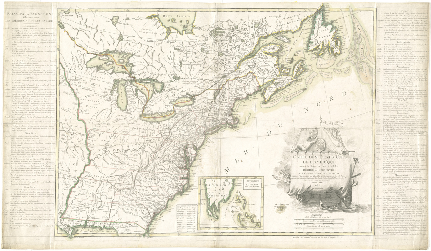
Carte des Etats-Unis de l'Amerique suivant le Traité de Paix de 1783
This map is also available in American Revolutionary Geographies Online (ARGO), a collections portal especially built for material relating to the American Revolutionary War Era. Visit ARGO to learn more about this item and explore the historical geography of North America in the late eighteenth century.
Item Information
- Title:
- Carte des Etats-Unis de l'Amerique suivant le Traité de Paix de 1783
- Creator:
- Lattré, Jean
- Name on Item:
-
par son trés humble et trés obeissant serviteur Lattrè.
- Date:
-
1784
- Format:
-
Maps/Atlases
- Location:
- George Washington's Mount Vernon
- Collection (local):
-
Richard H. Brown Revolutionary War Map Collection at Mount Vernon
- Subjects:
-
United States--History--Revolution, 1775-1783--Maps--Early works to 1800
- Places:
-
- Extent:
- 1 map : hand col. ; 56 x 76 cm.
- Terms of Use:
-
No known copyright restrictions.
This work is licensed for use under a Creative Commons Attribution Non-Commercial Share Alike License (CC BY-NC-SA).

- Publisher:
-
A Paris :
Chez Lattrè
- Scale:
-
Scale [ca. 1:4,800,000]
- Language:
-
French
- Catalog Record:
-
MVLA record
- Notes:
-
Relief shown pictorially.
Prime meridian: Ferro.
Inset: Suplément a la Floride.
Includes text in margin "Principaux evenemens militaires entre les Americans et les Anglois."
Includes table of the states and capitals.
Decorative title cartouche depicting a ship.
"Dediée et présentée a S. Excellence Mr. Benjamin Franklin."
Cataloging, conservation, and digitization made possible in part by The National Endowment for the Humanities: Exploring the human endeavor.
- Identifier:
-
06_01_008208
- LCCN:
-
gm 71002355


