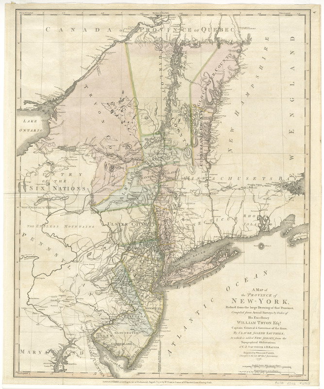
A map of the Province of New-York : reduc'd from the large drawing of that province, compiled from actual surveys by order of His Excellency William Tryon, Esqr. Captain General & Governor of the same
This map is also available in American Revolutionary Geographies Online (ARGO), a collections portal especially built for material relating to the American Revolutionary War Era. Visit ARGO to learn more about this item and explore the historical geography of North America in the late eighteenth century.
Item Information
- Title:
- A map of the Province of New-York : reduc'd from the large drawing of that province, compiled from actual surveys by order of His Excellency William Tryon, Esqr. Captain General & Governor of the same
- Creator:
- Sauthier, Claude Joseph
- Contributor:
- Ratzer, Bernard
- Publisher:
- Faden, William, 1749-1836
- Name on Item:
-
by Claude Joseph Sauthier; to which is added New-Jersey, from the topographical observations of C.J. Sauthier and B. Ratzer ; engraved by William Faden (successor to the late Mr. Thos. Jefferys).
- Date:
-
1776
- Format:
-
Maps/Atlases
- Location:
- George Washington's Mount Vernon
- Collection (local):
-
Richard H. Brown Revolutionary War Map Collection at Mount Vernon
- Subjects:
-
New York (State)--Administrative and political divisions--Maps--Early works to 1800
New Jersey--Administrative and political divisions--Maps--Early works to 1800
Northeastern States--Maps--Early works to 1800
- Places:
-
New Jersey
Northeastern United States (area)
New York
- Extent:
- 1 map : hand col. ; 71 x 57 cm.
- Terms of Use:
-
No known copyright restrictions.
This work is licensed for use under a Creative Commons Attribution Non-Commercial Share Alike License (CC BY-NC-SA).

- Publisher:
-
London :
Wm. Faden
- Scale:
-
Scale [ca. 1:1,000,000]
- Language:
-
English
- Catalog Record:
-
MVLA record
- Notes:
-
Relief shown by hachures.
Prime meridian: New York.
Shows administrative boundaries in New York and New Jersey. Also shows portions of Pennsylvania and New England.
- Identifier:
-
06_01_008211


