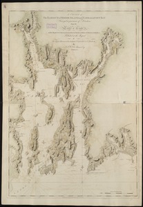
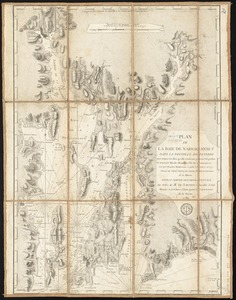
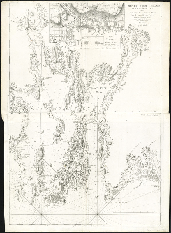
Port de Rhode Island et Narraganset Baye : publié à la requête du Vicomte Howe par le Chevalier des Barres ; traduit de l'anglais et augmenté d'après celui de Blaskowitz publiée à Londres en 1777
This map is also available in American Revolutionary Geographies Online (ARGO), a collections portal especially built for material relating to the American Revolutionary War Era. Visit ARGO to learn more about this item and explore the historical geography of North America in the late eighteenth century.
Item Information
- Title:
- Port de Rhode Island et Narraganset Baye : publié à la requête du Vicomte Howe par le Chevalier des Barres ; traduit de l'anglais et augmenté d'après celui de Blaskowitz publiée à Londres en 1777
- Creator:
- Le Rouge, Georges-Louis
- Contributor:
- Des Barres, Joseph F. W. (Joseph Frederick Wallet), 1722-1824
- Contributor:
- Howe, William Howe, Viscount, 1729-1814
- Date:
-
1778
- Format:
-
Maps/Atlases
- Location:
- George Washington's Mount Vernon
- Collection (local):
-
Richard H. Brown Revolutionary War Map Collection at Mount Vernon
- Subjects:
-
Nautical charts--Rhode Island--Narragansett Bay--Early works to 1800
Narragansett Bay (R.I.)--Maps--Early works to 1800
Newport (R.I.)--Maps--Early works to 1800
- Places:
-
Rhode IslandBristol (county)Narragansett Bay
Rhode IslandNewport (county)Newport
- Extent:
- 1 map on 2 sheets ; 101 x 69 cm.
- Terms of Use:
-
No known copyright restrictions.
This work is licensed for use under a Creative Commons Attribution Non-Commercial Share Alike License (CC BY-NC-SA).

- Publisher:
-
Paris :
Chez Le Rouge
- Scale:
-
Scale [ca. 1:52,000]
- Language:
-
French
- Catalog Record:
-
MVLA record
- Notes:
-
Relief shown by hachures. Depth shown by soundings.
Prime meridian: Greenwich.
Inset: Plan de Newport en Rhode Island.
Derived from a map in The Atlantic Neptune.
- Identifier:
-
06_01_008159