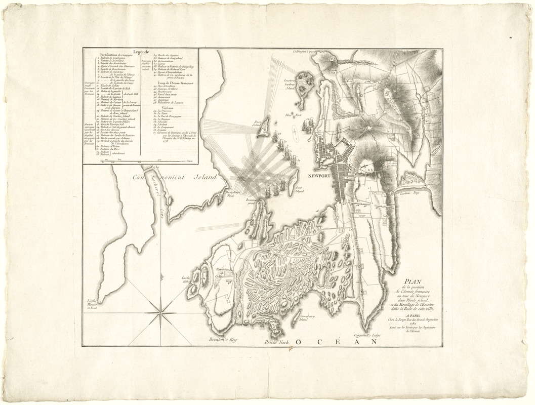
Plan de la position de l'armée française au tour de Newport dans Rhode Island et du mouillage de l'escadre dans la rade de cette ville
This map is also available in American Revolutionary Geographies Online (ARGO), a collections portal especially built for material relating to the American Revolutionary War Era. Visit ARGO to learn more about this item and explore the historical geography of North America in the late eighteenth century.
Item Information
- Title:
- Plan de la position de l'armée française au tour de Newport dans Rhode Island et du mouillage de l'escadre dans la rade de cette ville
- Creator:
- Le Rouge, Georges-Louis
- Contributor:
- France. Ingénieurs de l'Armée
- Date:
-
1782
- Format:
-
Maps/Atlases
- Location:
- George Washington's Mount Vernon
- Collection (local):
-
Richard H. Brown Revolutionary War Map Collection at Mount Vernon
- Subjects:
-
Newport (R.I.)--History--18th century--Maps--Early works to 1800
Newport (R.I. : Island)--Defenses--Maps--Early works to 1800
- Places:
-
Rhode IslandNewport (county)Newport
- Extent:
- 1 map ; 40 x 48 cm.
- Terms of Use:
-
No known copyright restrictions.
This work is licensed for use under a Creative Commons Attribution Non-Commercial Share Alike License (CC BY-NC-SA).

- Publisher:
-
Paris :
Chéz le Rouge
- Scale:
-
Scale [ca. 1:23,000]
- Language:
-
English
- Catalog Record:
-
MVLA record
- Notes:
-
Shows fortifications, camps, roads, battleships and lines of fire.
Relief shown by hachures.
"Levé sur les lieux par les Ingénieurs de l'Armée."
Includes "legende."
- Identifier:
-
06_01_008155

![[A map of part of Pennsylvania & Maryland intended to shew, at one view, the several places proposed for opening a communication between the waters of the Delaware & Chesopeak Bays]](https://bpldcassets.blob.core.windows.net/derivatives/images/commonwealth:z603vt12v/image_thumbnail_300.jpg)


