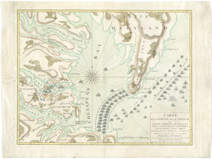
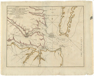
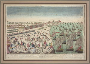
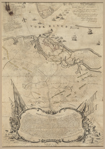
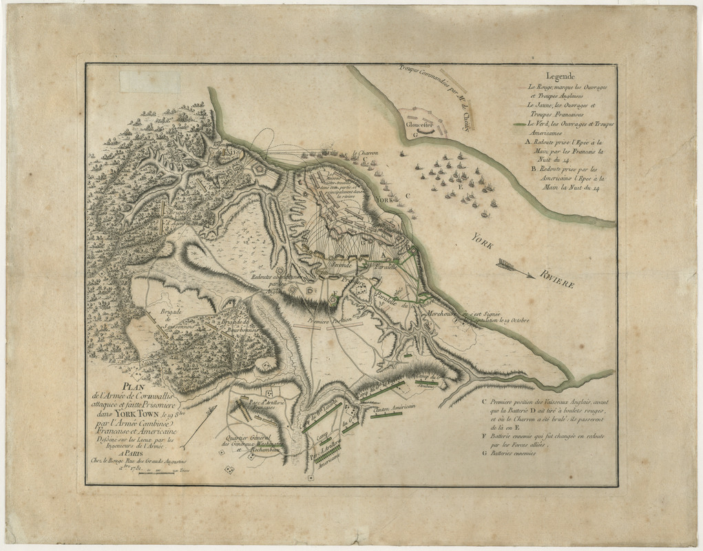
Plan de l'armée de Cornwallis attaquée et faitte prisoniere dans York Town : le 19 8bre par l'armée combinée Francaise et Americaine
This map is also available in American Revolutionary Geographies Online (ARGO), a collections portal especially built for material relating to the American Revolutionary War Era. Visit ARGO to learn more about this item and explore the historical geography of North America in the late eighteenth century.
Item Information
- Title:
- Plan de l'armée de Cornwallis attaquée et faitte prisoniere dans York Town : le 19 8bre par l'armée combinée Francaise et Americaine
- Contributor:
- Le Rouge, Georges-Louis
- Name on Item:
-
dessiné sur les lieux par les ingenieurs de l'armée.
- Date:
-
1781
- Format:
-
Maps/Atlases
- Location:
- George Washington's Mount Vernon
- Collection (local):
-
Richard H. Brown Revolutionary War Map Collection at Mount Vernon
- Subjects:
-
Yorktown (Va.)--History--Siege, 1781--Maps--Early works to 1800
Yorktown (Va.)--History--18th century--Maps--Early works to 1800
- Places:
-
York (county)Yorktown
- Extent:
- 1 map : col. ; 32 x 40 cm.
- Terms of Use:
-
No known copyright restrictions.
This work is licensed for use under a Creative Commons Attribution Non-Commercial Share Alike License (CC BY-NC-SA).

- Publisher:
-
Paris :
Chez Le Rouge
- Scale:
-
Scale [ca. 1:15,000]
- Language:
-
French
- Catalog Record:
-
MVLA record
- Notes:
-
Oriented with north to the upper right.
Relief shown by hachures.
Includes "Legende."
- Identifier:
-
06_01_008141