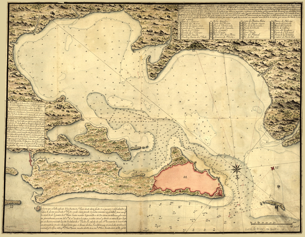
Nuevo plano de Puerto Rico
This map is also available in American Revolutionary Geographies Online (ARGO), a collections portal especially built for material relating to the American Revolutionary War Era. Visit ARGO to learn more about this item and explore the historical geography of North America in the late eighteenth century.
Item Information
- Title:
- Nuevo plano de Puerto Rico
- Creator:
- Montero de Espinosa, José
- Name on Item:
-
sondeado y registrado de orden del Capitan de Navio Dn. José Montero de Espinosa en el mes de nov. de 1785
- Date:
-
[1785]
- Format:
-
Maps/Atlases
Manuscripts
- Location:
- Library of Congress Geography and Map Division
- Collection (local):
-
Library of Congress Collection
- Subjects:
-
Harbors--Puerto Rico--San Juan--Maps--Early works to 1800
Manuscript maps--Early works to 1800
San Juan (P.R.)--Maps--Early works to 1800
- Places:
-
San Juan
- Extent:
- 1 map : col. ; 63 x 81 cm.
- Terms of Use:
-
No known copyright restrictions.
This work is licensed for use under a Creative Commons Attribution Non-Commercial Share Alike License (CC BY-NC-SA).

- Scale:
-
Scale ca. 1:8,500
- Language:
-
Spanish
- Catalog Record:
-
https://lccn.loc.gov/79693773
- Notes:
-
Has watermarks.
Manuscript; pen-and-ink, watercolor, and pencil.
Oriented with north toward the lower right.
Relief shown pictorially and by shading. Depths shown by soundings.
Selected buildings shown pictorially.
Covers San Juan Harbor.
Includes text and index to points of interest.
"Latin American Atlantic Port Cities exhibit, 1986." DLC
- Notes (date):
-
This date is inferred.
- Notes (citation):
-
LC Luso-Hispanic World, 766
- Identifier:
-
ct000306z


