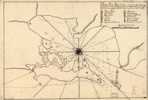
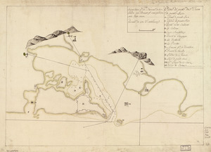
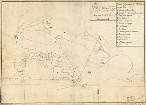
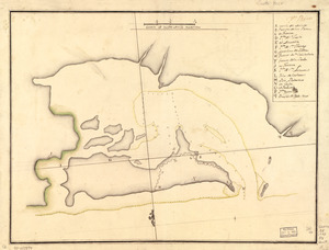
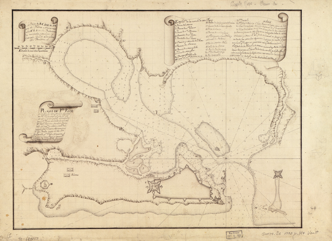
Plano de Pto. Rico en la ysla de este nombre situado en 18⁰37ʹ de latitd. N. y en 59⁰42ʹ de longd. O. de Cádiz
This map is also available in American Revolutionary Geographies Online (ARGO), a collections portal especially built for material relating to the American Revolutionary War Era. Visit ARGO to learn more about this item and explore the historical geography of North America in the late eighteenth century.
Item Information
- Title:
- Plano de Pto. Rico en la ysla de este nombre situado en 18⁰37ʹ de latitd. N. y en 59⁰42ʹ de longd. O. de Cádiz
- Creator:
- Méndez, Francisco Ramón
- Contributor:
- Navarrete, Joseph
- Name on Item:
-
lebantado por el 1er piloto abilitado de opficial Dn. Fanco. Ramón Méndez, segun orn. del Capn. de Navio y Comte. del nombrada Sn. Juan Nepomen seno Dn. Jph. Pereda surto en dho. pto. ; delineado pr. Dn. Jph. Navarrete, 2o piloto del numb. bajo la correccón. de Dn. Pedro Rivelles, thte. de fragata
- Date:
-
[1780?]
- Format:
-
Maps/Atlases
Manuscripts
- Location:
- Library of Congress Geography and Map Division
- Collection (local):
-
Library of Congress Collection
- Subjects:
-
San Juan (P.R.)--Maps, Manuscript--Early works to 1800
Manuscript maps--Early works to 1800
- Places:
-
San Juan
- Extent:
- 1 map : ms. ; 34 x 45 cm.
- Terms of Use:
-
No known copyright restrictions.
This work is licensed for use under a Creative Commons Attribution Non-Commercial Share Alike License (CC BY-NC-SA).

- Scale:
-
Scale [ca. 1:12,500]
- Language:
-
Spanish
- Catalog Record:
-
https://lccn.loc.gov/90683887
- Notes:
-
Shows vicinity of San Juan including forts and harbor.
Depths shown by soundings.
Prime meridian: Cádiz.
Oriented with north to the bottom.
Watermarks: J. Kool; and, Strasburg fleur-de-lis.
Pen-and-ink.
Mounted on cloth backing.
Indexed.
Maggs number annotated in pencil in lower right margin: 4.
- Notes (citation):
-
LC Luso-Hispanic World, 767
- Identifier:
-
lh000767