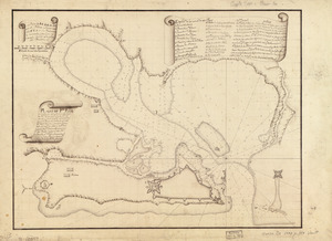
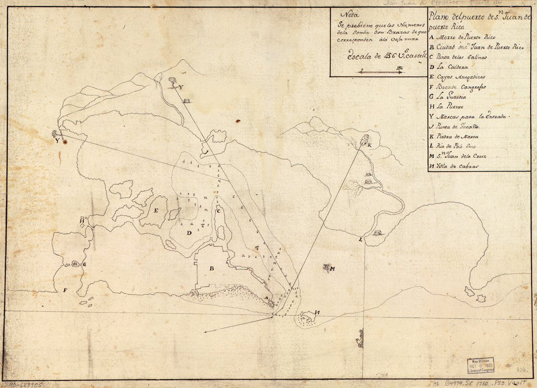
Plano del puerto de Sn. Juan de Puerto Rico
This map is also available in American Revolutionary Geographies Online (ARGO), a collections portal especially built for material relating to the American Revolutionary War Era. Visit ARGO to learn more about this item and explore the historical geography of North America in the late eighteenth century.
Item Information
- Title:
- Plano del puerto de Sn. Juan de Puerto Rico
- Date:
-
[1780?]
- Format:
-
Maps/Atlases
Manuscripts
- Location:
- Library of Congress Geography and Map Division
- Collection (local):
-
Library of Congress Collection
- Subjects:
-
San Juan (P.R.)--Maps, Manuscript--Early works to 1800
Manuscript maps--Early works to 1800
- Places:
-
San Juan
- Extent:
- 1 map : ms. ; 35 x 50 cm.
- Terms of Use:
-
No known copyright restrictions.
This work is licensed for use under a Creative Commons Attribution Non-Commercial Share Alike License (CC BY-NC-SA).

- Scale:
-
Scale [ca. 1:9,000]
- Language:
-
Spanish
- Catalog Record:
-
https://lccn.loc.gov/90683905
- Notes:
-
Shows vicinity of San Juan including fort and harbor.
Relief shown pictorially. Depths shown by soundings.
Oriented with north to the bottom.
Watermark: Unidentifiable.
Pen-and-ink.
Mounted on cloth backing.
Includes note and index.
Maggs number annotated in pencil in lower right corner: 324.
- Notes (citation):
-
LC Luso-Hispanic World, 770
- Identifier:
-
lh000770