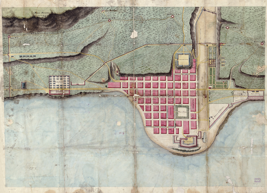
Plan du Môle St. Nicolas
This map is also available in American Revolutionary Geographies Online (ARGO), a collections portal especially built for material relating to the American Revolutionary War Era. Visit ARGO to learn more about this item and explore the historical geography of North America in the late eighteenth century.
Item Information
- Title:
- Plan du Môle St. Nicolas
- Date:
-
[1780?–1789?]
- Format:
-
Maps/Atlases
Manuscripts
- Location:
- Library of Congress Geography and Map Division
- Collection (local):
-
Library of Congress Collection
- Subjects:
-
Môle Saint-Nicolas, Haiti--Maps--Early works to 1800
Real property--Haiti--Môle Saint-Nicolas--Maps--Early works to 1800
- Places:
-
Nord-OuestMôle, Cap du (cape)
- Extent:
- 1 manuscript map : hand color 82 x 119 cm.
- Terms of Use:
-
No known copyright restrictions.
This work is licensed for use under a Creative Commons Attribution Non-Commercial Share Alike License (CC BY-NC-SA).

- Scale:
-
Scale not given
- Language:
-
French
English
- Catalog Record:
-
https://lccn.loc.gov/74692186
- Notes:
-
Title from verso.
Alternate title from verso: Plan de la ville du Mole.
Manuscript, pen-and-ink, pencil, and watercolor.
Oriented with north toward the lower left.
Relief shown by shading and hachures. Depths shown by soundings.
French and English.
Cadastral map.
- Notes (citation):
-
LC Luso-Hispanic World, 471
LC Maps of North America, 1750-1789, 1889
- Identifier:
-
ct001978


