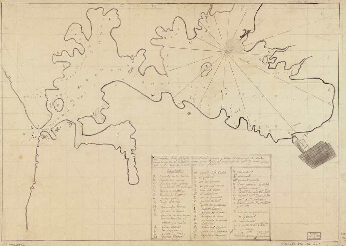
Descripción ychonográfica de la ciudad, puerto y bahía de Santiago de Cuba situado en 20⁰6ʹ de latitud norte y en longd. de Thenerife de 300⁰22ʹ, silla episcopal de dha. Ysla la de Xamayca y la Florida
This map is also available in American Revolutionary Geographies Online (ARGO), a collections portal especially built for material relating to the American Revolutionary War Era. Visit ARGO to learn more about this item and explore the historical geography of North America in the late eighteenth century.
Item Information
- Title:
- Descripción ychonográfica de la ciudad, puerto y bahía de Santiago de Cuba situado en 20⁰6ʹ de latitud norte y en longd. de Thenerife de 300⁰22ʹ, silla episcopal de dha. Ysla la de Xamayca y la Florida
- Date:
-
[1792?]
- Format:
-
Maps/Atlases
Manuscripts
- Location:
- Library of Congress Geography and Map Division
- Collection (local):
-
Library of Congress Collection
- Subjects:
-
Santiago de Cuba Bay (Cuba)--Maps, Manuscript--Early works to 1800
Coasts--Cuba--Santiago de Cuba Bay--Maps--Early works to 1800
Manuscript maps--Early works to 1800
- Places:
-
Bahía de Santiago de Cuba
- Extent:
- 1 map : ms. ; 46 x 65 cm.
- Terms of Use:
-
No known copyright restrictions.
This work is licensed for use under a Creative Commons Attribution Non-Commercial Share Alike License (CC BY-NC-SA).

- Scale:
-
Scale [ca. 1:60,000]
- Language:
-
Spanish
- Catalog Record:
-
https://lccn.loc.gov/91680862
- Notes:
-
Depths shown by soundings.
Prime meridian: Tenerife.
Oriented with north toward the upper right.
Watermarks: J. Kool; and, Strasburg fleur-de-lis. Watermark dated as 1792.
Pen-and-ink and pencil.
Mounted on cloth backing.
Indexed.
Maggs number annotated in pencil in lower right margin: 300.
- Notes (citation):
-
LC Luso-Hispanic World, 368
- Identifier:
-
lh000368


