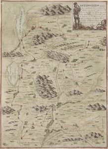
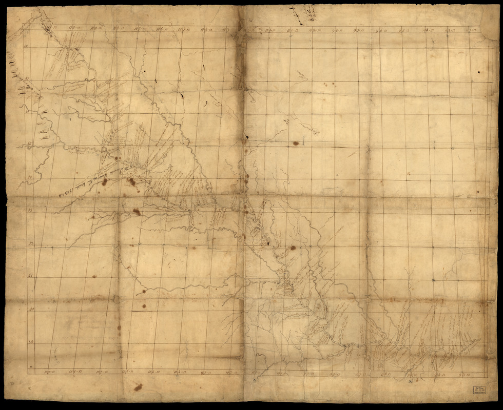
Map of Missouri River and vicinity from Saint Charles, Missouri, to Mandan villages of North Dakota : used by Meriwether Lewis and William Clark in their 1804 expedition up Missouri River
This map is also available in American Revolutionary Geographies Online (ARGO), a collections portal especially built for material relating to the American Revolutionary War Era. Visit ARGO to learn more about this item and explore the historical geography of North America in the late eighteenth century.
Item Information
- Title:
- Map of Missouri River and vicinity from Saint Charles, Missouri, to Mandan villages of North Dakota : used by Meriwether Lewis and William Clark in their 1804 expedition up Missouri River
- Creator:
- Finiels, Nicolas de
- Contributor:
- Lewis, Meriwether, 1774-1809
- Contributor:
- Clark, William, 1770-1838
- Contributor:
- Harrison, William Henry, 1773-1841
- Contributor:
- Mackay, James, 1761-1822
- Contributor:
- Evans, John, 1770-1799
- Date:
-
[1798]
- Format:
-
Maps/Atlases
Manuscripts
- Location:
- Library of Congress Geography and Map Division
- Collection (local):
-
Library of Congress Collection
- Subjects:
-
Missouri River Watershed--Maps, Manuscript--Early works to 1800
Maps, Manuscript--Early works to 1800
- Places:
-
Missouri River
- Extent:
- 1 map : ms. ; 76 x 99 cm., on sheet 81 x 101 cm.
- Terms of Use:
-
No known copyright restrictions.
This work is licensed for use under a Creative Commons Attribution Non-Commercial Share Alike License (CC BY-NC-SA).

- Scale:
-
Not drawn to scale
- Language:
-
English
French
- Catalog Record:
-
https://lccn.loc.gov/2002621122
- Notes:
-
Date from accompanying text.
Relief shown by symbols for "Black Mountains" or Black Hills.
Based on surveys up to the Mandan-Hidatsa villages by James Mackay and John Evans.
Longitudinal errors, at least in part, account for map not being drawn to scale.
Prime meridian: Paris [?].
Pen-and-ink. Some pen-and-ink annotations made after 1798.
Map backed with Japanese tissue paper.
Accompanied by photocopy of text on mapping of de Finiels: Missouri Historical Review, vol. 81, no. 4, July 1987, p. 387-402.
On verso written in pen-and-ink by William Henry Harrison but unsigned: For Captn. William Clark or Captn. Meriwether Lewis on their voyage up the Mississippi.
Also on verso written in pen-and-ink: Mr. Peter Tabeau at the Ricraries.
Imperfect: Stains, darkening, tears, creases, and small pieces missing.
Some place names in both English and French.
- Notes (date):
-
This date is inferred.
- Identifier:
-
ct000583Z