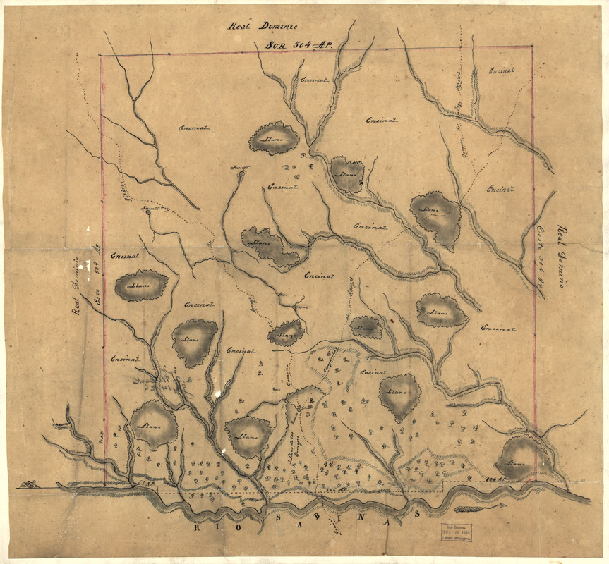
Map of Las Ormigas Grant, Sabine and DeSoto Parishes, Louisiana
This map is also available in American Revolutionary Geographies Online (ARGO), a collections portal especially built for material relating to the American Revolutionary War Era. Visit ARGO to learn more about this item and explore the historical geography of North America in the late eighteenth century.
Item Information
- Title:
- Map of Las Ormigas Grant, Sabine and DeSoto Parishes, Louisiana
- Date:
-
[1800–1809]
- Format:
-
Maps/Atlases
Manuscripts
- Location:
- Library of Congress Geography and Map Division
- Collection (local):
-
Library of Congress Collection
- Subjects:
-
Sabine Parish (La.)--Maps, Manuscript
De Soto Parish (La.)--Maps, Manuscript
Land grants--Louisiana--Sabine Parish--Maps
Land grants--Louisiana--De Soto Parish--Maps
- Places:
-
De Soto (county)
Sabine (county)
- Extent:
- 1 ms. map : col. ; 47 x 20 cm.
- Terms of Use:
-
No known copyright restrictions.
This work is licensed for use under a Creative Commons Attribution Non-Commercial Share Alike License (CC BY-NC-SA).

- Scale:
-
Scale not given
- Language:
-
Spanish
- Catalog Record:
-
https://lccn.loc.gov/2003623387
- Notes:
-
Relief shown pictorially.
Shows the present-day Sabine and DeSoto Parishes in eastern region of the Sabine River, Louisiana.
Pen-and-ink and watercolor.
Title derived from The Luso-Hispanic world in maps, 1999.
Mounted on cloth backing.
This Spanish map of the site of Las Ormigas land grand later known as the Arroyo Hondo grand includes streams, vegetation ... At time of map, this was an area of dispute between the United States and Spain.
Copy annotated in pencil on verso: "Los Ormigas grant" corrected to "Arroyo Hondo grant" in letter of Mr. Witbeck's. July 2, 1927 and May 31, 1927.
Names of places and features in Spanish.
- Notes (date):
-
This date is inferred.
- Notes (citation):
-
LC Luso-Hispanic world, 939
- Identifier:
-
ct000688


