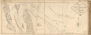
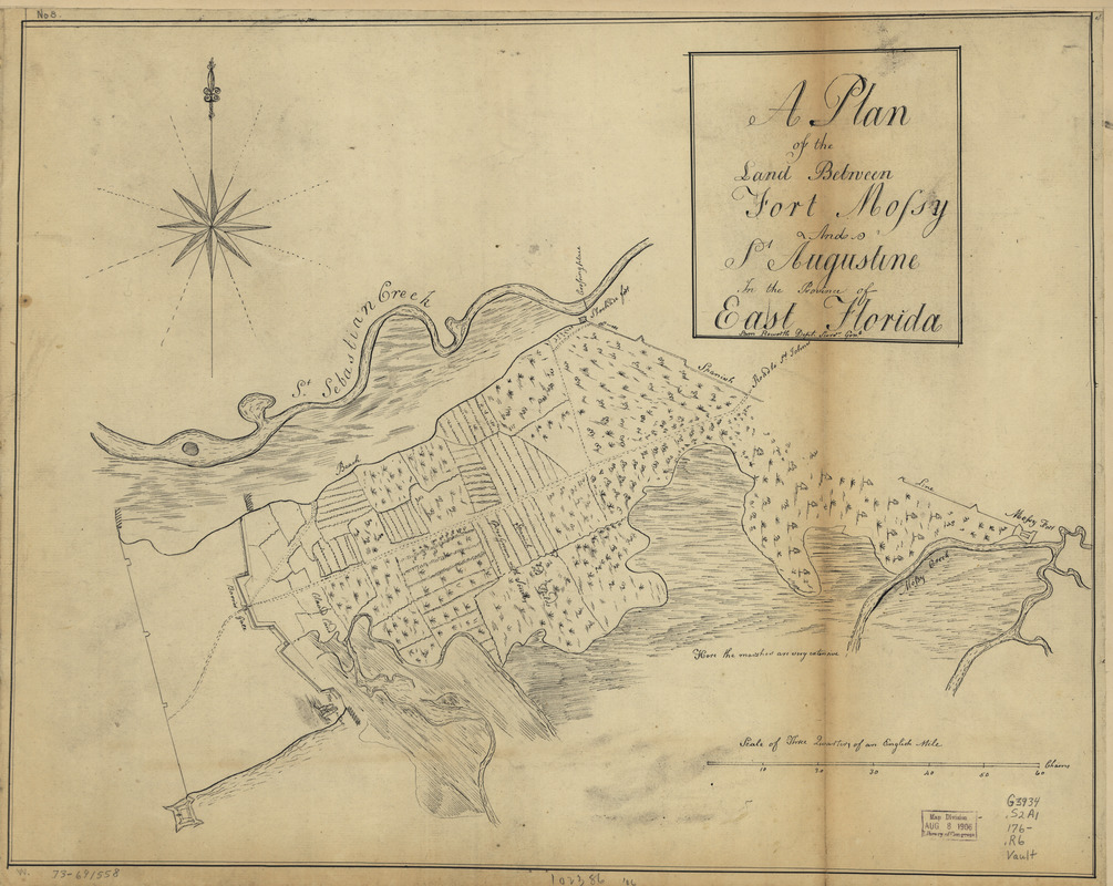
A plan of the land between Fort Mossy and St. Augustine in the province of East Florida
This map is also available in American Revolutionary Geographies Online (ARGO), a collections portal especially built for material relating to the American Revolutionary War Era. Visit ARGO to learn more about this item and explore the historical geography of North America in the late eighteenth century.
Item Information
- Title:
- A plan of the land between Fort Mossy and St. Augustine in the province of East Florida
- Title (alt.):
-
Fort Mossy and St. Augustine in the province of East Florida
- Creator:
- Roworth, Sam
- Name on Item:
-
Sam Roworth, dept. survr. genl.
- Date:
-
[1760?–1769?]
- Format:
-
Maps/Atlases
Manuscripts
- Location:
- Library of Congress Geography and Map Division
- Collection (local):
-
Library of Congress Collection
- Subjects:
-
Saint Augustine Region (Fla.)--Maps, Manuscript--Early works to 1800
Manuscript maps--Early works to 1800
- Places:
-
Saint Johns (county)Saint Augustine
- Extent:
- 1 manuscript map 40 x 51 cm.
- Terms of Use:
-
No known copyright restrictions.
This work is licensed for use under a Creative Commons Attribution Non-Commercial Share Alike License (CC BY-NC-SA).

- Scale:
-
Scale ca. 1:7,900
- Language:
-
English
- Catalog Record:
-
https://lccn.loc.gov/73691558
- Notes:
-
Manuscript, pen-and-ink.
Has watermarks.
Oriented with north to the right.
Shows "Spanish old fields overgrown with scrubs."
- Notes (citation):
-
LC Maps of North America, 1750-1789, 1635
LC Luso-Hispanic World, 879
- Identifier:
-
ar163500