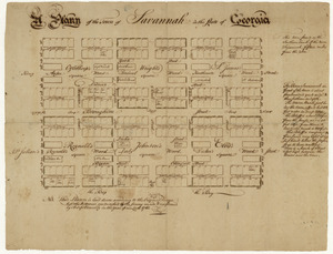
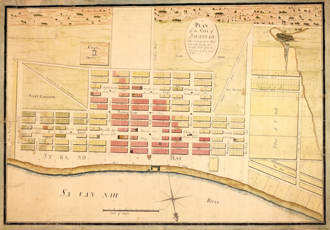
A plan of the city of Savannah : with a drawing of the part of the city burnt in the dreadful fires of the 26 November & 6 December, 1796
This map is also available in American Revolutionary Geographies Online (ARGO), a collections portal especially built for material relating to the American Revolutionary War Era. Visit ARGO to learn more about this item and explore the historical geography of North America in the late eighteenth century.
Item Information
- Title:
- A plan of the city of Savannah : with a drawing of the part of the city burnt in the dreadful fires of the 26 November & 6 December, 1796
- Title (alt.):
-
Map of Savannah after fire 1796
- Creator:
- Marian S. Carson Collection (Library of Congress)
- Date:
-
[1796?]
- Format:
-
Maps/Atlases
Manuscripts
- Location:
- Library of Congress Geography and Map Division
- Collection (local):
-
Library of Congress Collection
- Subjects:
-
Savannah (Ga.)--Maps, Manuscript--Early works to 1800
Real property--Georgia--Savannah--Maps--Early works to 1800
Fires--Georgia--Savannah--Maps--Early works to 1800
- Places:
-
Chatham (county)Savannah
- Extent:
- 1 ms. map : col. ; 49 x 71 cm.
- Terms of Use:
-
No known copyright restrictions.
This work is licensed for use under a Creative Commons Attribution Non-Commercial Share Alike License (CC BY-NC-SA).

- Scale:
-
Scale [ca. 1:2,400]
- Language:
-
English
- Catalog Record:
-
https://lccn.loc.gov/2008622170
- Notes:
-
Relief shown pictorially.
Oriented with north toward lower right.
Pen-and-ink and watercolor.
Select buildings shown pictorially.
Annotations in pencil.
Minor tears around edges of sheet repaired by conservation.
- Identifier:
-
ct002304