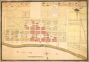
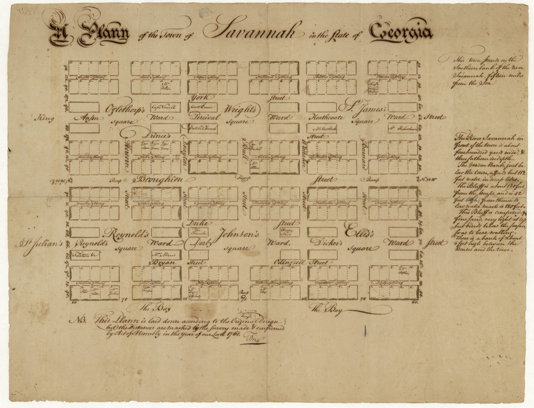
A plann of the town of Savannah in the state of Georgia
This map is also available in American Revolutionary Geographies Online (ARGO), a collections portal especially built for material relating to the American Revolutionary War Era. Visit ARGO to learn more about this item and explore the historical geography of North America in the late eighteenth century.
Item Information
- Title:
- A plann of the town of Savannah in the state of Georgia
- Creator:
- Marian S. Carson Collection (Library of Congress)
- Date:
-
[1761?]
- Format:
-
Maps/Atlases
Manuscripts
- Location:
- Library of Congress Geography and Map Division
- Collection (local):
-
Library of Congress Collection
- Subjects:
-
Savannah (Ga.)--Maps, Manuscript--Early works to 1800
Real property--Georgia--Savannah--Maps--Early works to 1800
Landowners--Georgia--Savannah--Maps--Early works to 1800
- Places:
-
Chatham (county)Savannah
- Extent:
- 1 ms. map ; on sheet 44 x 56 cm.
- Terms of Use:
-
No known copyright restrictions.
This work is licensed for use under a Creative Commons Attribution Non-Commercial Share Alike License (CC BY-NC-SA).

- Scale:
-
Scale [ca. 1:1,800]
- Language:
-
English
- Catalog Record:
-
https://lccn.loc.gov/2008622172
- Notes:
-
This plann is laid down according to the original design but the distances are marked by the survey made & confirmed by Act of Assembly in the year of our lord 1761. [illegible initials].
Oriented with north toward lower right.
Pen-and-ink.
Includes notes and names of select property owners.
Fold-lined. Minor losses along folds repaired by conservation. Pin holes in all corners.
- Identifier:
-
ct003966