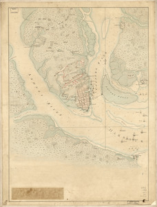
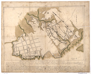
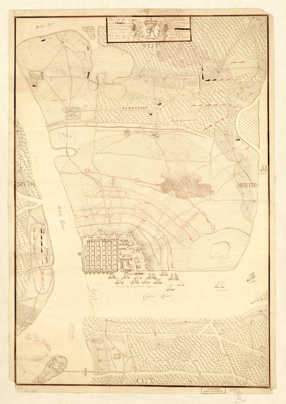
Plan of the siege of Charles Town in South Carolina : under command of His Excellence Sir Henry Clinton and under direction of ... Collonel Mount-Crieff as chief ingener, this town was surrendered with capitulation the 12. May 1780 after 6 weeks and 3 days siege
This map is also available in American Revolutionary Geographies Online (ARGO), a collections portal especially built for material relating to the American Revolutionary War Era. Visit ARGO to learn more about this item and explore the historical geography of North America in the late eighteenth century.
Item Information
- Title:
- Plan of the siege of Charles Town in South Carolina : under command of His Excellence Sir Henry Clinton and under direction of ... Collonel Mount-Crieff as chief ingener, this town was surrendered with capitulation the 12. May 1780 after 6 weeks and 3 days siege
- Creator:
- Fennigan, Patrick
- Date:
-
[1780]
- Format:
-
Maps/Atlases
Manuscripts
- Location:
- Library of Congress Geography and Map Division
- Collection (local):
-
Library of Congress Collection
- Subjects:
-
Charleston (S.C.)--History--Siege, 1780--Maps, Manuscript--Early works to 1800
- Places:
-
Charleston (county)Charleston
- Extent:
- 1 manuscript map : hand color 65 x 45 cm.
- Terms of Use:
-
No known copyright restrictions.
This work is licensed for use under a Creative Commons Attribution Non-Commercial Share Alike License (CC BY-NC-SA).

- Scale:
-
Scale ca. 1:11,500
- Language:
-
English
- Catalog Record:
-
https://lccn.loc.gov/gm71000887
- Notes:
-
Manuscript, pen-and-ink and watercolor.
Oriented with north to the right.
Shows detailed lines of fire for defenders and besiegers.
Ships shown pictorially.
On verso: Siege of Charles Town, South Carolina. Lieut. Finnegan, 16th Regt.
- Notes (date):
-
This date is inferred.
- Notes (citation):
-
LC Maps of North America, 1750-1789, 1556
- Identifier:
-
ar155600