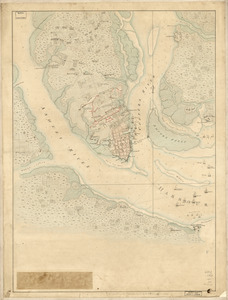
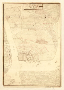
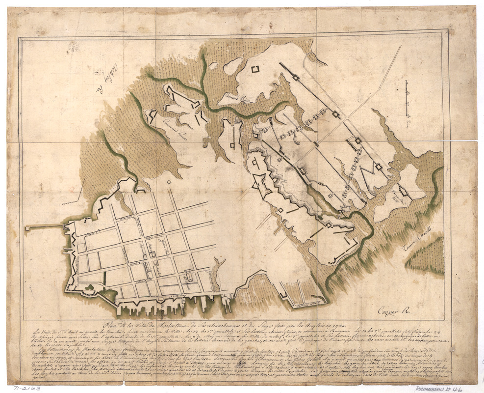
Plan de la ville de Charlestown, de ses retranchements et du siege faits par les Anglois en 1780
This map is also available in American Revolutionary Geographies Online (ARGO), a collections portal especially built for material relating to the American Revolutionary War Era. Visit ARGO to learn more about this item and explore the historical geography of North America in the late eighteenth century.
Item Information
- Title:
- Plan de la ville de Charlestown, de ses retranchements et du siege faits par les Anglois en 1780
- Date:
-
[1780]
- Format:
-
Maps/Atlases
Manuscripts
- Location:
- Library of Congress Geography and Map Division
- Collection (local):
-
Library of Congress Collection
- Subjects:
-
Charleston (S.C.)--History--Siege, 1780--Maps, Manuscript--Early works to 1800
- Places:
-
Charleston (county)Charleston
- Extent:
- 1 manuscript map : hand color 28 x 42 cm.
- Terms of Use:
-
No known copyright restrictions.
This work is licensed for use under a Creative Commons Attribution Non-Commercial Share Alike License (CC BY-NC-SA).

- Scale:
-
Scale ca. 1:10,320
- Language:
-
French
- Catalog Record:
-
https://lccn.loc.gov/gm71002163
- Notes:
-
Manuscript, pen-and-ink and watercolor.
Includes text.
- Notes (date):
-
This date is inferred.
- Notes (citation):
-
LC Maps of North America, 1750-1789, 1560
- Identifier:
-
ar156000