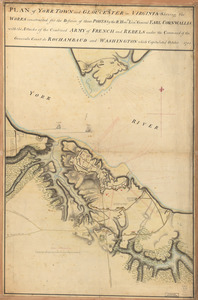
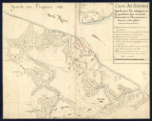
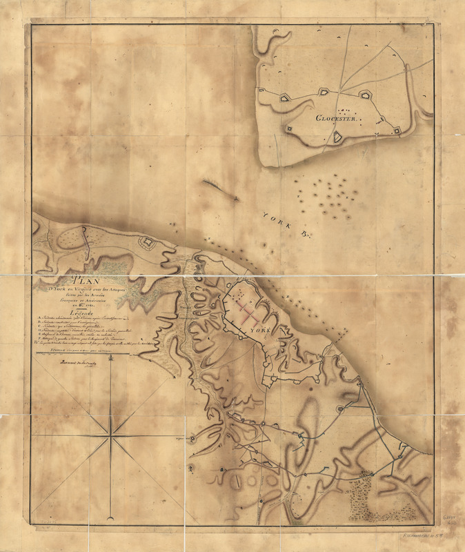
Plan d'York en Virginie avec les attaques faites par les Armées françoise et américaine en 8bre. 1781
This map is also available in American Revolutionary Geographies Online (ARGO), a collections portal especially built for material relating to the American Revolutionary War Era. Visit ARGO to learn more about this item and explore the historical geography of North America in the late eighteenth century.
Item Information
- Title:
- Plan d'York en Virginie avec les attaques faites par les Armées françoise et américaine en 8bre. 1781
- Creator:
- Querenet de La Combe
- Name on Item:
-
Querenet de La Combe
- Date:
-
[1781]
- Format:
-
Maps/Atlases
Manuscripts
- Location:
- Library of Congress Geography and Map Division
- Collection (local):
-
Library of Congress Collection
- Subjects:
-
Yorktown (Va.)--History--Siege, 1781--Maps, Manuscript--Early works to 1800
- Places:
-
York (county)Yorktown
- Extent:
- 1 manuscript map : hand color 87 x 70 cm.
- Terms of Use:
-
No known copyright restrictions.
This work is licensed for use under a Creative Commons Attribution Non-Commercial Share Alike License (CC BY-NC-SA).

- Scale:
-
Scale ca. 1:4,800
- Language:
-
French
- Catalog Record:
-
https://lccn.loc.gov/gm71002175
- Notes:
-
Manuscript, pen-and-ink and watercolor.
Relief shown by hachures.
- Notes (date):
-
This date is inferred.
- Notes (citation):
-
LC Maps of North America, 1750-1789, 1466
- Identifier:
-
ar146600z

![A Plan of the entrance of Chesapeak [sic] Bay, with James and York Rivers](https://bpldcassets.blob.core.windows.net/derivatives/images/commonwealth:q524nf233/image_thumbnail_300.jpg)