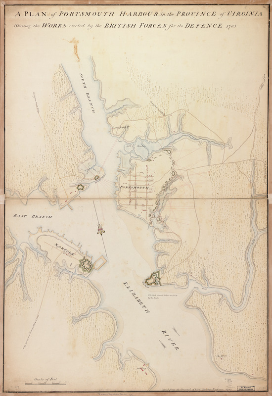
A plan of Portsmouth Harbour in the province of Virginia : shewing the works erected by the British forces for its defence, 1781
This map is also available in American Revolutionary Geographies Online (ARGO), a collections portal especially built for material relating to the American Revolutionary War Era. Visit ARGO to learn more about this item and explore the historical geography of North America in the late eighteenth century.
Item Information
- Title:
- A plan of Portsmouth Harbour in the province of Virginia : shewing the works erected by the British forces for its defence, 1781
- Creator:
- Stratton, James, (Engineer)
- Name on Item:
-
Copied from the original of Lieut. Stratton, engineer
- Date:
-
1782
- Format:
-
Maps/Atlases
Manuscripts
- Location:
- Library of Congress Geography and Map Division
- Collection (local):
-
Library of Congress Collection
- Subjects:
-
Fortification--Virginia--Portsmouth--Maps, Manuscript--Early works to 1800
Harbors--Virginia--Portsmouth--Maps, Manuscript--Early works to 1800
Portsmouth (Va.)--Buildings, structures, etc--Maps, Manuscript--Early works to 1800
- Places:
-
Portsmouth (independent city)
- Extent:
- 1 manuscript map : hand color 93 x 63 cm.
- Terms of Use:
-
No known copyright restrictions.
This work is licensed for use under a Creative Commons Attribution Non-Commercial Share Alike License (CC BY-NC-SA).

- Scale:
-
Scale ca. 1:95,000
- Language:
-
English
- Catalog Record:
-
https://lccn.loc.gov/gm71000689
- Notes:
-
Manuscript, pen-and-ink (black and red) and watercolor.
Oriented with north toward the lower right.
Relief shown by shading.
- Identifier:
-
ar145700


