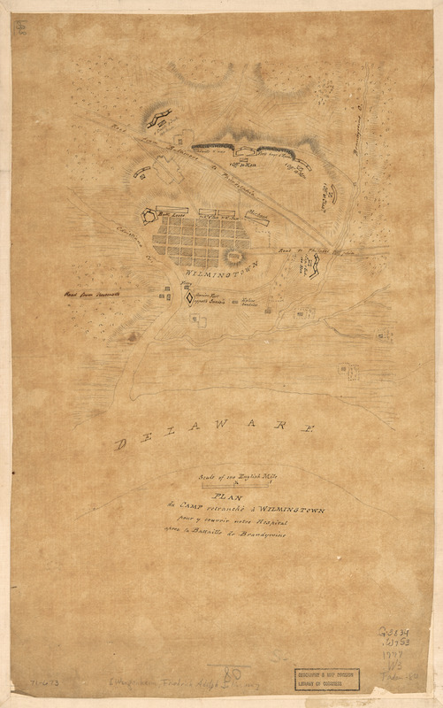
Plan du camp retranchè à Wilmington pour y couvrir notre hospital apres la Battaille de Brandywine
This map is also available in American Revolutionary Geographies Online (ARGO), a collections portal especially built for material relating to the American Revolutionary War Era. Visit ARGO to learn more about this item and explore the historical geography of North America in the late eighteenth century.
Item Information
- Title:
- Plan du camp retranchè à Wilmington pour y couvrir notre hospital apres la Battaille de Brandywine
- Title (alt.):
-
Wilmingtown
- Creator:
- Wangenheim, Friedrich Adam Julius von
- Date:
-
[1777]
- Format:
-
Maps/Atlases
Manuscripts
- Location:
- Library of Congress Geography and Map Division
- Collection (local):
-
Library of Congress Collection
- Subjects:
-
Wilmington (Del.)--History--Revolution, 1775-1783--Maps, Manuscript--Early works to 1800
- Places:
-
New Castle (county)Wilmington
- Extent:
- 1 manuscript map on sheet 44 x 28 cm.
- Terms of Use:
-
No known copyright restrictions.
This work is licensed for use under a Creative Commons Attribution Non-Commercial Share Alike License (CC BY-NC-SA).

- Scale:
-
Scale ca. 1:38,000
- Language:
-
French
- Catalog Record:
-
https://lccn.loc.gov/gm71000673
- Notes:
-
Manuscript, pen-and-ink and pencil on tracing paper.
Oriented with north toward the upper right.
Relief shown by hachures.
Title in French. Map in English and French.
- Notes (date):
-
This date is inferred.
- Notes (citation):
-
LC Maps of North America, 1750-1789, 1351
- Identifier:
-
ar135100


