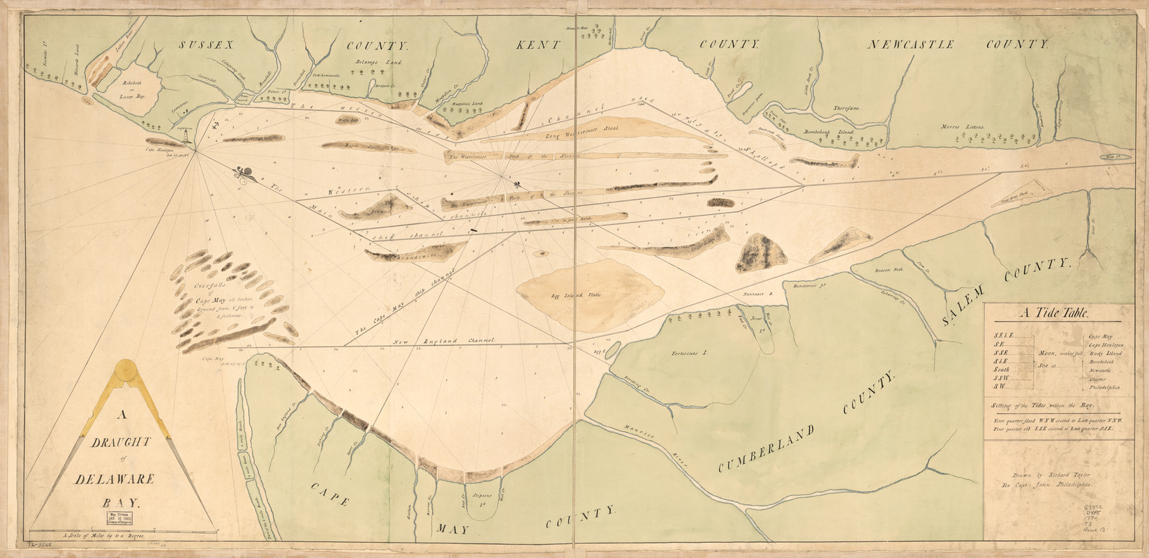
A draught of Delaware Bay
This map is also available in American Revolutionary Geographies Online (ARGO), a collections portal especially built for material relating to the American Revolutionary War Era. Visit ARGO to learn more about this item and explore the historical geography of North America in the late eighteenth century.
Item Information
- Title:
- A draught of Delaware Bay
- Creator:
- Taylor, Richard, 1749-1825
- Contributor:
- Jann, Captain
- Contributor:
- Hamond, Andrew Snape, Sir, 1738-1828
- Name on Item:
-
Drawn by Richard Taylor for Capt. Jann, Philadelphia
- Date:
-
[1770–1779]
- Format:
-
Maps/Atlases
Manuscripts
- Location:
- Library of Congress Geography and Map Division
- Collection (local):
-
Library of Congress Collection
- Subjects:
-
Nautical charts--Delaware Bay (Del. and N.J.)--Early works to 1800
Delaware Bay (Del. and N.J.)--Maps, Manuscript--Early works to 1800
- Places:
-
Delaware Bay
- Extent:
- 1 manuscript map : hand color 53 x 113 cm.
- Terms of Use:
-
No known copyright restrictions.
This work is licensed for use under a Creative Commons Attribution Non-Commercial Share Alike License (CC BY-NC-SA).

- Scale:
-
Scale ca. 1:127,000
- Language:
-
English
- Catalog Record:
-
https://lccn.loc.gov/gm72003568
- Notes:
-
Title on verso: Delaware River from Capt. Hamond. River Delaware, 226.
Manuscript, pen-and-ink and watercolor.
Oriented with north toward the lower right.
Depths shown by soundings.
Shows ship channels.
Includes "A tide table."
- Notes (date):
-
This date is inferred.
- Notes (citation):
-
LC Maps of North America, 1750-1789, 1354
- Identifier:
-
ar135400