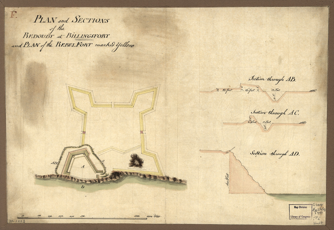
Plan and sections of the redoubt at Billingsfort and plan of the rebel fort marked yellow
This map is also available in American Revolutionary Geographies Online (ARGO), a collections portal especially built for material relating to the American Revolutionary War Era. Visit ARGO to learn more about this item and explore the historical geography of North America in the late eighteenth century.
Item Information
- Title:
- Plan and sections of the redoubt at Billingsfort and plan of the rebel fort marked yellow
- Title (alt.):
-
Billingsfort
- Date:
-
[1777?]
- Format:
-
Maps/Atlases
Manuscripts
- Location:
- Library of Congress Geography and Map Division
- Collection (local):
-
Library of Congress Collection
- Subjects:
-
Billingsport (Paulsboro, N.J.)--Buildings, structures, etc--Maps, Manuscript--Early works to 1800
Fortification--New Jersey--Billingsport--Maps--Early works to 1800
- Places:
-
Billingsport
- Extent:
- 1 manuscript map : hand color ; 26 x 38 cm.
- Terms of Use:
-
No known copyright restrictions.
This work is licensed for use under a Creative Commons Attribution Non-Commercial Share Alike License (CC BY-NC-SA).

- Scale:
-
Scale ca. 1:2,450
- Language:
-
English
- Catalog Record:
-
https://lccn.loc.gov/gm71002223
- Notes:
-
Manuscript, pen-and-ink and watercolor.
Has watermark.
Relief shown by shading.
"F."
Includes 3 col. cross sections.
- Notes (citation):
-
LC Maps of North America, 1750-1789, 1276
- Identifier:
-
ar127600


